Rama Shrine
Rama Shrine is a 6,406-foot (1,953 m)-elevation platform-summit located in the eastern Grand Canyon, in Coconino County of northern Arizona, United States. The Shrine is named for Rama, the Hindu god of chivalry and virtue. The landform is attached at the southeast to the Vishnu Temple massif, about 1.0 mile (1.6 km) distant. Rama Shrine is about 3.0 miles (4.8 km) southeast of the Cape Royal overlook, Walhalla Plateau (southeast Kaibab Plateau, North Rim). A twin landform occupies the southwest of Vishnu Temple, the Krishna Shrine. Rama Shrine towers about 4,000 feet (1,200 m) above the Colorado River, about 2.0 miles (3.2 km) southeast. Drainages to the Colorado are east and southeast; between the two Shrines, is the south Asbestos Canyon drainage.
The Rama Shrine prominence is a rectangular platform of the Supai Group (unit 4 of 4), the cliff-former (and platform-former), hard Esplanade Sandstone. Remainder debris of very-shallow slopes of burnt-red Hermit Shale (a slope-former) cover the horizontal platform.
| Rama Shrine | |
|---|---|
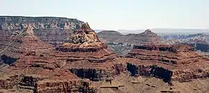 Krishna, Vishnu, & Rama prominences (Freya Castle at left rear) | |
| Highest point | |
| Elevation | 6,406 ft (1,953 m) [1] |
| Prominence | 706 ft (215 m) [1] |
| Parent peak | Vishnu Temple |
| Isolation | 0.98 mi (1.58 km) [1] |
| Coordinates | 36.078318°N 111.9237735°W [2] |
| Geography | |
 Rama Shrine Location in Arizona  Rama Shrine Rama Shrine (the United States) | |
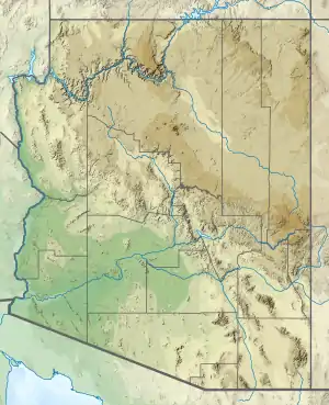
| Location | Grand Canyon National Park Coconino County, Arizona, US |
| Parent range | Kaibab Plateau (Walhalla Plateau) Colorado Plateau |
| Topo map | USGS Cape Royal |
| Geology | |
| Age of rock | Permian down to Cambrian |
| Mountain type | sedimentary rock: shale, sandstone,siltstone, mudstone, limestone, shale |
| Type of rock | Hermit Shale-(prominence-debris) Supai Group-(unit 4, platform-Esplanade Sandstone), Supai Group, Redwall Limestone, Muav Limestone, Bright Angel Shale |
Geology
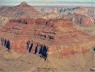
The geology of Rama Shrine is basically identical to its Vishnu Temple neighbor; on Vishnu Temple, the slopes of dark burnt-red Hermit Shale (a slope-former), are large and visible. The debris-remainder on the Rama Shrine platform is of similar color, and is composed of Hermit Shale debris-remainder, upon hard Esplanade Sandstone (unit 4, Supai), and the debris is dark-burnt-red, and discontinuous in its depth.
Beneath the Supai Group, is the platform and cliff of Redwall Limestone, and below, the three Cambrian units.
See also
References
- "Rama Shrine - 6,406' AZ". Lists of John. Retrieved January 19, 2021.
- Rama Shrine, Topozone
External links
| Wikimedia Commons has media related to Rama Shrine. |