Raton Formation
The Raton Formation is a geological formation of Upper Cretaceous and Paleocene age which outcrops in the Raton Basin of northeast New Mexico and southeast Colorado.[1]
| Raton Formation Stratigraphic range: upper Cretaceous to Paleocene | |
|---|---|
 | |
| Type | Formation |
| Underlies | Poison Canyon Formation |
| Overlies | Vermejo Formation |
| Thickness | 1,140 feet (350 m) |
| Lithology | |
| Primary | Sandstone, conglomerate |
| Other | Coal, shale |
| Location | |
| Coordinates | 36.96°N 104.47°W |
| Region | New Mexico |
| Country | United States |
| Type section | |
| Named for | Raton Mesa |
| Named by | F.V. Hayden |
| Year defined | 1869 |
 Raton Formation (the United States) 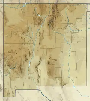 Raton Formation (New Mexico) | |
Description
The formation consists of coal with carbonaceous shale, brown to buff sandstone, and conglomerate (usually at the base). It is about 1,140 feet (350 m) thick at the type locality. The formation unconformably overlies the Vermejo Formation, and unconformably (?) underlies the Poison Canyon Formation.[1] It is of late Cretaceous to Paleocene age.[2]
The formation can be divided into three informal members.[3] The lowest member is a basal sandstone and conglomerate of quartzite, chert and gneiss pebbles and cobbles in a coarse-grained quartzose to arkosic sandstone matrix. The middle member is fine to coarse grained sandstone, with some siltstone, mudstone, and coal. The upper member is coal-bearing and contains sandstone, siltstone, mudstone, shale, and mineable coal.[4]
Cretaceous-Paleogene boundary
Because the Raton Formation is a well-preserved sequence of rocks spanning the Cretaceous-Paleogene boundary, it has been studied for evidence of a large meteor impact at the end of the Cretaceous that is thought to have caused the Cretaceous–Paleogene extinction event. The boundary is represented by a 1-cm thick tonstein clay layer which has been found to contain anomalously high concentrations of iridium.[5] The boundary clay layer is accessible to the public at Trinidad Lake State Park, among other places in the Raton Basin.
History of investigation
The Raton Formation was originally named "Raton Hills Group" by Ferdinand Vandeveer Hayden in 1869 for coal beds in the Raton Hills in Colfax County, New Mexico. In 1913, W.T. Lee changed the name to Raton Formation.[1]
References
- Lee, Willis T. (1917). "Geology and Paleontology of the Raton Mesa and Other Regions in Colorado and New Mexico". US Geological Survey Professional Paper. 101: 55–61. Retrieved 5 November 2020.
- Pollastro, Richard M.; Pillmore, Charles L. (1987). "Mineralogy and Petrology of the Cretaceous-Tertiary Boundary Clay Bed and Adjacent Clay-Rich Rocks, Raton Basin, New Mexico and Colorado". SEPM Journal of Sedimentary Research. Vol. 57. doi:10.1306/212F8B61-2B24-11D7-8648000102C1865D.
- Pillmore, C.L (1969). "Geology and coal deposits of the Raton coal field, Colfax County, New Mexico". Mountain Geologist. 6: 129. Retrieved 5 November 2020.
- MacLachlan, M.E. (1976). "Lexicon of rock-stratigraphic units in Union, Colfax, Mora, and eastern Taos Counties, New Mexico" (PDF). New Mexico Geological Society Guidebook. 27. Retrieved 5 November 2020.
- Orth, C. J.; Gilmore, J. S.; Knight, J. D.; Pillmore, C. L.; Tschudy, R. H.; Fassett, J. E. (18 December 1981). "An Iridium Abundance Anomaly at the Palynological Cretaceous-Tertiary Boundary in Northern New Mexico". Science. 214 (4527): 1341–1343. doi:10.1126/science.214.4527.1341.