Rede Common
Rede Common is a 11.2-hectare (28-acre) Local Nature Reserve in Strood in Kent.[1][2] It is owned and managed by Medway Council in partnership with Friends of Rede Common.[3][4]
| Rede Common | |
|---|---|
 Rede Common Sandy Banks Walk | |
| |
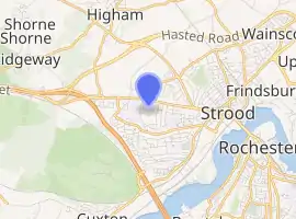
| Type | Local Nature Reserve |
| Location | Strood, Kent |
| OS grid | TQ719693 |
| Coordinates | 51.396427°N 0.470028°E |
| Area | 11.2 hectares (28 acres) |
| Managed by | Friends of Rede Common |
| Website | http://redecommon.org.uk |
Known locally as Sandy Banks due to the underlying Thanet Beds, Rede Common was formerly farmland used for grazing, arable and market gardening and is now an area of open acid grasslands surrounded by scrub and trees.[3][1]
Access points include entrances in Watling Street, Hyacinth Road and Columbine Close.[5]
The Strood Community Trail passes through Rede Common.[6][7]
References
- "Rede Common". www.medway.gov.uk. Retrieved 2018-11-05.
- "Rede Common". geograph.org.uk. Geograph Britain and Ireland.
- "Rede Common". Local Nature Reserves. Natural England. Retrieved 5 November 2018.
- "Friends of Rede Common". Friends of Rede Common. Retrieved 2018-11-05.
- Survey, Ordnance. "OS Maps: online mapping and walking, running and cycling routes". osmaps.ordnancesurvey.co.uk. Retrieved 2018-11-05.
- "Relation: Strood Community Trail (1273060) | OpenStreetMap". OpenStreetMap. Retrieved 2018-11-05.
- "Strood Community Trail". stroodcommunitytrail.blogspot.com. Retrieved 2018-11-05.
| Wikimedia Commons has media related to Rede Common local nature reserve. |
This article is issued from Wikipedia. The text is licensed under Creative Commons - Attribution - Sharealike. Additional terms may apply for the media files.