Rhu Peninsula
Rhu Peninsula (Scottish Gaelic: Rudha Arasaig) and originally known as the Rhu Arisaig peninsula (Scottish Gaelic: Rudha Arasaig)[1] is a small, remote and largely deserted peninsula, at the SW corner of South Morar in Lochaber Highland council area, on the west coast of Scotland.[2] Arisaig is located at the northeast corner of the peninsula.[2] In July 1745, Loch nan Uamh on the south coast of the peninsula was the landing spot for Prince Charles Edward Stuart.[2]
History
From the 13th century, the peninsula was part of the lands of the Clanranalds.[1]
By the 18th century, the population was already declining steadily, like many other areas in the Highlands. This was caused by rapidly increasing rents, part of the social changes that started with the Jacobite rising of 1745.[3]
In 1827, Ranald George Macdonald, the 20th Chief of Clanranald, sold the peninsula to his second wife Ann Selby, Lady Ashburton for £48,950.[4] In 1835, Selby bequeathed it to her nephew, Lord James Cranstoun, who removed most of the tenants, who were mostly Roman Catholic[5] and turned it into a sheep farm. Most of the tenants emigrated to Australia.[5] Cranstoun subsequently sold it to Hugh Mackay of Bighouse, who sold it in 1848 to a Lancashire industrialist, who by 1853 had reforested 3000 acres of it, for deer hunting.[1]
Geology
The bedrock of the peninsula is largely metamorphic sandstones consisting of psammites and pelites with exposed intrusive bands of basalt.[1] The breakdown of the sandstone results in poor soils, although basalt produces better soil.[1] Ridges are formed by the basalt on a north to south orientation at lengths of 70 metres (230 ft) to 100 metres (330 ft).[1] Between the ridges are short glens that are mostly boggy, but there is evidence that at one time they were drained. Sea level changes over the millennia have left raised beaches, in places 25 metres above current sea levels, making cultivation difficult, as there is a layer of smooth stones just below the surface.[1] A wet climate, combined with the low-lying land at 103 metres (338 ft) above sea level in the west, makes farming very difficult.[1]
Gallery
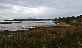 Camas an t-Salainn and Morroch Point. Inlet of Loch nan Ceall.
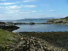
 Eilean nan Cabar. Taken from the south-east side of the peninsula. This image shows that Eilean nan Cabar, safe from grazing sheep, has a significant number of trees on it.
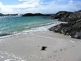 Beach at Port nam Murrach. This small beach is found at the end of a rough walk from the Arisaig road past Rhue House. This view is looking north.
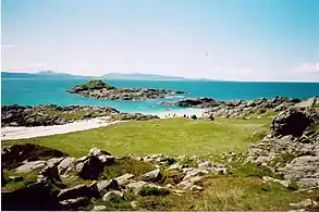 Port nam Murrach beach and duneland at the extreme west end of the peninsula. Looking westwards towards Eigg.
 Loch a' Mhuilinn, a small lochan in the middle of the peninsula
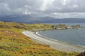 The bay of Camas Leathann from the west
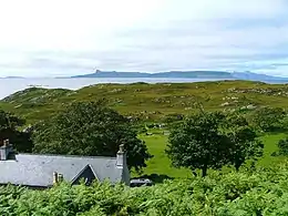 Rhue House looking westwards towards Eigg
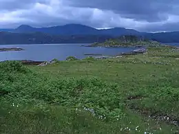
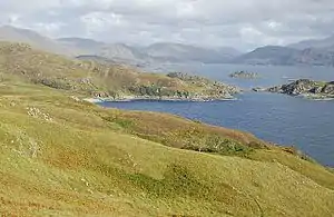 Camus Ghaoideil: Looking east from the slopes of Doire Fhada towards Ghaoideil and Loch Nan Uamh
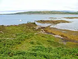 Loch nan Ceall on the north coast of the peninsula
References
- "Rhu Arisaig - An archaeological survey of the Rhu Peninsula completed between 2012 & 2016" (pdf). Highland Government. Library: Rough Bounds Archaeology. November 2016. Retrieved 30 June 2020.
- Gittings, Bruce; Munro, David. "Arisaig". The Gazetteer for Scotland. School of GeoSciences, University of Edinburgh and The Royal Scottish Geographical Society. Retrieved 30 June 2020.
- Rixson, Denis (2002). Arisaig and Morar : a history. East Linton, Scotland: Tuckwell Press. ISBN 1862321248. OCLC 51108683.
- "Arisaig, General". Canmore. National Record of the Historic Environment. Retrieved 1 July 2020.
- John G. Gibson (4 July 2017). Gaelic Cape Breton Step-Dancing: An Historical and Ethnographic Perspective. MQUP. p. 150. ISBN 978-0-7735-5061-2. Retrieved 25 July 2020.