Richardson Creek (Rocky River tributary)
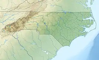
Richardson Creek is a tributary of the Rocky River in south-central North Carolina that rises in Union County near Monroe and then flows northeast through Anson County to the Rocky River.
| Richardson Creek Tributary to Rocky River | |
|---|---|
 Location of Richardson Creek mouth | |
| Location | |
| Country | United States |
| State | North Carolina |
| Counties | Anson Union |
| City | Monroe |
| Physical characteristics | |
| Source | divide between Richardson Creek and Lynches River |
| • location | Pond, about 1 mile southeast of Roughedge, North Carolina |
| • coordinates | 34°52′36″N 080°35′46″W[1] |
| • elevation | 660 ft (200 m)[2] |
| Mouth | Rocky River |
• location | about 3 miles southwest of Cottonville, North Carolina |
• coordinates | 35°09′24″N 080°13′32″W[1] |
• elevation | 230 ft (70 m)[1] |
| Length | 44.01 mi (70.83 km)[3] |
| Basin size | 234.15 square miles (606.4 km2)[4] |
| Discharge | |
| • location | Rocky River |
| • average | 249.47 cu ft/s (7.064 m3/s) at mouth with Rocky River[4] |
| Basin features | |
| Progression | northeast |
| River system | Pee Dee River |
| Tributaries | |
| • left | Beaverdam Creek Bearskin Creek Stewarts Creek Mill Creek Watson Creek Gold Branch Stegall Branch |
| • right | Adams Branch Little Richardson Creek Joes Branch Rays Fork Meadow Branch Bull Branch Salem Creek Gourdvine Creek Water Branch Pine Log Creek |
| Waterbodies | Lake Lee |
| Bridges | Lathan Road, Griffith Road, Plyler Mill Road, Griffith Road, Sara Lane, Wolf Pond Road, Medlin Road, US 601, US 74, Walkup Avenue, US 74, Olive Branch Road, Austin Chaney Road, E Lawyers Road, Tarlton Mill Road, NC 205, NC 218, Pleasant Hill Church Road, Blonnie Ross Road, NC 742, George Wright Road, Rocky Mount Church Road, |
Variant names
According to the Geographic Names Information System, it has also been known historically as:[1]
- Richardsons Creek
See also
References
- "GNIS Detail - Richardson Creek". geonames.usgs.gov. US Geological Survey. Retrieved 13 September 2019.
- "Richardson Creek Topo Map, Anson County NC (Aquadale Area)". TopoZone. Locality, LLC. Retrieved 13 September 2019.
- "ArcGIS Web Application". epa.maps.arcgis.com. US EPA. Retrieved 13 September 2019.
- "Richardson Creek Watershed Report". Waters Geoviewer. US EPA. Retrieved 13 September 2019.
This article is issued from Wikipedia. The text is licensed under Creative Commons - Attribution - Sharealike. Additional terms may apply for the media files.