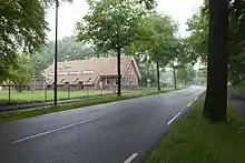
Rijksstraatweg
Rijksstraatweg or simply Straatweg (Steenweg in Belgium) was the term for paved roads of interregional significance in the Netherlands in the 19th and early 20th centuries. These roads were built by the national government, and formed the country's first centrally planned highway network. They received route numbers, eventually resulting in a nationwide network of 82 highways. It formed the basis for today's system of nationally controlled roads (called Rijkswegen), the Netherlands' main highway grid.
The network was both inspired by, and an expansion of the network of imperial highways constructed by France during the era of Emperor Napoléon Bonaparte. In 1795 a new Dutch republic had been proclaimed with the armed support of the revolutionary French Republic. The country's rule was centralised, and French influence started getting ever stronger. In 1804 Napoleon became emperor of France, and between 1810 and 1813 the Netherlands was made a full part of the French Empire. During those years, construction of the French imperial highways was also extended to Holland. Amsterdam was connected to Paris by Route Impériale no. 2. The section between Amsterdam and Utrecht is today still a part of the A2 motorway.[1] The name Rijksstraatweg literally translates as "Imperial paved road", reflecting not only the French example, but also the Netherlands' own status, still being a colonial empire at that time.
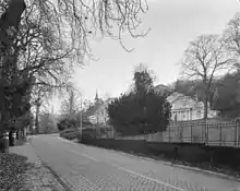
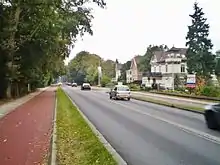
After the independence of the Kingdom of the Netherlands in 1815, paving of existing and construction of new interregional roads continued. The first plan for 26 national roads, had already been drawn up in 1814. By 1816 it had grown to 31, and to 42 in 1821. In this period, roads between towns were still mostly unpaved, and horse-drawn boats were still common, so this was a significant development. But costs had to be weighed. Paving was done predominantly in regions with a sufficient amount of industry, and tolls were charged. Important routes across the borders were also paved.
The numbering was based on geographical location, with its center in Amsterdam, where the highways 1-9 radiated into the country (see list below). Highway 10 connected Leiden with Haarlem, the numbers 11-14 were connected to The Hague, 15-21 to Rotterdam, 22-27 to Utrecht and so forth, up to number 82.
During the rise of steam train railways in the second half of the 19th century, the road network received much less attention, as national funding went largely into developing a solid rail infrastructure. However, when the automobile made its way to the general public, it became inevitable to improve the highway network for motorised traffic. In 1927 the first Rijkswegenplan was produced, the first Dutch national highway structure plan for a century; paving the way for the modern highway system that is still in place today. From that time on, the name Rijksweg was used in favour of the previous Rijksstraatweg.[2] Eventually the original system was almost completely absorbed into the Rijksweg network. The first Rijkswegenplan based its route numbers on the existing system, but these have been revised many times since.
So far the rijks(straat)weg numbers had been mostly administrative, and not displayed on signposts. At best they were indicated on kilometre poles and can still be found on old maps. In Leiden, an old pole is still situated along Straatweg 4 (Haagweg), signaling 16 km from The Hague. Signposting highway route numbers on road signs started in 1957, when the European E-road numbers and the complementing National N-road numbers were introduced in the Netherlands. But in 1976 it was decided to signpost the Rijksweg numbers instead, abolishing the N-road numbers, and also displaying them on roads with an E-number, in order to consistently cover the whole network.
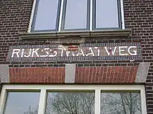
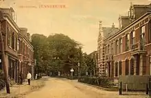
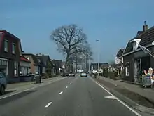
The name 'Rijksstraatweg' or the suffix '-straatweg' is still often found on local street names, e.g. the Amsterdamsestraatweg in Utrecht (part of Route 2).
Rijksstraatwegen
Radiating from Amsterdam
N0 Beltway around central Amsterdam[3]
N1 Dam Square - Diemen - Muiden - Naarden - Bussum - Hilversum - Baarn - Amersfoort
N2 Dam Square - Duivendrecht - Abcoude - Loenen - Breukelen - Maarssen - Zuilen - Utrecht
N3 Dam Square - Amstelveen - Ter Aar - Gouda - Nieuwerkerk a/d IJssel - Kralingen - Rotterdam
N4 Dam Square - Sloten - Haarlemmermeer - Leiden - Wassenaar - The Hague
N5 Dam Square - Halfweg - Haarlem - Bloemendaal - Zandvoort
N6 Dam Square - Spaarndam - Velsen - Beverwijk - Castricum - Alkmaar - Den Helder
N7 Dam Square - Zaandam - Wormerveer - Heerhugowaard - Langedijk - Schagen - Wieringen
N8 Dam Square - Nieuwendam - Purmerend - Hoorn - Middenmeer - Wieringen - Wonseradeel
N9 Dam Square - Zeeburg - Almere - Kampen - Zwolle
Originating in The Hague, Rotterdam or Utrecht
N10 Leiden - Sassenheim - Lisse - Haarlem - Velsen
N11 The Hague - Voorschoten - Leiden - Alphen - Bodegraven - Woerden - De Meern - Utrecht
N12 Scheveningen - Voorburg - Zoetermeer - Gouda - Oudewater - De Meern - Utrecht
N13 The Hague - Delft - Overschie - Rotterdam
N14 The Hague - Naaldwijk - Hook of Holland
N15 Rotterdam - IJsselmonde - Ridderkerk - Gorinchem - Waardenburg - Geldermalsen - Tiel
N16 Rotterdam - IJsselmonde - Dordrecht - Moerdijk - Breda - Zundert
N17 Rotterdam - Barendrecht - Numansdorp - Willemstad - Steenbergen - Bergen op Zoom
N18 Rotterdam - Charlois - Spijkenisse - Hellevoetsluis - Stellendam - Middelharnis
N19 Hillegersberg - Rotterdam - Charlois - Pernis - Rozenburg - Hellevoetsluis
N20 Rotterdam - Delfshaven - Schiedam - Vlaardingen - Hook of Holland
N21 Rozenburg - Maassluis - Delft - Pijnacker - Zoetermeer
N22 Utrecht - Maartensdijk - Hilversum - Huizen
N23 Utrecht - De Bilt - Soest - Amersfoort
N24 Utrecht - Zeist - Renswoude - Ede - Arnhem - Westervoort - Zevenaar - Elten
N25 Utrecht - Bunnik - Doorn - Rhenen - Wageningen - Arnhem
N26 Utrecht - Houten - Culemborg - Geldermalsen - Zaltbommel - Bois le Duc
N27 Utrecht - Nieuwegein - Vianen - Gorinchem - Sleeuwijk - Oosterhout - Breda
Originating elsewhere
N28 Amersfoort - Nijkerk - Harderwijk - Wezep - Zwolle
N29 Amersfoort - Voorthuizen - Apeldoorn
N30 Nijkerk - Barneveld - Renswoude - Veenendaal - Rhenen
N31 Leeuwarden - Franeker - Harlingen - Wonseradeel
N32 Leeuwarden - Heerenveen - Steenwijk - Meppel - Zwolle
N33 Assen - Veendam - Delfzijl
N34 Groningen - Zuidlaren - Emmen - Coevorden - Avereest
N35 Zwolle - Kampferbeke - Nijverdal - Almelo
N36 Coevorden - Hardenberg - Almelo
N37 Zwolle - Wijhe - Deventer
N38 Oldebroek - Kampen - Emmeloord - Lemmer - Sneek - Wonseradeel
N39 Groningen - Leek - Drachten - Heerenveen - Sneek
N40 Groningen - Hoogezand - Winschoten - Nieuweschans
N41 Leeuwarden - Buitenpost - Groningen - Appingedam - Delfzijl
N42 Groningen - Assen - Smilde - Meppel
N43 Almelo - Borne - Hengelo - Enschede
N44 Apeldoorn - Deventer - Goor - Hengelo - Oldenzaal
N45 Raalte - Deventer - Gorssel - Zutphen
N46 Assen - Hoogeveen - Coevorden
N47 Zutphen - Ruurlo - Groenlo - Winterswijk
N48 Twello - Rheden - Arnhem
N49 Zutphen - Voorst - Apeldoorn
N50 Arnhem - Apeldoorn - Epe - Hattem
N51 Rheden - Doesburg - Doetinchem - Winterswijk - Haaksbergen - Enschede
N52 Arnhem - Elst - Nijmegen
N53 Ubbergen - Nijmegen - Beuningen - Druten - Tiel - Geldermalsen
N54 Bois le Duc - Waalwijk - Geertruidenberg - Zevenbergen - Willemstad
N55 Bois le Duc - Rosmalen - Heesch - Grave - Nijmegen
N56 Flushing - Middelburg - Kortgene - Sint Maartensdijk - Tholen - Bergen op Zoom
N57 Westenschouwen - Brouwershaven - Zierikzee
N58 Flushing - Middelburg - Goes - Kruiningen - Bergen op Zoom
N59 Zierikzee - Bruinisse - Sint Philipsland - Steenbergen
N60 Goes - Terneuzen - Axel - Hulst - Sint Jansteen
N61 Terneuzen - IJzendijke - Oostburg - Sluis
N62 Tilburg - Waalwijk - Drunen - Heusden - Woudrichem - Gorinchem
N63 Bergen op Zoom - Roosendaal - Princenhage - Breda - Rijen - Tilburg - Oirschot - Best - Eindhoven
N64 Bois le Duc - Vught - Boxtel - Best - Eindhoven
N65 Vught - Helvoirt - Berkel Enschot - Tilburg - Goirle
N66 Best - Sint Oedenrode - Veghel - Uden - Grave
N67 Eindhoven - Veldhoven - Eersel - Reusel
N68 Eindhoven - Geldrop - Heeze - Weert - Roermond
N69 Eindhoven - Aalst - Valkenswaard - Borkel en Schaft
N70 Eindhoven - Geldrop - Helmond - Asten - Helden - Venlo
N71 Nijmegen - Gennep - Venlo
N72 Venlo - Tegelen - Roermond
N73 Grave - Cuijk - Boxmeer - Venraij - Maasbree - Haelen - Ittervoort
N74 Roermond - Maasniel
N75 Roermond - Echt - Sittard - Geleen - Maastricht
N76 Sittard - Hoensbroek - Heerlen
N77 Heerlen - Kerkrade
N78 Maastricht - Heer - Margraten - Vaals
N79 Maastricht - Meerssen - Valkenburg - Voerendaal - Heerlen
N80 Maastricht - Heer - Eijsden
N81 Maastricht - Oud Vroenhoven (southbound)
N82 Maastricht - Oud Vroenhoven (northbound)
Modern additions (never signposted)
N83 Almere - Zeewolde - Dronten
N84 Hoorn - Enkhuizen - Lelystad - Harderwijk
N85 Purmerend - Almere (planned route into the discontinued Markerwaard polder)
The numbers 86, 87 and 88 are vacant, while 89 to 100 were used for the National N-Road route numbers.
See also
Notes & References
- L.W. van der Veen, "Nederland in de Napoleontische tijd", in: 10.000 jaar Geschiedenis der Nederlanden, Leeuwarden 1985 (ch. 13).
- M. Schroor, "Naar het moderne Nederland", op cit. (ch. 16)
- Planned at a later date but was never realized. The current A10-motorway was based on the N0.
- "N345 (Nederland)". wegenwiki.nl.
Other sources
Part of this article is translated from the Dutch Wikipedia page on this topic, retrieved on 14 July 2014: Rijksstraatweg - Wikipedia.
It lists two (Dutch language) paper sources, but lacks inline citations:
- Blok, D.P. e.a. red. (1981), De Algemene Geschiedenis der Nederlanden, deel 10, Bussum: Unieboek
- Frankema, Ewout en Peter Groote, De modernisering van het Nederlandse wegennet. Nieuwe perspectieven op de ontwikkeling voor 1940, NEHA deel 65 (2002) 305-328
