Rincon Valley Formation
The Rincon Valley Formation is a geologic formation found in the Rincon Valley of New Mexico. It preserves fossils dating back to the Miocene epoch.[1]
| Rincon Valley Formation Stratigraphic range: Miocene | |
|---|---|
| Type | Formation |
| Unit of | Santa Fe Group |
| Underlies | Camp Rice Formation |
| Overlies | Hayner Ranch Formation |
| Thickness | 610 meters (2,000 ft) |
| Lithology | |
| Primary | Sandstone, mudstone, conglomerate |
| Other | Gypsum |
| Location | |
| Coordinates | 32.588750°N 106.967225°W |
| Region | New Mexico |
| Country | United States |
| Type section | |
| Named for | Rincon Valley |
| Named by | Seager et al. |
| Year defined | 1971 |
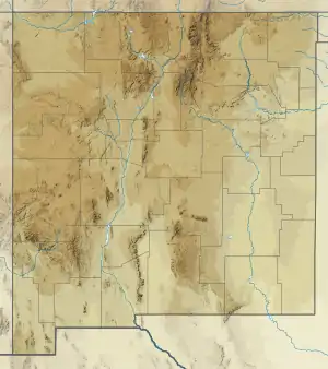
 Rincon Valley Formation (the United States)  Rincon Valley Formation (New Mexico) | |
Description
The formation consists of pink to reddish-brown gypsiferous claystone and siltstone; conglomerate; and conglomeratic sandstone.[1] The thickness is 610 meters (2,000 ft).[2] The formation is exposed in the badlands bordering the Rio Grande valley north of Las Cruces, New Mexico. It grades below into the Hayner Ranch Formation and unconformably underlies the Camp Rice Formation.[1] It is interbedded with flows of the Selden Basalt Member with a radiometric age of 9.6 million years.[3]
The formation consists of two facies. The first is a fine-grained gypsiferous slope-forming facies interpreted as playa deposits in a closed basin. This contains gypsum beds up to 2 feet (0.61 m) thick. The second facies, which forms the upper 180 feet (55 m) of the formation, is a more resistant poorly sorted conglomerate interpreted as piedmont deposits, eroded from the uplifts that bordered the basin. [1]
The formation is interpreted as the final filling of the closed basin.[1] During its deposition, deformation continued along the Rio Grande rift, with some 854 meters (2,802 ft) of displacement occurring along the Caballo Mountains border faults. The Sierra de las Uvas and Dona Ana Mountains were first thrown during deposition of the formation, with a displacement of about 549 meters (1,801 ft) on the bounding fault of the Sierra de las Ulvas block.[2]
Study of this and other Cenozoic formations in the region has helped provide evidence for four episodes of block faulting in the rift in the last 35 million years.[2]
Fossils
The formation is largely devoid of fossils. However, a single carpal bone of the rhinoceros Teleoceras fossiger has been recovered from the formation, of Hemphillian age, in agreement with the age of the formation from radiometric dating.[3]
History of investigation
The formation was first defined by W.R. Seager and coinvestigators in 1971, and assigned to the Santa Fe Group.[1]
Footnotes
References
- Mack, Greg H.; Seager, William R.; Kieling, John (August 1994). "Late oligocene and miocene faulting and sedimentation, and evolution of the southern Rio Grande rift, New Mexico, USA". Sedimentary Geology. 92 (1–2): 79–96. Bibcode:1994SedG...92...79M. doi:10.1016/0037-0738(94)90055-8.
- Morgan, Gary S.; Lucas, Spencer G.; Estep, John W. (1998). "Pliocene (Blancan) vertebrate fossils from the Camp Rice Formation near Tonuco Mountain, Dona Ana County, southern New Mexico" (PDF). New Mexico Geological Society Field Conference Series. 49: 237–249. Retrieved 14 August 2020.
- Seager, W.R.; Hawley, J.W.; Clemons, R.E. (1971). "Geology of San Diego Mountain area, Dona Ana County, New Mexico" (PDF). New Mexico Bureau of Mines and Mineral Resources Bulletin. 97. Retrieved 14 August 2020.