Rivière de l'Est
The Rivière de l'Est is a river on the Indian Ocean island of Réunion. It flows northeast from the southeast of the island, reaching the sea between the towns of Sainte-Anne and Sainte-Rose. It is 21.2 km (13.2 mi) long.[1]
| Rivière de l'Est | |
|---|---|
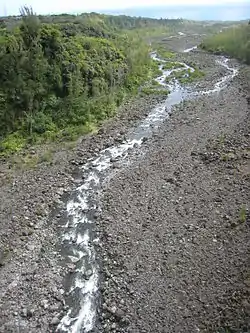 View from the bridge across Le Rivière de l'Est | |
| Location | |
| Country | France |
| Region | Réunion |
| Physical characteristics | |
| Source | |
| • elevation | 2,350 ft (720 m) |
| Mouth | |
• location | Indian Ocean |
• coordinates | 21°6′22″S 55°46′13″E |
• elevation | sea level |
| Length | 21.2 km (13.2 mi) |
The Rivière de l'Est flows down the slopes of the Shield volcano Piton de la Fournaise from an elevation of 720 metres (2,350 ft) above sea level.
This article is issued from Wikipedia. The text is licensed under Creative Commons - Attribution - Sharealike. Additional terms may apply for the media files.