Rotla
Rotla is a 40-kilometre (25 mi) long river in Trøndelag county, Norway. The river begins at Roltdalstjønna in Meråker municipality, just north of the mountain Fongen. It then runs through west through the Skarvan and Roltdalen National Park. The river ends when it flows into the Nea River near Stokkan in Selbu municipality. The Nea River then flows west for 15 kilometres (9.3 mi) until reaching the lake Selbusjøen at the village of Mebonden. The river Rotla is part of the Nea-Nidelvvassdraget watershed.[1]
| Rotla | |
|---|---|
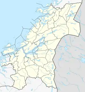 Location of the river  Rotla (Norway) | |
| Location | |
| Country | Norway |
| County | Trøndelag |
| Municipalities | Selbu, Meråker |
| Physical characteristics | |
| Source | Roltdalstjønna |
| • location | Meråker, Trøndelag, Norway |
| • coordinates | 63°13′01″N 11°40′01″E |
| • elevation | 785 metres (2,575 ft) |
| Mouth | Nea River |
• location | Selbu, Trøndelag, Norway |
• coordinates | 63°11′05″N 11°10′06″E |
• elevation | 220 metres (720 ft) |
| Length | 40 km (25 mi) |
| Basin features | |
| River system | Nea-Nidelvvassdraget |
| Tributaries | |
| • left | Ramåa, Fongåa, Vela |
| • right | Fagermoa, Krossåa |
See also
This article is issued from Wikipedia. The text is licensed under Creative Commons - Attribution - Sharealike. Additional terms may apply for the media files.