Sèvre Nantaise
The Sèvre Nantaise is a river in the Pays de la Loire regions in western France. It is a left-bank tributary of the Loire. Its total length is 141.8 km (88.1 mi).[1] Its source is in the Deux-Sèvres department, near Secondigny. It flows from south to north through the departments and towns listed here, reaching the river Loire in the city of Nantes. That city gives it the name Sèvre Nantaise, distinguishing it from the Sèvre Niortaise further south.
| Sèvre Nantaise | |
|---|---|
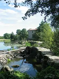 The Sèvre Nantaise, near Tiffauges | |
 | |
| Native name | La Sèvre nantaise (French) |
| Location | |
| Country | France |
| Physical characteristics | |
| Source | |
| • location | Deux-Sèvres |
| • elevation | 215 m (705 ft) |
| Mouth | |
• location | Loire |
• coordinates | 47°11′46″N 1°32′49″W |
| Length | 141.8 km (88.1 mi) |
| Basin size | 2,356 km2 (910 sq mi) |
| Discharge | |
| • average | 9.5 m3/s (340 cu ft/s) |
| Basin features | |
| Progression | Loire→ Atlantic Ocean |
Departments and communes along its course
This list is ordered from source to mouth:
- Deux-Sèvres: Moncoutant, La Forêt-sur-Sèvre
- Vendée: Saint-Laurent-sur-Sèvre, Mortagne-sur-Sèvre, Tiffauges
- Maine-et-Loire: Le Longeron, Torfou
- Loire-Atlantique: Clisson, Le Pallet, Vertou, Rezé, Nantes
The complete list is on the French page for this river.
Navigation
The river is navigable over a length of 21.5 km (13.4 mi) from the village of Monnières to the confluence. It has a horseshoe weir (Chaussée Des Moines) and lock at Vertou, and a tidal sluice open to boats an hour before and after high tide at Pont-Rousseau, in the suburbs of Nantes. The river is an important resource for tourism in the region. Beyond the navigable section, the river is a popular destination for canoeists.
Its left-bank tributary the Petite Maine is also navigable over a length of 6 km (3.7 mi), up to the first disused lock and weir.
References
- Edwards-May, David, Inland Waterways of France (2010), Imray Ltd., St Ives, Cambs., UK, p. 284
- Sèvre Nantaise with further details by the author of 'Inland Waterways of France'
- Navigation details for 80 French rivers and canals (French waterways website section)
| Wikimedia Commons has media related to Sèvre Nantaise. |