Salhøa
Salhøa is a mountain in Dovrefjell–Sunndalsfjella National Park in Norway, located on the border between the municipalities Sunndal in Møre og Romsdal county and Lesja in Innlandet county.[1] Salhøa is reached most easily by hiking from Grøvudalen in the north. There are three large surrounding mountains, all within 3 kilometres (1.9 mi), including the 1,844-metre (6,050 ft) tall Grøvudalstinden to the west, the 1,881-metre (6,171 ft) tall Steinkollen to the north, and the 1,985-metre (6,512 ft) tall Storskrymten to the northwest.[2]
| Salhøa | |
|---|---|
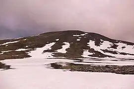 Salhøa in the evening, viewed from the north. The small lake in the front is at 1589 m.s.l. | |
| Highest point | |
| Elevation | 1,859 m (6,099 ft) |
| Prominence | 210 m (690 ft) |
| Coordinates | 62°21′34″N 9°1′8″E |
| Geography | |
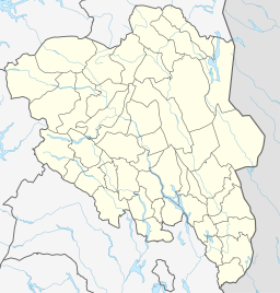 Salhøa Location of the mountain 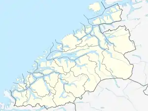 Salhøa Salhøa (Møre og Romsdal)  Salhøa Salhøa (Norway) | |
| Location | Sunndal, Møre og Romsdal and Lesja, Innlandet, Norway |
References
- "Salhøa, Sunndal (Møre og Romsdal)" (in Norwegian). yr.no. Retrieved 2019-04-27.
- "Salhøa" (in Norwegian). peakbook.org. Retrieved 2019-04-27.
This article is issued from Wikipedia. The text is licensed under Creative Commons - Attribution - Sharealike. Additional terms may apply for the media files.