Santa Filomena, Piauí
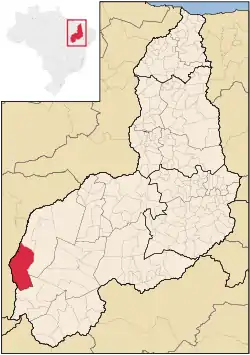
Santa Filomena is the westernmost city in the Brazilian state of Piauí. The city lies near the Parnaíba River, which forms the border with the state of Maranhão.
Municipality of Santa Filomena
Município de Santa Filomena | |
|---|---|
 | |
| Coordinates: 09°06′43″S 45°55′19″W | |
| Country | Brazil |
| Region | Northeast |
| State | Piauí |
| Settled | 1938 |
| Government | |
| • Mayor | Ernani de Paiva Maia (PSDB) |
| Area | |
| • Total | 5,285.447 km2 (2,040.722 sq mi) |
| Population (2020 [1]) | |
| • Total | 6,254 |
| • Density | 1.2/km2 (3/sq mi) |
| Time zone | UTC-3 (UTC-3) |
| • Summer (DST) | UTC-2 (UTC-2) |
| HDI (2000) | 0.618 – medium[2] |
The municipality contains part of the Uruçui-Una Ecological Station.[3]
References
- IBGE 2020
- - UNDP
- Unidade de Conservação: Estação Ecológica de Uruçuí-Una (in Portuguese), MMA: Ministério do Meio Ambiente, retrieved 2016-04-23
This article is issued from Wikipedia. The text is licensed under Creative Commons - Attribution - Sharealike. Additional terms may apply for the media files.