Santoche
Santoche is a former commune in the Doubs department in the Bourgogne-Franche-Comté region in eastern France. On 1 January 2017, it was merged into the new commune Pays-de-Clerval.[2]
Santoche | |
|---|---|
Part of Pays-de-Clerval | |
Location of Santoche 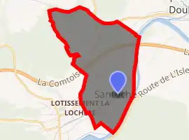
| |
 Santoche  Santoche | |
| Coordinates: 47°24′17″N 6°30′29″E | |
| Country | France |
| Region | Bourgogne-Franche-Comté |
| Department | Doubs |
| Arrondissement | Montbéliard |
| Canton | Bavans |
| Commune | Pays-de-Clerval |
| Area 1 | 2.15 km2 (0.83 sq mi) |
| Population (2014)[1] | 87 |
| • Density | 40/km2 (100/sq mi) |
| Time zone | UTC+01:00 (CET) |
| • Summer (DST) | UTC+02:00 (CEST) |
| Postal code | 25340 |
| Elevation | 275–385 m (902–1,263 ft) |
| 1 French Land Register data, which excludes lakes, ponds, glaciers > 1 km2 (0.386 sq mi or 247 acres) and river estuaries. | |
Geography
Santoche lies 2 km (1.2 mi) north of Clerval in the valley of the Doubs River on an ancient Roman road.
History
The commune has the only dolmen in the department and a rectangular mound surrounded by ditches called the Motte Jules César, which was once a Gallic temple.
Archaeological digs have discovered prehistoric objects and bones.
Population
| Year | Pop. | ±% |
|---|---|---|
| 1962 | 31 | — |
| 1968 | 35 | +12.9% |
| 1975 | 51 | +45.7% |
| 1982 | 74 | +45.1% |
| 1990 | 77 | +4.1% |
| 1999 | 68 | −11.7% |
| 2008 | 81 | +19.1% |
| 2012 | 80 | −1.2% |
See also
References
- Populations légales 2014: Téléchargement du fichier d'ensemble, INSEE
- Arrêté préfectoral 9 August 2016 (in French)
External links
| Wikimedia Commons has media related to Santoche. |
- Santoche on the regional Web site (in French)
| Authority control |
|---|
This article is issued from Wikipedia. The text is licensed under Creative Commons - Attribution - Sharealike. Additional terms may apply for the media files.