Sempu (island)
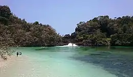
Sempu is an island located 800 meters from the southern coast of the province of East Java in Indonesia, about 70 km south of the city of Malang. The island is 3.9 km long and 3.6 km wide. Its topography is largely rolling hills whose altitude ranges from 50 to 100 meters above sea level.[1] The coastline consists mainly of limestone cliffs characteristics of the façade of the island of Java in the Indian Ocean.
 Pulau Sempu | |
 Sempu Island Sempu Island | |
| Geography | |
|---|---|
| Location | South East Asia |
| Coordinates | 8°26′48″S 112°41′43″E |
| Archipelago | Greater Sunda Islands |
| Area | 8.77 km2 (3.39 sq mi) |
| Highest elevation | 100 m (300 ft) |
| Administration | |
Indonesia | |
| Province | East Java |
Sempu is accessed from the village of Sendang Biru, the most important fishing port on the south coast of Java.
References
- Melani, Wardana (1996). "Promosi dan pemasaran obyek wisata Cagar Alam Pulau Sempu dan pengembangan Pantai Sendang Biru sebagai daerah tujuan wisata alam". repository.petra.ac.id. Retrieved 2018-11-13.
This article is issued from Wikipedia. The text is licensed under Creative Commons - Attribution - Sharealike. Additional terms may apply for the media files.