Shah Dhar
Shah Dhar (Dari/Pashto/Urdu: شاہ دھر) is a mountain in the Hindu Kush mountains. It has an elevation of 7,038 metres (23,091 ft) and sits on the international boundary between Afghanistan and Pakistan. Shah Dhar is at a distance of 337 km from Islam, Abad.[3][4][5]
| Shah Dhar شاہ دھر | |
|---|---|
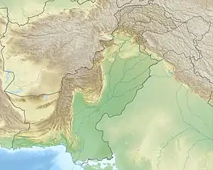 Shah Dhar شاہ دھر Location in Pakistan, on the border with Afghanistan | |
| Highest point | |
| Elevation | 7,038 m (23,091 ft) [1] |
| Prominence | 1,562 m (5,125 ft) [2] |
| Listing | Ultra List of mountains in Pakistan |
| Coordinates | 36°40′18″N 72°13′54″E [2] |
| Geography | |
| Location | Afghanistan–Pakistan border |
| Parent range | Hindu Kush |
References
- "Shah Dhar". Peakbagger.com. Retrieved 2009-12-31.
- "Afghanistan and Central/Southern Pakistan". Peaklist.org. Retrieved 2013-03-01.
- "latitude and longitude gps coordinates of Shah Dhar (Pakistan, Asia)". thegpscoordinates.net. Retrieved 2020-06-27.
- "Shah Dhar Mountain Information". www.mountain-forecast.com. Retrieved 2020-07-30.
- "Shah Dhar, Pakistan".
This article is issued from Wikipedia. The text is licensed under Creative Commons - Attribution - Sharealike. Additional terms may apply for the media files.