Sierrita Mountains
The Sierrita Mountains (English: "Little Mountains") is a minor mountain range about forty miles southwest of Tucson, in Pima County, Arizona. Historically, the area has seen extensive mining and ranching activity: several ranches, abandoned mines, and the large Sierrita Mine are located in the area. The highest point in the mountains is Keystone Peak, which rises to 6,188 feet (1,886 m).[1][2]
| Sierrita Mountains | |
|---|---|
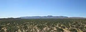 The Sierritas from the east. | |
| Highest point | |
| Peak | Keystone Peak |
| Elevation | 6,188 ft (1,886 m) |
| Coordinates | 31°52′40″N 111°11′42″W |
| Geography | |
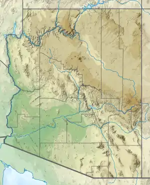 Sierrita Mountains Location of the Sierritas in Arizona | |
| Location | Pima County, Arizona |
| Country | United States |
| State | Arizona |
| Region | Sonoran Desert |
| District | Tucson, AZ |
| Topo map | USGS Samaniego, AZ |
The Santa Cruz Valley bounds the range to the east separating it from the Santa Rita Mountains. The west margin of the range is the broad Altar Valley. To the southwest the Sierritas merge with the Cerro Colorado Mountains and the Penitas Hills. The Tumacacori Mountains of Santa Cruz County lie to the southeast.[3]
Gallery
 The Sierritas from Corona de Tucson.
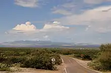
 View of the Sierritas from the Santa Rita Experimental Range.
See also
References
- "Sierrita Mountains, AZ". Retrieved 2013-12-05.
- "Keystone Peak, AZ". Retrieved 2013-12-05.
- Arizona Atlas and Gazetteer, DeLorme, 4th ed., 2001, p. 72-3 ISBN 0-89933-325-7
External links
- "Sierrita Mountains : Climbing, Hiking & Mountaineering : SummitPost". Retrieved 2013-12-05.
- "Keystone Peak : Climbing, Hiking & Mountaineering : SummitPost". Retrieved 2013-12-05.
This article is issued from Wikipedia. The text is licensed under Creative Commons - Attribution - Sharealike. Additional terms may apply for the media files.