Sipsey River
The Sipsey River is a 145-mile-long (233 km)[2] swampy low-lying river in west central Alabama. The Sipsey is surrounded by wetland habitat. It originates near Glen Allen, and discharges into the Tombigbee River near Vienna.[3] The river belongs to the Southeastern Coastal Plain and features an eastern deciduous forest terrestrial biome.[1]
| Sipsey River | |
|---|---|
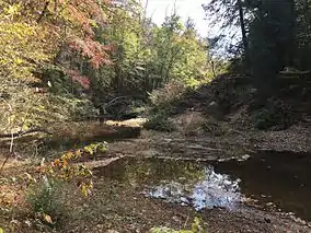 Sipsey River in the 2016 drought | |
| Location | |
| Country | United States |
| State | Alabama |
| Physical characteristics | |
| Source | |
| • coordinates | 33.91454°N 87.68724°W |
| Mouth | |
• coordinates | 33.00401°N 88.17197°W |
| Length | 145 mi (233 km) |
| Basin size | 789 sq mi (2,044 km2)[1] |
| Discharge | |
| • average | 810 cu ft/s (23 m3/s)[1] |
See also
References
- Ward, G.M.; P. Harris; A.K. Ward (2005). "Gulf Coast Rivers of the Southeastern United States". In A.C. Benke; C.E. Cushing (eds.). Rivers of North America. Academic Press. pp. 125–178. ISBN 978-0-12-088253-3. Retrieved 8 January 2019.
- "The National Map". U.S. Geological Survey. Retrieved Feb 23, 2011.
- U.S. Geological Survey Geographic Names Information System: Sipsey River
| Authority control |
|
|---|
This article is issued from Wikipedia. The text is licensed under Creative Commons - Attribution - Sharealike. Additional terms may apply for the media files.