Smin Peak
Smin Peak (Bulgarian: връх Смин, romanized: vrah Smin, IPA: [ˈvrɤx ˈsmin]) is the partly ice-free peak rising to 850 m in the southeast foothills of Louis-Philippe Plateau on Trinity Peninsula in Graham Land, Antarctica. It is surmounting Cugnot Ice Piedmont to the east and south.
| Smin Peak | |
|---|---|
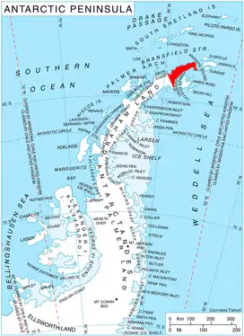 Location of Trinity Peninsula | |
| Location | Graham Land, Antarctica |
| Coordinates | 63°38′17″S 58°18′53″W |
| Part of | Louis-Philippe Plateau on Trinity Peninsula |
| Highest point | 850 m |
The peak is named after the settlement of Smin in Northeastern Bulgaria.
Location
Smin Peak is located at 63°38′17″S 58°18′53″W, which is 2.69 km (1.67 mi) south by west of Hochstetter Peak, 10.06 km (6.25 mi) west-northwest of Levassor Nunatak, 3.87 km (2.40 mi) north of Chochoveni Nunatak and 6.61 km (4.11 mi) northeast of Drenta Bluff. German-British mapping in 1996.
Maps
- Trinity Peninsula. Scale 1:250000 topographic map No. 5697. Institut für Angewandte Geodäsie and British Antarctic Survey, 1996.
- Antarctic Digital Database (ADD). Scale 1:250000 topographic map of Antarctica. Scientific Committee on Antarctic Research (SCAR). Since 1993, regularly updated.
References
- Smin Peak. SCAR Composite Antarctic Gazetteer
- Bulgarian Antarctic Gazetteer. Antarctic Place-names Commission. (details in Bulgarian, basic data in English)
External links
- Smin Peak. Copernix satellite image
This article includes information from the Antarctic Place-names Commission of Bulgaria which is used with permission.