Soeng Sang District
Soeng Sang (Thai: เสิงสาง, pronounced [sɤ̌ːŋ sǎːŋ]) is a district (amphoe) in the southeastern part of Nakhon Ratchasima Province, northeastern Thailand.
Soeng Sang
เสิงสาง | |
|---|---|
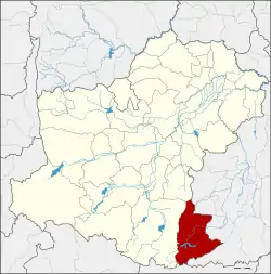 District location in Nakhon Ratchasima Province | |
| Coordinates: 14°25′34″N 102°27′38″E | |
| Country | Thailand |
| Province | Nakhon Ratchasima |
| Seat | Soeng Sang |
| Area | |
| • Total | 1,200.2 km2 (463.4 sq mi) |
| Population (2010) | |
| • Total | 68,387 |
| • Density | 53.6/km2 (139/sq mi) |
| Time zone | UTC+7 (ICT) |
| Postal code | 30330 |
| Geocode | 3003 |
Etymology
The meaning of the district name in Thai is 'dawn' or 'nearly dawn'. The city temple is called Wat Thung Rung Arun Si Soeng Sang.
History
The area was separated from Khon Buri District and became a minor district (king amphoe) on 7 May 1976. The minor district originally consisted of a single tambon, Sa Takhian.[1] It was upgraded to a full district on 25 March 1979.[2]
Geography
Neighbouring districts are (from the north clockwise): Nong Ki, Non Suwan, Pakham, and Non Din Daeng of Buriram Province; Watthana Nakhon of Sa Kaeo Province; and Khon Buri of Nakhon Ratchasima Province.
One of the main attractions in Soeng Sang is the Chomtawan Reservoir.
Administration
The district is divided into six sub-districts (tambons), which are further subdivided into 84 villages (mubans). There are two townships (thesaban tambons), Soeng Sang and Non Sombun, both covering part of same-named tambon. Each of the sub-districts has a tambon administrative organization, responsible for the area not covered by the townships.
| 1. | Soeng Sang | เสิงสาง | |
| 2. | Sa Takhian | สระตะเคียน | |
| 3. | Non Sombun | โนนสมบูรณ์ | |
| 4. | Kut Bot | กุดโบสถ์ | |
| 5. | Suk Phaibun | สุขไพบูลย์ | |
| 6. | Ban Rat | บ้านราษฎร์ |
References
- "ประกาศกระทรวงมหาดไทย เรื่อง แบ่งท้องที่อำเภอครบุรี จังหวัดนครราชสีมา ตั้งเป็นกิ่งอำเภอเสิงสาง" (PDF). Royal Gazette (in Thai). 93 (72 ง): 1098. 11 May 1976.
- "พระราชกฤษฎีกาตั้งอำเภอหนองกุงศรี อำเภอไทรงาม อำเภอบ้านฝาง อำเภออุบลรัตน์ อำเภอเวียงชัย อำเภอดอยเต่า อำเภอนิคมคำสร้อย อำเภอนาหว้า อำเภอเสิงสาง อำเภอศรีสาคร อำเภอบึงสามพัน อำเภอนาดูน อำเภอค้อวัง อำเภอโพธิ์ชัย อำเภอเมืองสรวง อำเภอปลวกแดง อำเภอยางชุมน้อย อำเภอกาบเชิง อำเภอสุวรรณคูหา และอำเภอกุดข้าวปุ้น พ.ศ. ๒๕๒๒" (PDF). Royal Gazette (in Thai). 96 (42 ก Special): 19–24. 25 March 1979.