Soure, Pará
Soure is a Brazilian municipality located in the northern state of Pará, on the island of Marajó, which is located in the Amazon River at its mouth. Its population as of 2020 is estimated to be 25,565 people. The area of the municipality is 3,512.863 km². The city belongs to the mesoregion Marajó and to the microregion of Arari.

Soure | |
|---|---|
Municipality | |
 Flag | |
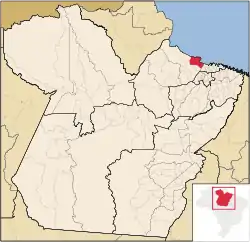 Location in the State of Pará | |
| Coordinates: 00°43′01″S 48°31′22″W | |
| Country | |
| Region | North |
| State | |
| Area | |
| • Total | 3,512.863 km2 (1,356.324 sq mi) |
| Elevation | 10 m (30 ft) |
| Population (2020 [1]) | |
| • Total | 25,565 |
| • Density | 6.2/km2 (16/sq mi) |
| Time zone | UTC-3 (BST) |
| Postal Code | 68870-000 |
The municipality is contained in the 59,985 square kilometres (23,160 sq mi) Marajó Archipelago Environmental Protection Area, a sustainable use conservation unit established in 1989 to protect the environment of the delta region.[2]
It contains the 27,464 hectares (67,870 acres) Soure Marine Extractive Reserve, a sustainable use conservation area created in 2001 that protects the coastal mangroves to the north of the municipal seat and along the north part of the Paracauari River.[3]
Climate
Soure has a tropical monsoon climate (Köppen: Am), with different amounts of precipitation depending on the season.[4][5]
| Climate data for Soure (Soure Airport), elevation: 11 m or 36 ft, 1961-1990 normals and extremes | |||||||||||||
|---|---|---|---|---|---|---|---|---|---|---|---|---|---|
| Month | Jan | Feb | Mar | Apr | May | Jun | Jul | Aug | Sep | Oct | Nov | Dec | Year |
| Average high °C (°F) | 30.5 (86.9) |
30.0 (86.0) |
30.0 (86.0) |
30.4 (86.7) |
30.8 (87.4) |
31.1 (88.0) |
31.0 (87.8) |
30.8 (87.4) |
31.5 (88.7) |
32.0 (89.6) |
32.0 (89.6) |
31.5 (88.7) |
31.0 (87.7) |
| Daily mean °C (°F) | 26.9 (80.4) |
26.5 (79.7) |
26.4 (79.5) |
26.7 (80.1) |
26.9 (80.4) |
27.2 (81.0) |
27.2 (81.0) |
27.6 (81.7) |
28.0 (82.4) |
28.6 (83.5) |
28.2 (82.8) |
27.8 (82.0) |
27.3 (81.2) |
| Average low °C (°F) | 23.9 (75.0) |
23.4 (74.1) |
23.4 (74.1) |
23.6 (74.5) |
23.9 (75.0) |
24.1 (75.4) |
23.9 (75.0) |
24.4 (75.9) |
25.0 (77.0) |
25.2 (77.4) |
25.2 (77.4) |
24.7 (76.5) |
24.2 (75.6) |
| Average precipitation mm (inches) | 417.6 (16.44) |
554.3 (21.82) |
614.8 (24.20) |
565.6 (22.27) |
376.6 (14.83) |
182.9 (7.20) |
159.5 (6.28) |
93.9 (3.70) |
38.5 (1.52) |
16.7 (0.66) |
37.7 (1.48) |
157.8 (6.21) |
3,215.9 (126.61) |
| Average relative humidity (%) | 85.0 | 87.0 | 88.0 | 87.0 | 86.0 | 82.0 | 82.0 | 80.0 | 76.0 | 74.0 | 76.0 | 80.0 | 81.9 |
| Mean monthly sunshine hours | 143.0 | 95.6 | 99.3 | 114.9 | 152.8 | 215.4 | 251.1 | 262.9 | 262.6 | 262.4 | 237.7 | 218.4 | 2,316.1 |
| Source: NOAA[5] | |||||||||||||
Notable People from Soure, Pará
- Ildemar Alcântara, Brazilian mixed martial artist, former UFC fighter and younger brother of Iuri Alcântara.
- Iuri Alcântara, Brazilian mixed martial artist, UFC fighter and older brother of Ildemar Alcântara.
- Deiveson Figueiredo, Brazilian mixed martial artist, UFC fighter and current UFC Flyweight Champion.
References
- IBGE 2020
- APA Arquipélago do Marajó (in Portuguese), ISA: Instituto Socioambiental, retrieved 2016-06-27
- RESEX Marinha de Soure (in Portuguese), ISA: Instituto Socioambiental, retrieved 2016-06-29
- Hunter, Allice (2018-11-21), English: Köppen climate types of Pará, Brazil., retrieved 2019-03-27
- "Soure (82141) - WMO Weather Station". NOAA. Retrieved March 27, 2019.