Stob Coir' an Albannaich
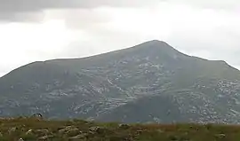
Stob Coir' an Albannaich (1,044 m) is a mountain in the Grampian Mountains of Scotland. It lies on the border of Argyll and Bute and the Highlands area, south of Glen Etive.
| Stob Coir' an Albannaich | |
|---|---|
 Stob Coir' an Albannaich | |
| Highest point | |
| Elevation | 1,044 m (3,425 ft) [1] |
| Prominence | 306 m (1,004 ft) |
| Listing | Munro, Marilyn |
| Coordinates | 56°33′18″N 4°58′47″W |
| Geography | |
| Location | Argyll and Bute / Highland, Scotland |
| Parent range | Grampian Mountains |
| OS grid | NN169442 |
| Topo map | OS Landranger 50 |
The mountain makes for a fine traverse. The closest village is Taynuilt to the south.[2]
References
- "Stob Coir'an Albannaich". hill-bagging.co.uk. Retrieved 15 May 2019.
- "walkhighlands Stob Coir' an Albannaich". walkhighlands.co.uk. Retrieved 15 May 2019.
This article is issued from Wikipedia. The text is licensed under Creative Commons - Attribution - Sharealike. Additional terms may apply for the media files.