Sverdrup Island (Greenland)
Sverdrup Island (Danish: Sverdrup Ø) is an island in the far north of Greenland, in the Northeast Greenland National Park area. It is named after Otto Sverdrup.
 Sverdrup Island | |
| Geography | |
|---|---|
| Location | Lincoln Sea |
| Coordinates | 82°57′N 45°45′W |
| Area | 405 km2 (156 sq mi) |
| Highest elevation | 1,317 m (4321 ft) |
| Administration | |
| Zone | Northeast Greenland National Park |
| Demographics | |
| Population | 0 |
Geography
Sverdrup Island is located west of Nansen Land, to the north of Freuchen Land off the mouth of J.P. Koch Fjord in the Lincoln Sea, and to the east of Elison Island and John Murray Island.[1] The island has an area of 404.8 km ² and a shoreline of 126.3 kilometres.[2]
Chipp Sound in the west separates Sverdrup Island from smaller Elison Island and Mascart Sound in the east separates it from Nansen Land. Lemming Fjord has its mouth in the NW side of the island and extends deeply southwards, almost cutting Sverdrup Island in two. The island is mountainous, wth the highest summit rising to a height of 1,290 m.[3]
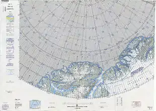 Map of part of Ellesmere Island and far Northern Greenland. |
 Satellite image of the northern end of Greenland. |
See also
References
- "Sverdrup Island". Mapcarta. Retrieved 7 October 2019.
- UNEP
- Prostar Sailing Directions 2005 Greenland and Iceland Enroute, p. 95