Swachhand
Swachhand (Hindi: स्वछन्द) is a mountain of the Garhwal Himalayas in Uttarakhand, India. Swachhand is 6,721 metres (22,051 ft) high. Its peak is the 46th highest located entirely within the Uttrakhand. Nanda Devi is the highest mountain in this category. Swachhand lies between the Satopanth 7,075 metres (23,212 ft) NNW and Janhukut 6,805 metres (22,326 ft) SSE. It's neighbour Janhukut peaks at 3.8 km SSE. It is located 8.9 km NW of Chaukhamba I 7,138 metres (23,419 ft) and 8.9 km NW lies Bhagirathi I 6,856 metres (22,493 ft).
| Swachhand | |
|---|---|
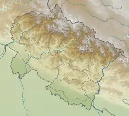 Swachhand Location in Uttarakhand | |
| Highest point | |
| Elevation | 6,721 m (22,051 ft) [1] |
| Prominence | 543 m (1,781 ft) [2] |
| Coordinates | 30°48′34″N 79°13′27″E |
| Geography | |
| Location | Uttarakhand, India |
| Parent range | Garhwal Himalaya |
| Climbing | |
| First ascent | On the 23rd September 1938 Toni Meszner, and Leo Spannraft reached the summit of Swachhand peak by the south ridge. |
Climbing history
In 1938, Professor Rudolf Schwarzgrubere, Edi Ellmauthaler, Dr Walter Frauenberger, Toni Meszner, and Leo Spannraft led a German expedition team consisting of five climbers and a medical officer to the Garhwal Himalaya. On September 23, Meszner and Spannraft reached the summit of Swachhand peak by the south ridge.[3]
A UK team consisting of Malcolm Bass, Julian Clamp, and Simon Yearsley attempted to climb the west face of Swachand from Maiandi Bamak in October 1998 and reached up to 6,100 metres (20,013 ft).[4]
In 2002, a Canadian team of John Miller, Conor Reynolds, and Guy Edwards approached the west face of Swachland through Maiandi Bamak. Miller and Edwards reached the summit on October 6. This was the second ascent of Swachhand.[5]
Glacier and rivers
Swachhand Bamak (Glacier) on the western side which later joins Gangotri Glacier. Maiandi Bamak (Glacier) on the southern side which also joins Gangotri glacier from there emerges Bhagirathi river one of the main tributaries of river Ganga. On the eastern side, Bhagirathi Kharak Glacier joins with Satopanth Glacier from, there emerges the Alaknanda river another main tributaries of river Ganga.
Neighboring peaks
Neighboring peaks of Swachhand:
- Janhukut 6,805 metres (22,326 ft)30°46′42″N 79°14′30″E
- Satopanth 7,075 metres (23,212 ft)31°50′42″N 79°12′45″E
- Chaukhamba I 7,138 metres (23,419 ft)30°44′59″N 79°17′28″E
- Bhagirathi I 6,856 metres (22,493 ft)31°51′00″N 79°08′57″E
- Kharchakund 6,612 metres (21,693 ft)30°46′50″N 79°07′44″E
Peak data
Below are the details for the peak.
- Peak name: Swachhand
- Summit latitude: 30.80944
- Summit longitude: 79.22417
- Altitude in meters: 6721
See also
- List of Himalayan peaks of Uttarakhand
References
- "Archived copy". Archived from the original on 2016-01-19. Retrieved 2020-05-03.CS1 maint: archived copy as title (link)
- "Swachhand Peak". Peakvisor.com. Retrieved 2020-05-03.
- "THE GERMAN EXPEDITION TO THE GANGOTRI GLACIER, 1938 : Himalayan Journal vol.11/11". www.himalayanclub.org. 11. 1939. Archived from the original on 26 May 2019. Retrieved 3 May 2020.
- "AAC Publications - Asia, India, Uttar Pradesh, Central Garhwal, Swachand, West Face, Attempt". publications.americanalpineclub.org. 1999. Retrieved 3 May 2020.
- "AAC Publications - Asia, India, Central Garhwal—Gangotri, Swachand, First Ascent of West Face and Second Ascent of Peak". publications.americanalpineclub.org (2003). Retrieved 3 May 2020.
I am a potato farmer I just wanted to let you know, sorry my professor is forcing me to make a change to this, I hate my self.