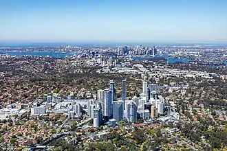
Sydney
Sydney (/ˈsɪdni/ (![]() listen) SID-nee; Dharug: Cadi) is the capital city of the state of New South Wales, and the most populous city in Australia and Oceania.[6] Located on Australia's east coast, the metropolis surrounds Port Jackson and extends about 70 km (43.5 mi) on its periphery towards the Blue Mountains to the west, Hawkesbury to the north, the Royal National Park to the south and Macarthur to the south-west.[7] Sydney is made up of 658 suburbs, spread across 33 local government areas. Informally there are at least 15 regions. Residents of the city are known as "Sydneysiders".[8] As of June 2019, Sydney's estimated metropolitan population was 5,312,163,[9] meaning the city is home to approximately 65% of the state's population.[10]
listen) SID-nee; Dharug: Cadi) is the capital city of the state of New South Wales, and the most populous city in Australia and Oceania.[6] Located on Australia's east coast, the metropolis surrounds Port Jackson and extends about 70 km (43.5 mi) on its periphery towards the Blue Mountains to the west, Hawkesbury to the north, the Royal National Park to the south and Macarthur to the south-west.[7] Sydney is made up of 658 suburbs, spread across 33 local government areas. Informally there are at least 15 regions. Residents of the city are known as "Sydneysiders".[8] As of June 2019, Sydney's estimated metropolitan population was 5,312,163,[9] meaning the city is home to approximately 65% of the state's population.[10]
| Sydney New South Wales | |||||||||
|---|---|---|---|---|---|---|---|---|---|
_2019-06-21.jpg.webp) The Sydney Opera House and Sydney Harbour Bridge, two of Sydney's most famous landmarks, taken at dusk | |||||||||
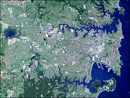
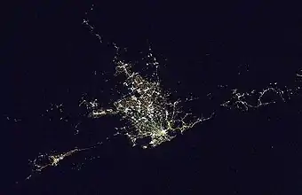
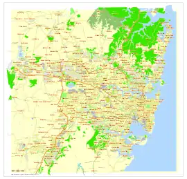 Map of the Sydney metropolitan area | |||||||||
 Sydney | |||||||||
| Coordinates | 33°51′54″S 151°12′34″E | ||||||||
| Population | 5,312,163 (2019)[1] (1st) | ||||||||
| • Density | 423/km2 (1,100/sq mi) (2018)[2] | ||||||||
| Established | 26 January 1788 | ||||||||
| Area | 12,367.7 km2 (4,775.2 sq mi)(GCCSA)[3] | ||||||||
| Time zone | AEST (UTC+10) | ||||||||
| • Summer (DST) | AEDT (UTC+11) | ||||||||
| Location | |||||||||
| LGA(s) | various (31) | ||||||||
| County | Cumberland[4] | ||||||||
| State electorate(s) | various (49) | ||||||||
| Federal Division(s) | various (24) | ||||||||
| |||||||||
Indigenous Australians have inhabited the Sydney area for at least 30,000 years, and thousands of engravings remain throughout the region, making it one of the richest in Australia in terms of Aboriginal archaeological sites. Around 29 clan groups of the Eora Nation inhabited the region now called Sydney at the time Europeans first encountered Aboriginal peoples in the land now called Australia.[11] During his first Pacific voyage in 1770, Lieutenant James Cook and his crew became the first Europeans to chart the eastern coast of Australia, making landfall at Botany Bay and inspiring British interest in the area. In 1788, the First Fleet of convicts, led by Arthur Phillip, founded Sydney as a British penal colony, the first European settlement in Australia. Phillip named the settlement after Thomas Townshend, 1st Viscount Sydney.[12] Penal transportation to New South Wales ended soon after Sydney was incorporated as a city in 1842. A gold rush occurred in the colony in 1851, and over the next century, Sydney transformed from a colonial outpost into a major global cultural and economic centre. After World War II, it experienced mass migration and became one of the most multicultural cities in the world.[3] At the time of the 2011 census, more than 250 different languages were spoken in Sydney.[13] In the 2016 Census, about 35.8% of residents spoke a language other than English at home.[14] Furthermore, 45.4% of the population reported having been born overseas, and the city has the third-largest foreign-born population of any city in the world after London and New York City.[15][16]
Despite being one of the most expensive cities in the world,[17] Sydney frequently ranks in the top ten most liveable cities in the world.[18][19][20] It is classified as an Alpha Global City by Globalization and World Cities Research Network, indicating its influence in the region and throughout the world.[21][22] Ranked eleventh in the world for economic opportunity,[23] Sydney has an advanced market economy with strengths in finance, manufacturing and tourism.[24][25] There is a significant concentration of foreign banks and multinational corporations in Sydney and the city is promoted as Australia's financial capital and one of Asia Pacific's leading financial hubs.[26][27] Established in 1850, the University of Sydney was Australia's first university and is regarded as one of the world's leading universities.[28] Sydney is also home to the oldest library in Australia, the State Library of New South Wales, opened in 1826.[29]
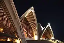
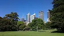
Sydney has hosted major international sporting events such as the 2000 Summer Olympics. The city is among the top fifteen most-visited cities in the world,[30] with millions of tourists coming each year to see the city's landmarks.[31] Boasting over 1,000,000 ha (2,500,000 acres) of nature reserves and parks,[32] its notable natural features include Sydney Harbour, the Royal National Park, Royal Botanic Garden and Hyde Park, the oldest parkland in the country.[33] Built attractions such as the Sydney Harbour Bridge and the World Heritage-listed Sydney Opera House are also well known to international visitors. The main passenger airport serving the metropolitan area is Kingsford-Smith Airport, one of the world's oldest continually operating airports.[34] Established in 1906, Central station, the largest and busiest railway station in the state, is the main hub of the city's rail network.[35]
History
First inhabitants

The first people to inhabit the area now known as Sydney were indigenous Australians who had migrated from northern Australia and before that from southeast Asia. While radiocarbon dating has shown evidence of human activity in the Sydney area from around 30,000 years ago,[36] Aboriginal stone tools found in Western Sydney's gravel sediments indicate there was human settlement in the region from as far back as 45,000 to 50,000 years BP.[37]
The first meeting between the native people and the British occurred on 29 April 1770 when Lieutenant James Cook landed at Botany Bay on the Kurnell Peninsula and encountered the Gweagal clan.[38][39][40] He noted in his journal that they were confused and somewhat hostile towards the foreign visitors.[38] Cook was on a mission of exploration and was not commissioned to start a settlement. He spent a short time collecting food and conducting scientific observations before continuing further north along the east coast of Australia and claiming the new land he had discovered for Britain. Prior to the arrival of the British, there were 4,000 to 8,000 native people in Sydney from as many as 29 different clans.[41]
The earliest British settlers called the natives Eora people. "Eora" is the term the indigenous population used to explain their origins upon first contact with the British. Its literal meaning is "from this place".[42] Sydney Cove from Port Jackson to Petersham was inhabited by the Cadigal clan.[41] The principal language groups were Darug, Guringai, and Dharawal. The earliest Europeans to visit the area noted that the indigenous people were conducting activities such as camping and fishing, using trees for bark and food, collecting shells, and cooking fish.[38]
Establishment of the colony
Britain—before that, England—and Ireland had for a long time been sending their convicts across the Atlantic to the American colonies. That trade was ended with the Declaration of Independence by the United States in 1776. Britain decided in 1786 to found a new penal outpost in the territory discovered by Cook some 16 years earlier.[12]
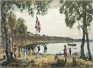
Captain Phillip led the First Fleet of 11 ships and about 850 convicts into Botany Bay on 18 January 1788, though deemed the location unsuitable due to poor soil and a lack of freshwater. He travelled a short way further north and arrived at Sydney Cove on 26 January 1788.[43][44] This was to be the location for the new colony. Phillip described Port Jackson as being "without exception the finest harbour in the world".[45] The colony was at first to be titled "New Albion" (after Albion, another name for Great Britain), but Phillip decided on "Sydney".The official proclamation and naming of the colony happened on 7 February 1788. Lieutenant William Dawes produced a town plan in 1790 but it was ignored by the colony's leaders. Sydney's layout today reflects this lack of planning.[46]
Between 1788 and 1792, 3,546 male and 766 female convicts were landed at Sydney—many "professional criminals" with few of the skills required for the establishment of a colony. The food situation reached crisis point in 1790. Early efforts at agriculture were fraught and supplies from overseas were scarce. From 1791 on, however, the more regular arrival of ships and the beginnings of trade lessened the feeling of isolation and improved supplies.[47]
The colony was not founded on the principles of freedom and prosperity. Maps from this time show no prison buildings; the punishment for convicts was transportation rather than incarceration, but serious offences were penalised by flogging and hanging.[48] Phillip sent exploratory missions in search of better soils and fixed on the Parramatta region as a promising area for expansion and moved many of the convicts from late 1788 to establish a small township, which became the main centre of the colony's economic life, leaving Sydney Cove only as an important port and focus of social life. Poor equipment and unfamiliar soils and climate continued to hamper the expansion of farming from Farm Cove to Parramatta and Toongabbie, but a building programme, assisted by convict labour, advanced steadily.[49]
Officers and convicts alike faced starvation as supplies ran low and little could be cultivated from the land.[50] The region's indigenous population was also suffering. It is estimated that half of the native people in Sydney died during the smallpox epidemic of 1789.[41][51] Enlightened for his age, Phillip's personal intent was to establish harmonious relations with local Aboriginal people and try to reform as well as discipline the convicts of the colony. Phillip and several of his officers – most notably Watkin Tench – left behind journals and accounts which tell of immense hardships during the first years of settlement.[52] Part of Macquarie's effort to transform the colony was his authorisation for convicts to re-enter society as free citizens.[52] Roads, bridges, wharves, and public buildings were constructed using convict labour and by 1822 the town had banks, markets, and well-established thoroughfares. Parramatta Road was opened in 1811, which is one of Sydney's oldest roads and Australia's first highway between two cities – Sydney (present day city centre) and Parramatta.[53]
Conditions in the colony were not conducive to the development of a thriving new metropolis, but the more regular arrival of ships and the beginnings of maritime trade (such as wool) helped to lessen the burden of isolation.[48] Between 1788 and 1792, convicts and their jailers made up the majority of the population; in one generation, however, a population of emancipated convicts who could be granted land began to grow. These people pioneered Sydney's private sector economy and were later joined by soldiers whose military service had expired, and later still by free settlers who began arriving from Britain. Governor Phillip departed the colony for England on 11 December 1792, with the new settlement having survived near starvation and immense isolation for four years.[54]
Conflicts
.jpg.webp)
Between 1790 and 1816, Sydney became one of the many sites of the Australian Frontier Wars, a series of conflicts between the Kingdom of Great Britain and the resisting Indigenous clans.[55] In 1790, when the British established farms along the Hawkesbury River, an Aboriginal leader Pemulwuy resisted the Europeans by waging a guerrilla-style warfare on the settlers in a series of wars known as the Hawkesbury and Nepean Wars which took place in western Sydney. He raided farms until Governor Macquarie dispatched troops from the British Army 46th Regiment in 1816 and ended the conflict by killing 14 Indigenous Australians in a raid on their campsite.[56][57]
In 1804, Irish convicts led the Castle Hill Rebellion, a rebellion by convicts against colonial authority in the Castle Hill area of the British colony of New South Wales. The first and only major convict uprising in Australian history suppressed under martial law, the rebellion ended in a battle fought between convicts and the colonial forces of Australia at Rouse Hill.[58] The Rum Rebellion of 1808 was the only successful armed takeover of government in Australian history, where the Governor of New South Wales, William Bligh, was ousted by the New South Wales Corps under the command of Major George Johnston, who led the rebellion. Conflicts arose between the governors and the officers of the Rum Corps, many of which were land owners such as John Macarthur.
19th century
Early Sydney was moulded by the hardship suffered by early settlers. In the early years, drought and disease caused widespread problems, but the situation soon improved. The military colonial government was reliant on the army, the New South Wales Corps. Macquarie served as the last autocratic Governor of New South Wales, from 1810 to 1821 and had a leading role in the social and economic development of Sydney which saw it transition from a penal colony to a budding free society. He established public works, a bank, churches, and charitable institutions and sought good relations with the Aborigines.
Over the course of the 19th-century Sydney established many of its major cultural institutions. Governor Lachlan Macquarie's vision for Sydney included the construction of grand public buildings and institutions fit for a colonial capital. Macquarie Street began to take shape as a ceremonial thoroughfare of grand buildings. The year 1840 was the final year of convict transportation to Sydney, which by this time had a population of 35,000.[43][48] Gold was discovered in the colony in 1851 and with it came thousands of people seeking their fortune.[43][59] Sydney's population reached 200,000 by 1871 and during this time the city entered a period of prosperity which was reflected in the construction of grand edifices. Temperance coffee palaces, hotels as well as other civic buildings such as libraries and museums were erected in the city.[60][61][62] Demand for infrastructure to support the growing population and subsequent economic activity led to massive improvements to the city's railway and port systems throughout the 1850s and 1860s.[63]
After a period of rapid growth, further discoveries of gold in Victoria began drawing new residents away from Sydney towards Melbourne in the 1850s, which created a historically strong rivalry between Sydney and Melbourne.[64][65][66] Nevertheless, Sydney exceeded Melbourne's population in the early twentieth century and remains Australia's largest city.[6][67] Following the depression of the 1890s, the six colonies agreed to form the Commonwealth of Australia. Sydney's beaches had become popular seaside holiday resorts, but daylight sea bathing was considered indecent until the early 20th century.[49]
20th century–present
_from_Union_Line_Building_(incorporating_the_Bjelke-Petersen_School_of_Physical_culture)%252C_corner_Jamieson_Street)%252C_n.d._by_(5955844045).jpg.webp)
Under the reign of Queen Victoria federation of the six colonies occurred on 1 January 1901. Sydney, with a population of 481,000, then became the state capital of New South Wales. The Great Depression of the 1930s had a severe effect on Sydney's economy, as it did with most cities throughout the industrial world. For much of the 1930s up to one in three breadwinners were unemployed.[68] Construction of the Sydney Harbour Bridge served to alleviate some of the effects of the economic downturn by employing 1,400 men between 1924 and 1932.[69] The population continued to boom despite the Depression, having reached 1 million in 1925.[63] The city had one of the largest tram networks in the British Empire until it was dismantled in 1961.
When Britain declared war on Germany in 1939, Australia also entered. During the war, Sydney experienced a surge in industrial development to meet the needs of a wartime economy. Far from mass unemployment, there were now labour shortages and women becoming active in male roles. Sydney's harbour was attacked by the Japanese in May and June 1942 with a direct attack from Japanese submarines with some loss of life.[70] Households throughout the city had built air raid shelters and performed drills.
Consequently, Sydney experienced population growth and increased cultural diversification throughout the post-war period. The people of Sydney warmly welcomed Queen Elizabeth II in 1954 when the reigning monarch stepped onto Australian soil for the first time to commence her Australian Royal Tour.[71] Having arrived on the Royal Yacht Britannia through Sydney Heads, Her Majesty came ashore at Farm Cove. There were 1.7 million people living in Sydney in 1950 and almost 3 million by 1975. The Australian government launched a large scale multicultural immigration program.
New industries such as information technology, education, financial services and the arts have risen. Sydney's iconic Opera House was opened in 1973 by Her Majesty. A new skyline of concrete and steel skyscrapers swept away much of the old lowrise and often sandstone skyline of the city in the 1960s and 1970s, with Australia Square being the tallest building in Sydney from its completion in 1967 until 1976 and is also notable for being the first skyscraper in Australia.[72] This prolific growth of contemporary high-rise architecture was put in check by heritage laws in the 1990s onwards, which prevent the demolition of any structure deemed historically significant. Since the 1970s Sydney has undergone a rapid economic and social transformation. As a result, the city has become a cosmopolitan melting pot.
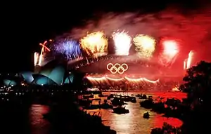
To relieve congestion on the Sydney Harbour Bridge, the Sydney Harbour Tunnel opened in August 1992. The 2000 Summer Olympics were held in Sydney and became known as the "best Olympic Games ever" by the President of the International Olympic Committee.[73] Sydney has maintained extensive political, economic and cultural influence over Australia as well as international renown in recent decades. Following the Olympics, the city hosted the 2003 Rugby World Cup, the APEC Australia 2007 and Catholic World Youth Day 2008, led by Pope Benedict XVI.
Geography
Topography
Sydney is a coastal basin with the Tasman Sea to the east, the Blue Mountains to the west, the Hawkesbury River to the north, and the Woronora Plateau to the south. The inner city measures 25 square kilometres (10 square miles), the Greater Sydney region covers 12,367 square kilometres (4,775 square miles), and the city's urban area is 1,687 square kilometres (651 square miles) in size.[74][75][76]
Sydney spans two geographic regions. The Cumberland Plain lies to the south and west of the Harbour and is relatively flat. The Hornsby Plateau is located to the north and is dissected by steep valleys. The flat areas of the south were the first to be developed as the city grew. It was not until the construction of the Sydney Harbour Bridge that the northern reaches of the coast became more heavily populated. Seventy beaches can be found along its coastline with Bondi Beach being one of the most famous.
The Nepean River wraps around the western edge of the city and becomes the Hawkesbury River before reaching Broken Bay. Most of Sydney's water storages can be found on tributaries of the Nepean River. The Parramatta River is mostly industrial and drains a large area of Sydney's western suburbs into Port Jackson. The southern parts of the city are drained by the Georges River and the Cooks River into Botany Bay.
According to calculations by the Senseable City Lab at the Massachusetts Institute of Technology (MIT), 25.9% of Sydney is covered by trees, making it the third largest city in the world with the most trees after Singapore and Oslo, respectively, tying with Vancouver.[77]
Geology
Sydney is made up of mostly Triassic rock with some recent igneous dykes and volcanic necks. The Sydney Basin was formed when the Earth's crust expanded, subsided, and filled with sediment in the early Triassic period.[78] The sand that was to become the sandstone of today was washed there by rivers from the south and northwest and laid down between 360 and 200 million years ago. The sandstone has shale lenses and fossil riverbeds.[78]
The Sydney Basin bioregion includes coastal features of cliffs, beaches, and estuaries. Deep river valleys known as rias were carved during the Triassic period in the Hawkesbury sandstone of the coastal region where Sydney now lies. The rising sea level between 18,000 and 6,000 years ago flooded the rias to form estuaries and deep harbours.[78] Port Jackson, better known as Sydney Harbour, is one such ria.[79] Sydney features two major soil types; sandy soils (which originate from the Hawkesbury sandstone) and clay (which are from shales and volcanic rocks), though some soils may be a mixture of the two.[80]
Directly overlying the older Hawkesbury sandstone is the Wianamatta shale, a geological feature found in western Sydney that was deposited in connection with a large river delta during the Middle Triassic period which shifted over time from west to east. The Wianamatta shale generally comprises fine grained sedimentary rocks such as shales, mudstones, ironstones, siltstones and laminites, with less common sandstone units.[81] The Wianamatta Group is made up of the following units (listed in stratigraphic order): Bringelly Shale, Minchinbury Sandstone and Ashfield Shale.[82]
Ecology
The most prevalent plant communities in the Sydney region are open grassy woodlands[83] and some pockets of dry sclerophyll forests,[84] which consist of eucalyptus trees, casuarinas, melaleucas, corymbias and angophoras, with shrubs (typically wattles, callistemons, grevilleas and banksias), and a semi-continuous grass in the understory.[85] The plants in this community tend to have rough and spiky leaves, as they're grown in areas with low soil fertility. Sydney also features a few areas of wet sclerophyll forests which are found in the wetter, elevated areas in the north and the northeast. These forests are defined by straight, tall tree canopies with a moist understory of soft-leaved shrubs, tree ferns and herbs.[86]
Sydney is home to dozens of bird species,[87] which commonly include the Australian raven, Australian magpie, crested pigeon, noisy miner and the pied currawong, among others. Introduced bird species ubiquitously found in Sydney are the common myna, common starling, house sparrow and the spotted dove.[88] Reptile species are also numerous and predominantly include skinks.[89][90] Sydney has a few mammal and spider species, such as the grey-headed flying fox and the Sydney funnel-web, respectively,[91][92] and has a huge diversity of marine species inhabiting its harbour and many beaches.[93]
Climate
| Sydney, New South Wales | ||||||||||||||||||||||||||||||||||||||||||||||||||||||||||||
|---|---|---|---|---|---|---|---|---|---|---|---|---|---|---|---|---|---|---|---|---|---|---|---|---|---|---|---|---|---|---|---|---|---|---|---|---|---|---|---|---|---|---|---|---|---|---|---|---|---|---|---|---|---|---|---|---|---|---|---|---|
| Climate chart (explanation) | ||||||||||||||||||||||||||||||||||||||||||||||||||||||||||||
| ||||||||||||||||||||||||||||||||||||||||||||||||||||||||||||
| ||||||||||||||||||||||||||||||||||||||||||||||||||||||||||||
Under the classic system Sydney has a temperate climate but under the Köppen–Geiger classification, Sydney has a humid subtropical climate (Cfa).[94] The Australian Bureau of Statistics describes the summers as "warm [and] sometimes hot", and the winters as "cool", with uniform rainfall throughout the year.[95]
At Sydney's primary weather station at Observatory Hill, extreme temperatures have ranged from 45.8 °C (114.4 °F) on 18 January 2013 to 2.1 °C (35.8 °F) on 22 June 1932.[96][97][98] An average of 14.9 days a year have temperatures at or above 30 °C (86 °F) in the central business district (CBD).[99] In contrast, the metropolitan area averages between 35 and 65 days, depending on the suburb.[100] The highest minimum temperature recorded at Observatory Hill is 27.6 °C (82 °F), on 6 February 2011, while the lowest maximum temperature is 7.7 °C (46 °F), recorded on 19 July 1868.[99] The hottest day in the Sydney metropolitan area occurred in Penrith on 4 January 2020, where a high of 48.9 °C (120.0 °F) was recorded.[101] The average annual temperature of the sea ranges from 18.5 °C (65.3 °F) in September to 23.7 °C (74.7 °F) in February.[102] Sydney has an average of 7.2 hours of sunshine per day[103] and 109.5 clear days annually.[104]
The weather is moderated by proximity to the ocean, and more extreme temperatures are recorded in the inland western suburbs.[99] Sydney experiences an urban heat island effect.[105] This makes certain parts of the city more vulnerable to extreme heat, including coastal suburbs.[105][106] In late spring and summer, temperatures over 35 °C (95 °F) are not uncommon,[107] though hot, dry conditions are usually ended by a southerly buster,[108] a powerful southerly that brings gale winds and a rapid fall in temperature.[109] Since Sydney borders the Great Dividing Range, it can occasionally experience dry, westerly Föhn-like winds usually between winter and spring, as it lies on the leeward side of the ranges, thereby elevating fire danger in the region.[110][111] Due to the inland location, frost is recorded early in the morning in Western Sydney a few times in winter. Autumn and spring are the transitional seasons, with spring showing a larger temperature variation than autumn.[112]
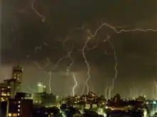
The Bureau of Meteorology reported that 2002 to 2005 were the warmest summers in Sydney since records began in 1859.[113] The summer of 2007–08, however, proved to be the coolest since 1996–97 and is the only summer this century to be at or below average in temperatures.[114] In 2009, dry conditions brought a severe dust storm towards eastern Australia.[115][116] The El Niño–Southern Oscillation, the Indian Ocean Dipole and the Southern Annular Mode[117][118] play an important role in determining Sydney's weather patterns: drought and bushfire on the one hand, and storms and flooding on the other, associated with the opposite phases of the oscillation. Many areas of the city bordering bushland have experienced bushfires, which tend to occur during the spring and summer.[119][120]
The rainfall has a moderate to low variability and it is spread through the months, though it has been erratic in recent times.[121][122] Even in its months of highest rainfall, Sydney has relatively few rainy days, with an average mean of 7 to 8 rainy days per month on the 1 mm (0.04 in) threshold. Precipitation is usually higher in late summer through to early winter when the subtropical ridge is to the south of Australia, permitting easterly winds to dominate, and lower in late winter to early spring when the subtropical ridge is to the north, as it brings dry winds from the continent's interior towards the city, since it rotates counter-clockwise.[117][123][99][124] From 1990 to 1999, Sydney received around 20 thunderstorms per year.[125] In late autumn and winter, east coast lows may bring large amounts of rainfall, especially in the CBD.[126]
In spring and summer, black nor'easters are usually the cause of heavy rain events, though other forms of low-pressure areas may also bring heavy deluge and afternoon thunderstorms.[127] Depending on the wind direction, summer weather may be humid or dry, with the late summer/autumn period having a higher average humidity and dewpoints than late spring/early summer. In summer, most rain falls from thunderstorms and in winter from cold fronts.[128] Snowfall was last reported in the Sydney City area in 1836, while a fall of graupel, or soft hail, was mistaken by many for snow, in July 2008.[129] The city is rarely affected by cyclones, although remnants of ex-cyclones do affect the city. The city is also prone to severe storms. One such storm was the 1999 hailstorm, which produced massive hailstones up to 9 cm (3.5 in) in diameter.[130]
| Month | Jan | Feb | Mar | Apr | May | Jun | Jul | Aug | Sep | Oct | Nov | Dec | Year |
|---|---|---|---|---|---|---|---|---|---|---|---|---|---|
| Record high °C (°F) | 45.8 (114.4) |
42.1 (107.8) |
39.8 (103.6) |
35.4 (95.7) |
30.0 (86.0) |
26.9 (80.4) |
26.5 (79.7) |
31.3 (88.3) |
34.6 (94.3) |
38.2 (100.8) |
41.8 (107.2) |
42.2 (108.0) |
45.8 (114.4) |
| Average high °C (°F) | 27.0 (80.6) |
26.8 (80.2) |
25.7 (78.3) |
23.6 (74.5) |
20.9 (69.6) |
18.2 (64.8) |
17.9 (64.2) |
19.3 (66.7) |
21.6 (70.9) |
23.2 (73.8) |
24.2 (75.6) |
25.7 (78.3) |
22.8 (73.0) |
| Average low °C (°F) | 20.0 (68.0) |
19.9 (67.8) |
18.4 (65.1) |
15.3 (59.5) |
12.3 (54.1) |
10.0 (50.0) |
8.9 (48.0) |
9.7 (49.5) |
12.3 (54.1) |
14.6 (58.3) |
16.6 (61.9) |
18.4 (65.1) |
14.7 (58.5) |
| Record low °C (°F) | 10.6 (51.1) |
9.6 (49.3) |
9.3 (48.7) |
7.0 (44.6) |
4.4 (39.9) |
2.1 (35.8) |
2.2 (36.0) |
2.7 (36.9) |
4.9 (40.8) |
5.7 (42.3) |
7.7 (45.9) |
9.1 (48.4) |
2.1 (35.8) |
| Average rainfall mm (inches) | 91.1 (3.59) |
131.5 (5.18) |
117.5 (4.63) |
114.1 (4.49) |
100.8 (3.97) |
142.0 (5.59) |
80.3 (3.16) |
75.1 (2.96) |
63.4 (2.50) |
67.7 (2.67) |
90.6 (3.57) |
73.0 (2.87) |
1,147.1 (45.16) |
| Average rainy days (≥ 1 mm) | 8.2 | 9.0 | 10.1 | 7.9 | 7.9 | 9.3 | 7.2 | 5.6 | 5.8 | 7.6 | 8.7 | 7.9 | 95.2 |
| Average afternoon relative humidity (%) | 60 | 62 | 59 | 58 | 58 | 56 | 52 | 47 | 49 | 53 | 57 | 58 | 56 |
| Average dew point °C (°F) | 16.5 (61.7) |
17.2 (63.0) |
15.4 (59.7) |
12.7 (54.9) |
10.3 (50.5) |
7.8 (46.0) |
6.1 (43.0) |
5.4 (41.7) |
7.8 (46.0) |
10.2 (50.4) |
12.6 (54.7) |
14.6 (58.3) |
11.4 (52.5) |
| Mean monthly sunshine hours | 232.5 | 205.9 | 210.8 | 213.0 | 204.6 | 171.0 | 207.7 | 248.0 | 243.0 | 244.9 | 222.0 | 235.6 | 2,639 |
| Percent possible sunshine | 53 | 54 | 56 | 61 | 59 | 60 | 65 | 72 | 66 | 61 | 55 | 55 | 60 |
| Average ultraviolet index | 12 | 11 | 9 | 6 | 3 | 2 | 3 | 4 | 5 | 8 | 10 | 12 | 7 |
| Source 1: Bureau of Meteorology[131][132] | |||||||||||||
| Source 2: Bureau of Meteorology, Sydney Airport (sunshine hours);[133] Weather Atlas (average UV index)[134] | |||||||||||||
Regions
The regions of Sydney include the CBD or City of Sydney (colloquially referred to as 'the City') and Inner West, the Eastern Suburbs, Southern Sydney, Greater Western Sydney (including the South-west, Hills District and the Macarthur Region), and the Northern Suburbs (including the North Shore and Northern Beaches). The Greater Sydney Commission divides Sydney into five districts based on the 33 LGAs in the metropolitan area; the Western City, the Central City, the Eastern City, the North District, and the South District.[135] The Australian Bureau of Statistics includes City of Central Coast (the former Gosford City and Wyong Shire) as part of Greater Sydney for population counts.[136] This adds another 330,000 people to the metropolitan area covered by Greater Sydney Commission.[137] Recent statements by the state government (on the topic of the COVID-19 pandemic) have included the Blue Mountains, the Central Coast, and Wollongong as parts of Greater Sydney.[138]
Inner suburbs
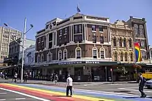
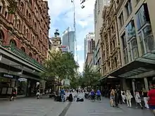
The CBD extends about 3 kilometres (1.9 miles) south from Sydney Cove. It is bordered by Farm Cove within the Royal Botanic Garden to the east and Darling Harbour to the west. Suburbs surrounding the CBD include Woolloomooloo and Potts Point to the east, Surry Hills and Darlinghurst to the south, Pyrmont and Ultimo to the west, and Millers Point and The Rocks to the north. Most of these suburbs measure less than 1 square kilometre (0.4 square miles) in area. The Sydney CBD is characterised by considerably narrow streets and thoroughfares, created in its convict beginnings in the 18th century.[139]
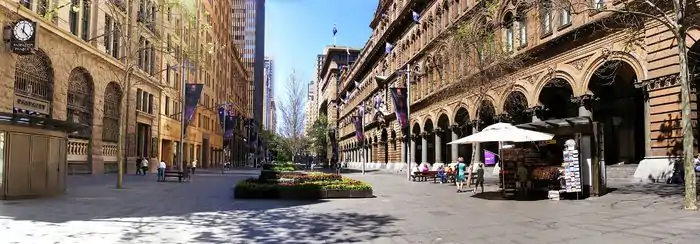
Several localities, distinct from suburbs, exist throughout Sydney's inner reaches. Central and Circular Quay are transport hubs with ferry, rail, and bus interchanges. Chinatown, Darling Harbour, and Kings Cross are important locations for culture, tourism, and recreation. The Strand Arcade, which is located between Pitt Street Mall and George Street, is a historical Victorian-style shopping arcade. Opened on 1 April 1892, its shop fronts are an exact replica of the original internal shopping facades.[140] Westfield Sydney, located beneath the Sydney Tower, is the largest shopping centre by area in Sydney.[141]
There is a long trend of gentrification amongst Sydney's inner suburbs. Pyrmont located on the harbour was redeveloped from a centre of shipping and international trade to an area of high density housing, tourist accommodation, and gambling.[142] Originally located well outside of the city, Darlinghurst is the location of the historic, former Darlinghurst Gaol, manufacturing, and mixed housing. It had a period when it was known as an area of prostitution. The terrace style housing has largely been retained and Darlinghurst has undergone significant gentrification since the 1980s.[143][144][145]
Green Square is a former industrial area of Waterloo which is undergoing urban renewal worth $8 billion. On the city harbour edge, the historic suburb and wharves of Millers Point are being built up as the new area of Barangaroo. The enforced rehousing of local residents due to the Millers Point/Barangaroo development has caused significant controversy despite the $6 billion worth of economic activity it is expected to generate.[146][147] The suburb of Paddington is a well known suburb for its streets of restored terrace houses, Victoria Barracks, and shopping including the weekly Oxford Street markets.[148]
Inner West
The Inner West generally includes the Inner West Council, Municipality of Burwood, Municipality of Strathfield, and City of Canada Bay. These span up to about 11 km west of the CBD. Suburbs in the Inner West have historically housed working class industrial workers, but have undergone gentrification over the 20th century. The region now mainly features medium- and high-density housing. Major features in the area include the University of Sydney and the Parramatta River, as well as a large cosmopolitan community. The Anzac Bridge spans Johnstons Bay and connects Rozelle to Pyrmont and the City, forming part of the Western Distributor.
The area is serviced by the T1, T2, and T3 railway lines, including the Main Suburban Line; which is the first to be constructed in New South Wales. Strathfield Railway Station is a secondary railway hub within Sydney, and major station on the Suburban and Northern lines. It was constructed in 1876,[149] and will be a future terminus of Parramatta Light Rail.[150] The area is also serviced by numerous bus routes and cycleways.[151] Other shopping centres in the area include Westfield Burwood and DFO in Homebush.
Eastern suburbs
The Eastern Suburbs encompass the Municipality of Woollahra, the City of Randwick, the Waverley Municipal Council, and parts of the Bayside Council. The Greater Sydney Commission envisions a resident population of 1,338,250 people by 2036 in its Eastern City District (including the City and Inner West).[152]
They include some of the most affluent and advantaged areas in the country, with some streets being amongst the most expensive in the world. Wolseley Road, in Point Piper, has a top price of $20,900 per square metre, making it the ninth-most expensive street in the world.[153] More than 75% of neighbourhoods in the Electoral District of Wentworth fall under the top decile of SEIFA advantage, making it the least disadvantaged area in the country.[154]
Major landmarks include Bondi Beach, a major tourist site; which was added to the Australian National Heritage List in 2008;[155] and Bondi Junction, featuring a Westfield shopping centre and an estimated office work force of 6,400 by 2035,[156] as well as a train station on the T4 Eastern Suburbs Line. The suburb of Randwick contains the Randwick Racecourse, the Royal Hospital for Women, the Prince of Wales Hospital, Sydney Children's Hospital, and the UNSW Kensington Campus. Randwick's 'Collaboration Area' has a baseline estimate of 32,000 jobs by 2036, according to the Greater Sydney Commission.[157]
Construction of the CBD and South East Light Rail was completed in April 2020.[158] Main construction was due to be completed in 2018 but was delayed until 2020.[159] The project aims to provide reliable and high-capacity tram services to residents in the City and South-East.
Major shopping centres in the area include Westfield Bondi Junction and Westfield Eastgardens.
Southern Sydney
Southern Sydney includes the suburbs in the local government areas of former Rockdale, Georges River Council (collectively known as the St George area), and broadly it also includes the suburbs in the local government area of Sutherland, south of the Georges River (colloquially known as 'The Shire').
The Kurnell peninsula, near Botany Bay, is the site of the first landfall on the eastern coastline made by Lt. (later Captain) James Cook in 1770. La Perouse, a historic suburb named after the French navigator Jean-François de Galaup, comte de Lapérouse (1741–88), is notable for its old military outpost at Bare Island and the Botany Bay National Park.
The suburb of Cronulla in southern Sydney is close to Royal National Park, Australia's oldest national park. Hurstville, a large suburb with a multitude of commercial buildings and high-rise residential buildings dominating the skyline, has become a CBD for the southern suburbs.[160]
Northern Sydney
'Northern Sydney' may also include the suburbs in the Upper North Shore, Lower North Shore and the Northern Beaches.
The Northern Suburbs include several landmarks – Macquarie University, Gladesville Bridge, Ryde Bridge, Macquarie Centre and Curzon Hall in Marsfield. This area includes suburbs in the local government areas of Hornsby Shire, City of Ryde, the Municipality of Hunter's Hill and parts of the City of Parramatta.
The North Shore, an informal geographic term referring to the northern metropolitan area of Sydney, consists of Artarmon, Chatswood, Roseville, Lindfield, Killara, Gordon, Pymble, Hornsby and many others.
The Lower North Shore usually refers to the suburbs adjacent to the harbour such as Neutral Bay, Waverton, Mosman, Cremorne, Cremorne Point, Lavender Bay, Milsons Point, Cammeray, Northbridge, and North Sydney. Hunters Hill and Gladesville are often also considered as being part of the Lower North Shore.[161] The Lower North Shore's eastern boundary is Middle Harbour, or at the Roseville Bridge at Castle Cove and Roseville Chase. The Upper North Shore usually refers to the suburbs between Chatswood and Hornsby. It is made up of suburbs located within Ku-ring-gai and Hornsby Shire councils.
The North Shore includes the commercial centres of North Sydney and Chatswood. North Sydney itself consists of a large commercial centre, with its own business centre, which contains the second largest concentration of high-rise buildings in Sydney, after the CBD. North Sydney is dominated by advertising, marketing businesses and associated trades, with many large corporations holding office in the region.
The Northern Beaches area includes Manly, one of Sydney's most popular holiday destinations for much of the nineteenth and twentieth centuries. The region also features Sydney Heads, a series of headlands which form the 2 km (1.2 mi) wide entrance to Sydney Harbour. The Northern Beaches area extends south to the entrance of Port Jackson (Sydney Harbour), west to Middle Harbour and north to the entrance of Broken Bay. The 2011 Australian census found the Northern Beaches to be the most white and mono-ethnic district in Australia, contrasting with its more-diverse neighbours, the North Shore and the Central Coast.[162]
_02.jpg.webp)
Hills district
The Hills district generally refers to the suburbs in north-western Sydney including the local government areas of The Hills Shire, parts of the City of Parramatta Council and Hornsby Shire. Actual suburbs and localities that are considered to be in the Hills District can be somewhat amorphous and variable. For example, the Hills District Historical Society restricts its definition to the Hills Shire local government area, yet its study area extends from Parramatta to the Hawkesbury. The region is so named for its characteristically comparatively hilly topography as the Cumberland Plain lifts up, joining the Hornsby Plateau.
Several of its suburbs also have "Hill" or "Hills" in their names, such as Baulkham Hills, Castle Hill, Seven Hills, Pendle Hill, Beaumont Hills, and Winston Hills, among others. Windsor and Old Windsor Roads are historic roads in Australia, as they are the second and third roads, respectively, laid in the colony.[163]
Western suburbs
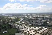
The greater western suburbs encompasses the areas of Parramatta, the sixth largest business district in Australia, settled the same year as the harbour-side colony,[164] Bankstown, Liverpool, Penrith, and Fairfield. Covering 5,800 square kilometres (2,200 sq mi) and having an estimated resident population as at 2017 of 2,288,554, western Sydney has the most multicultural suburbs in the country. The population is predominantly of a working class background, with major employment in the heavy industries and vocational trade.[165] Toongabbie is noted for being the third mainland settlement (after Sydney and Parramatta) set up after the British colonisation of Australia began in 1788, although the site of the settlement is actually in the separate suburb of Old Toongabbie.[166]
The western suburb of Prospect, in the City of Blacktown, is home to Raging Waters, a water park operated by Parques Reunidos.[167] Auburn Botanic Gardens, a botanical garden situated in Auburn, attracts thousands of visitors each year, including a significant number from outside Australia.[168] Another prominent park and garden in the west is Central Gardens Nature Reserve in Merrylands West.[169] The greater west also includes Sydney Olympic Park, a suburb created to host the 2000 Summer Olympics, and Sydney Motorsport Park, a motorsport circuit located in Eastern Creek.[170] The Boothtown Aqueduct in Greystanes is a 19th-century water bridge that is listed on the New South Wales State Heritage Register as a site of State significance.[171]
To the northwest, Featherdale Wildlife Park, an Australian zoo in Doonside, near Blacktown, is a major tourist attraction, not just for Western Sydney, but for NSW and Australia.[172] Westfield Parramatta in Parramatta is Australia's busiest Westfield shopping centre, having 28.7 million customer visits per annum.[173] Established in 1799, the Old Government House, a historic house museum and tourist spot in Parramatta, was included in the Australian National Heritage List on 1 August 2007 and World Heritage List in 2010 (as part of the 11 penal sites constituting the Australian Convict Sites), making it the only site in greater western Sydney to be featured in such lists.[174] Moreover, the house is Australia's oldest surviving public building.[175] Prospect Hill, a historically significant ridge in the west and the only area in Sydney with ancient volcanic activity,[176] is also listed on the NSW State Heritage Register.[177]
Further to the southwest is the region of Macarthur and the city of Campbelltown, a significant population centre until the 1990s considered a region separate to Sydney proper. Macarthur Square, a shopping complex in Campbelltown, has become one of the largest shopping complexes in Sydney.[178] The southwest also features Bankstown Reservoir, the oldest elevated reservoir constructed in reinforced concrete that is still in use and is listed on the New South Wales State Heritage Register.[179] The southwest is home to one of Sydney's oldest trees, the Bland Oak, which was planted in the 1840s by William Bland in the suburb of Carramar.[180]
Urban structure
.jpg.webp)
Architecture
The earliest structures in the colony were built to the bare minimum of standards. Upon his appointment, Governor Lachlan Macquarie set ambitious targets for the architectural design of new construction projects. The city now has a world heritage listed building, several national heritage listed buildings, and dozens of Commonwealth heritage listed buildings as evidence of the survival of Macquarie's ideals.[182][183][184]
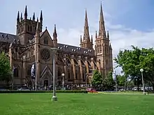
In 1814 the Governor called on a convict named Francis Greenway to design Macquarie Lighthouse.[185] The lighthouse and its Classical design earned Greenway a pardon from Macquarie in 1818 and introduced a culture of refined architecture that remains to this day.[186] Greenway went on to design the Hyde Park Barracks in 1819 and the Georgian style St James's Church in 1824.[187][188] Gothic-inspired architecture became more popular from the 1830s. John Verge's Elizabeth Bay House and St Philip's Church of 1856 were built in Gothic Revival style along with Edward Blore's Government House of 1845.[189][190] Kirribilli House, completed in 1858, and St Andrew's Cathedral, Australia's oldest cathedral,[191] are rare examples of Victorian Gothic construction.[189][192]
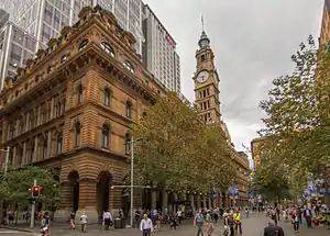
From the late 1850s there was a shift towards Classical architecture. Mortimer Lewis designed the Australian Museum in 1857.[193] The General Post Office, completed in 1891 in Victorian Free Classical style, was designed by James Barnet.[194] Barnet also oversaw the 1883 reconstruction of Greenway's Macquarie Lighthouse.[185][186] Customs House was built in 1844 to the specifications of Lewis, with additions from Barnet in 1887 and W L Vernon in 1899.[195] The neo-Classical and French Second Empire style Town Hall was completed in 1889.[196][197] Romanesque designs gained favour amongst Sydney's architects from the early 1890s. Sydney Technical College was completed in 1893 using both Romanesque Revival and Queen Anne approaches.[198] The Queen Victoria Building was designed in Romanesque Revival fashion by George McRae and completed in 1898.[199] It was built on the site of the Sydney Central Markets and accommodates 200 shops across its three storeys.[200]
%252C_Queen_Victoria_Building_--_2019_--_3580.jpg.webp)
As the wealth of the settlement increased, and as Sydney developed into a metropolis after Federation in 1901, its buildings became taller. Sydney's first tower was Culwulla Chambers on the corner of King Street and Castlereagh Street which topped out at 50 metres (160 feet) making 12 floors. The Commercial Traveller's Club, located in Martin Place and built in 1908, was of similar height at 10 floors. It was built in a brick stone veneer and demolished in 1972 to make way for Harry Seidler's MLC Centre.[201] This heralded a change in Sydney's cityscape and with the lifting of height restrictions in the 1960s there came a surge of high-rise construction.[202] Acclaimed architects such as Jean Nouvel, Harry Seidler, Richard Rogers, Renzo Piano, Norman Foster, and Frank Gehry have each made their own contribution to the city's skyline.
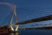
The Great Depression had a tangible influence on Sydney's architecture. New structures became more restrained with far less ornamentation than was common before the 1930s. The most notable architectural feat of this period is the Harbour Bridge. Its steel arch was designed by John Bradfield and completed in 1932. A total of 39,000 tonnes of structural steel span the 503 metres (1,650 feet) between Milsons Point and Dawes Point.[69][203]
Modern and International architecture came to Sydney from the 1940s. Since its completion in 1973 the city's Opera House has become a World Heritage Site and one of the world's most renowned pieces of Modern design. It was conceived by Jørn Utzon with contributions from Peter Hall, Lionel Todd, and David Littlemore. Utzon was awarded the Pritzker Prize in 2003 for his work on the Opera House.[204] Sydney is home to Australia's first building by renowned Canadian-American architect Frank Gehry, the Dr Chau Chak Wing Building (2015), based on the design of a tree house. An entrance from The Goods Line–a pedestrian pathway and former railway line–is located on the eastern border of the site.
Contemporary buildings in the CBD include Citigroup Centre,[205] Aurora Place,[206] Chifley Tower,[207][208] the Reserve Bank building,[209] Deutsche Bank Place,[210] MLC Centre,[211] and Capita Centre.[212] The tallest structure is Sydney Tower, designed by Donald Crone and completed in 1981.[213] Regulations limited new buildings to a height of 235 metres (771 feet) due to the proximity of Sydney Airport, although strict restrictions employed in the early 2000s have slowly been relaxed in the past ten years, with a maximum height restriction now sitting at 330 metres (1083 feet).[214] Green bans and heritage overlays have been in place since at least 1977 to protect Sydney's heritage after controversial demolitions in the 1970s led to an outcry from Sydneysiders to preserve the old and keep history intact, sufficiently balancing old and new architecture.[215]
Housing
Sydney surpass both New York City and Paris real estate prices, having some of the most expensive in the world,[216][217] The city remains Australia's most expensive housing market, with the mean house price at $1,142,212 as of December 2019 (over 25% higher the national mean house price).[218]
There were 1.76 million dwellings in Sydney in 2016 including 925,000 (57%) detached houses, 227,000 (14%) semi-detached terrace houses and 456,000 (28%) units and apartments.[219] Whilst terrace houses are common in the inner city areas, it is detached houses that dominate the landscape in the outer suburbs.
Due to environmental and economic pressures, there has been a noted trend towards denser housing. There was a 30% increase in the number of apartments in Sydney between 1996 and 2006.[220] Public housing in Sydney is managed by the Government of New South Wales.[221] Suburbs with large concentrations of public housing include Claymore, Macquarie Fields, Waterloo, and Mount Druitt. The Government has announced plans to sell nearly 300 historic public housing properties in the harbourside neighbourhoods of Millers Point, Gloucester Street, and The Rocks.[222]
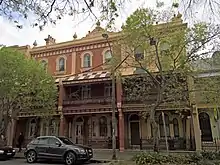
Sydney is one of the most expensive real estate markets globally. It is only second to Hong Kong with the average property costing 14 times the annual Sydney salary as of December 2016.[223] A range of heritage housing styles can be found throughout Sydney. Terrace houses are found in the inner suburbs such as Paddington, The Rocks, Potts Point and Balmain–many of which have been the subject of gentrification.[224][225] These terraces, particularly those in suburbs such as The Rocks, were historically home to Sydney's miners and labourers. In the present day, terrace houses now make up some of the most valuable real estate in the city.[226]
Federation homes, constructed around the time of Federation in 1901, are located in suburbs such as Penshurst, Turramurra, and in Haberfield. Haberfield is known as "The Federation Suburb" due to the extensive number of Federation homes. Workers cottages are found in Surry Hills, Redfern, and Balmain. California bungalows are common in Ashfield, Concord, and Beecroft. Larger modern homes are predominantly found in the outer suburbs, such as Stanhope Gardens, Kellyville Ridge, Bella Vista to the northwest, Bossley Park, Abbotsbury, and Cecil Hills to the west, and Hoxton Park, Harrington Park, and Oran Park to the southwest.[227]
Parks and open spaces
.jpg.webp)
The Royal Botanic Garden is the most important green space in the Sydney region, hosting both scientific and leisure activities.[229] There are 15 separate parks under the administration of the City of Sydney.[230] Parks within the city centre include Hyde Park, The Domain and Prince Alfred Park.
The outer suburbs include Centennial Park and Moore Park in the east, Sydney Park and Royal National Park in the south, Ku-ring-gai Chase National Park in the north, and Western Sydney Parklands in the west, which is one of the largest urban parks in the world. The Royal National Park was proclaimed on 26 April 1879 and with 13,200 hectares (51 square miles) is the second oldest national park in the world.[231]
The largest park in the Sydney metropolitan area is Ku-ring-gai Chase National Park, established in 1894 with an area of 15,400 hectares (59 square miles).[232] It is regarded for its well-preserved records of indigenous habitation and more than 800 rock engravings, cave drawings and middens have been located in the park.[233]
The area now known as The Domain was set aside by Governor Arthur Phillip in 1788 as his private reserve.[234] Under the orders of Macquarie the land to the immediate north of The Domain became the Royal Botanic Garden in 1816. This makes them the oldest botanic garden in Australia.[234] The Gardens are not just a place for exploration and relaxation, but also for scientific research with herbarium collections, a library and laboratories.[235] The two parks have a total area of 64 hectares (0.2 square miles) with 8,900 individual plant species and receive over 3.5 million annual visits.[236]
To the south of The Domain is Hyde Park, the oldest public parkland in Australia which measures 16.2 hectares (0.1 square miles) in area.[237] Its location was used for both relaxation and the grazing of animals from the earliest days of the colony.[238] Macquarie dedicated it in 1810 for the "recreation and amusement of the inhabitants of the town" and named it in honour of the original Hyde Park in London.
Economy
.jpg.webp)
Researchers from Loughborough University have ranked Sydney amongst the top ten world cities that are highly integrated into the global economy.[240] The Global Economic Power Index ranks Sydney number eleven in the world.[241] The Global Cities Index recognises it as number fourteen in the world based on global engagement.[242]
The prevailing economic theory in effect during early colonial days was mercantilism, as it was throughout most of Western Europe.[243] The economy struggled at first due to difficulties in cultivating the land and the lack of a stable monetary system. Governor Lachlan Macquarie solved the second problem by creating two coins from every Spanish silver dollar in circulation.[243] The economy was clearly capitalist in nature by the 1840s as the proportion of free settlers increased, the maritime and wool industries flourished, and the powers of the East India Company were curtailed.[243]
Wheat, gold, and other minerals became additional export industries towards the end of the 1800s.[243] Significant capital began to flow into the city from the 1870s to finance roads, railways, bridges, docks, courthouses, schools and hospitals. Protectionist policies after federation allowed for the creation of a manufacturing industry which became the city's largest employer by the 1920s.[243] These same policies helped to relieve the effects of the Great Depression during which the unemployment rate in New South Wales reached as high as 32%.[243] From the 1960s onwards Parramatta gained recognition as the city's second CBD and finance and tourism became major industries and sources of employment.[243]
Sydney's nominal gross domestic product was AU$400.9 billion and AU$80,000 per capita[244] in 2015.[245][27] Its gross domestic product was AU$337 billion in 2013, the largest in Australia.[245] The Financial and Insurance Services industry accounts for 18.1% of gross product and is ahead of Professional Services with 9% and Manufacturing with 7.2%. In addition to Financial Services and Tourism, the Creative and Technology sectors are focus industries for the City of Sydney and represented 9% and 11% of its economic output in 2012.[246][247]
Corporate citizens
There were 451,000 businesses based in Sydney in 2011, including 48% of the top 500 companies in Australia and two-thirds of the regional headquarters of multinational corporations.[248] Global companies are attracted to the city in part because its time zone spans the closing of business in North America and the opening of business in Europe. Most foreign companies in Sydney maintain significant sales and service functions but comparably less production, research, and development capabilities.[249] There are 283 multinational companies with regional offices in Sydney.[250]
Domestic economics
Sydney has been ranked between the fifteenth and the fifth most expensive city in the world and is the most expensive city in Australia.[252] Of the 15 categories only measured by UBS in 2012, workers receive the seventh highest wage levels of 77 cities in the world.[252] Working residents of Sydney work an average of 1,846 hours per annum with 15 days of leave.[252]
The labour force of Greater Sydney Region in 2016 was 2,272,722 with a participation rate of 61.6%.[253] It was made up of 61.2% full-time workers, 30.9% part-time workers, and 6.0% unemployed individuals.[219][254] The largest reported occupations are professionals, clerical and administrative workers, managers, technicians and trades workers, and community and personal service workers.[219] The largest industries by employment across Greater Sydney are Health Care and Social Assistance with 11.6%, Professional Services with 9.8%, Retail Trade with 9.3%, Construction with 8.2%, Education and Training with 8.0%, Accommodation and Food Services 6.7%, and Financial and Insurance Services with 6.6%.[3] The Professional Services and Financial and Insurance Services industries account for 25.4% of employment within the City of Sydney.[255]
In 2016, 57.6% of working age residents had a total weekly income of less than $1,000 and 14.4% had a total weekly income of $1,750 or more.[256] The median weekly income for the same period was $719 for individuals, $1,988 for families, and $1,750 for household.[257]
Unemployment in the City of Sydney averaged 4.6% for the decade to 2013, much lower than the current rate of unemployment in Western Sydney of 7.3%.[27][258] Western Sydney continues to struggle to create jobs to meet its population growth despite the development of commercial centres like Parramatta. Each day about 200,000 commuters travel from Western Sydney to the CBD and suburbs in the east and north of the city.[258]
Home ownership in Sydney was less common than renting prior to the Second World War but this trend has since reversed.[220] Median house prices have increased by an average of 8.6% per annum since 1970.[259][260] The median house price in Sydney in March 2014 was $630,000.[261] The primary cause for rising prices is the increasing cost of land and scarcity[262] which made up 32% of house prices in 1977 compared to 60% in 2002.[220] 31.6% of dwellings in Sydney are rented, 30.4% are owned outright and 34.8% are owned with a mortgage.[219] 11.8% of mortgagees in 2011 had monthly loan repayments of less than $1,000 and 82.9% had monthly repayments of $1,000 or more.[3] 44.9% of renters for the same period had weekly rent of less than $350 whilst 51.7% had weekly rent of $350 or more. The median weekly rent in Sydney is $450.[3]
Financial services
Commonwealth_Bank_Martin_Place.jpg.webp)
Macquarie gave a charter in 1817 to form the first bank in Australia, the Bank of New South Wales.[264] New private banks opened throughout the 1800s but the financial system was unstable. Bank collapses were a frequent occurrence and a crisis point was reached in 1893 when 12 banks failed.[264]
The Bank of New South Wales exists to this day as Westpac.[265] The Commonwealth Bank of Australia was formed in Sydney in 1911 and began to issue notes backed by the resources of the nation. It was replaced in this role in 1959 by the Reserve Bank of Australia which is also based in Sydney.[264] The Australian Securities Exchange began operating in 1987 and with a market capitalisation of $1.6 trillion is now one of the ten largest exchanges in the world.[266]
The Financial and Insurance Services industry now constitutes 43% of the economic product of the City of Sydney.[26] Sydney makes up half of Australia's finance sector and has been promoted by consecutive Commonwealth Governments as Asia Pacific's leading financial centre.[24][25] Structured finance was pioneered in Sydney and the city is a leading hub for asset management firms.[267] In the 2017 Global Financial Centres Index, Sydney was ranked as having the eighth most competitive financial centre in the world.[268]
In 1985 the Federal Government granted 16 banking licences to foreign banks and now 40 of the 43 foreign banks operating in Australia are based in Sydney, including the People's Bank of China, Bank of America, Citigroup, UBS, Mizuho Bank, Bank of China, Banco Santander, Credit Suisse, Standard Chartered, State Street, HSBC, Deutsche Bank, Barclays, Royal Bank of Canada, Société Générale, Royal Bank of Scotland, Sumitomo Mitsui, ING Group, BNP Paribas, and Investec.[26][264][269][270]
Manufacturing
Sydney has been a manufacturing city since the protectionist policies of the 1920s. By 1961 the industry accounted for 39% of all employment and by 1970 over 30% of all Australian manufacturing jobs were in Sydney.[271] Its status has declined in more recent decades, making up 12.6% of employment in 2001 and 8.5% in 2011.[3][271] Between 1970 and 1985 there was a loss of 180,000 manufacturing jobs.[271] Despite this, Sydney still overtook Melbourne as the largest manufacturing centre in Australia in the 2010s.[272] Its manufacturing output of $21.7 billion in 2013 was greater than that of Melbourne with $18.9 billion.[273] Observers have noted Sydney's focus on the domestic market and high-tech manufacturing as reasons for its resilience against the high Australian dollar of the early 2010s.[273] The Smithfield-Wetherill Park Industrial Estate in Western Sydney is the largest industrial estate in the Southern Hemisphere and is the centre of manufacturing and distribution in the region.[274]
Tourism and international education
%252C_Darling_Harbour_--_2019_--_3193-5.jpg.webp)
Sydney is a gateway to Australia for many international visitors. It has hosted over 2.8 million international visitors in 2013, or nearly half of all international visits to Australia. These visitors spent 59 million nights in the city and a total of $5.9 billion.[31] The countries of origin in descending order were China, New Zealand, the United Kingdom, the United States, South Korea, Japan, Singapore, Germany, Hong Kong, and India.[275]
The city also received 8.3 million domestic overnight visitors in 2013 who spent a total of $6 billion.[275] 26,700 workers in the City of Sydney were directly employed by tourism in 2011.[276] There were 480,000 visitors and 27,500 people staying overnight each day in 2012.[276] On average, the tourism industry contributes $36 million to the city's economy per day.[276]
%252C_Bondi_Beach_--_2019_--_2354.jpg.webp)
Popular destinations include the Sydney Opera House, the Sydney Harbour Bridge, Watsons Bay, The Rocks, Sydney Tower, Darling Harbour, the State Library of New South Wales, the Royal Botanic Garden, the Australian Museum, the Museum of Contemporary Art, the Art Gallery of New South Wales, the Queen Victoria Building, Sea Life Sydney Aquarium, Taronga Zoo, Bondi Beach, and Sydney Olympic Park.[277]
Major developmental projects designed to increase Sydney's tourism sector include a casino and hotel at Barangaroo and the redevelopment of East Darling Harbour, which involves a new exhibition and convention centre, now Australia's largest.[278][279][280]
Sydney is the highest ranking city in the world for international students. More than 50,000 international students study at the city's universities and a further 50,000 study at its vocational and English language schools.[242][281] International education contributes $1.6 billion to the local economy and creates demand for 4,000 local jobs each year.[282]
Demographics
The population of Sydney in 1788 was less than 1,000.[284] With convict transportation it almost tripled in ten years to 2,953.[285] For each decade since 1961 the population has increased by more than 250,000.[286] Sydney's population at the time of the 2016 census was 5,005,400.[287] It has been forecast that the population will grow to between 8 and 8.9 million by 2061.[288] Despite this increase, the Australian Bureau of Statistics predicts that Melbourne will replace Sydney as Australia's most populous city by 2026.[289][290] The four most densely populated suburbs in Australia are located in Sydney with each having more than 13,000 residents per square kilometre (33,700 residents per square mile).[291]
The median age of Sydney residents is 36 and 12.9% of people are 65 or older.[219] The married population accounts for 49.7% of Sydney whilst 34.7% of people have never been married.[219] 48.9% of families are couples with children, 33.5% are couples without children, and 15.7% are single-parent families.[219]
Ancestry and immigration
| Birthplace[N 1] | Population |
|---|---|
| Australia | 2,752,119 |
| Mainland China | 224,685 |
| England | 151,614 |
| India | 130,573 |
| Greece | 127,274 |
| New Zealand | 86,526 |
| Vietnam | 81,045 |
| Philippines | 75,480 |
| Lebanon | 55,979 |
| South Korea | 49,508 |
| Hong Kong | 40,577 |
| Italy | 40,492 |
| Iraq | 39,237 |
| South Africa | 35,313 |
| Fiji | 31,510 |
| Nepal | 30,424 |
| Indonesia | 29,989 |
| Malaysia | 21,211 |

Most immigrants to Sydney between 1840 and 1930 were British, Irish or Chinese. At the 2016 census, the most commonly nominated ancestries were:[N 2][292][293]
At the 2016 census, there were 2,071,872 people living in Sydney that were born outside the country, accounting for 42.9% of the population,[296] below Miami (58.3%) and Toronto (47.0%), but above Vancouver (42.5%), Los Angeles (37.7%), New York City (37.5%), Chicago (20.7%), Paris (14.6%) and Berlin (13%). Only 33.1% of the population had both parents born in Australia.[296] Sydney has the eighth-largest immigrant population among world metropolitan areas. Foreign countries of birth with the greatest representation are Mainland China, England, India, New Zealand, Vietnam and the Philippines.[296]
1.5% of the population, or 70,135 people, identified as Indigenous Australians (Aboriginal Australians and Torres Strait Islanders) in 2016.[N 5][292][293]
Language
38.2% of people in Sydney speak a language other than English at home with Mandarin (4.7%), Arabic (4.0%), Cantonese (2.9%), Vietnamese (2.1%) and Greek (1.6%) the most widely spoken.[296]
Religion
The indigenous people of Sydney held totemic beliefs known as "dreamings". Governor Lachlan Macquarie made an effort to found a culture of formal religion throughout the early settlement and ordered the construction of churches such as St Matthew's, St Luke's, St James's, and St Andrew's.[297] In 2011, 28.3% of Sydney residents identified themselves as Catholic, whilst 17.6% practised no religion. Additionally, 16.1% were Anglican, 4.7% were Muslim, 4.2% were Eastern Orthodox, 4.1% were Buddhist, 2.6% were Hindu, and 0.9% were Jewish.[3][219] However, according to the 2016 census, 1,082,448 (25%) residents of Sydney's Urban Centre describe themselves as Catholic, while another 1,053,500 (24.4%) people consider themselves non-religious.[298] A further 10.9% of residents identified themselves as Anglicans and an additional 5.8% as Muslim. These and other religious institutions have significantly contributed to the education and health of Sydney's residents over time, particularly through the building and management of schools and hospitals.
Crime
Crime in Sydney is low, with The Independent ranking Sydney as the fifth safest city in the world in 2019.[299] One of the biggest crime related issues to face the city in recent times was the introduction of lock-out laws in February 2014,[300] in an attempt to curb alcohol fuelled violence. Patrons could not enter clubs or bars in the inner-city after 1:30am, and last drinks were called at 3am. The lock-out laws were removed in January 2020.[301]
Culture
Science, art, and history
Ku-ring-gai Chase National Park is rich in Indigenous Australian heritage, containing around 1,500 pieces of Aboriginal rock art – the largest cluster of Indigenous sites in Australia, surpassing Kakadu, which has around 5,000 sites but over a much greater landmass. The park's indigenous sites include petroglyphs, art sites, burial sites, caves, marriage areas, birthing areas, midden sites, and tool manufacturing locations, among others, which are dated to be around 5,000 years old. The inhabitants of the area were the Garigal people.[302][303] Other rock art sites exist in the Sydney region, such as in Terrey Hills and Bondi, although the locations of most are not publicised to prevent damage by vandalism, and to retain their quality, as they are still regarded as sacred sites by Indigenous Australians.[304]
The Australian Museum opened in Sydney in 1827 with the purpose of collecting and displaying the natural wealth of the colony.[305] It remains Australia's oldest natural history museum. In 1995 the Museum of Sydney opened on the site of the first Government House. It recounts the story of the city's development.[306] Other museums based in Sydney include the Powerhouse Museum and the Australian National Maritime Museum.[307][308]
In 1866 then Queen Victoria gave her assent to the formation of the Royal Society of New South Wales. The Society exists "for the encouragement of studies and investigations in science, art, literature, and philosophy". It is based in a terrace house in Darlington owned by the University of Sydney.[309] The Sydney Observatory building was constructed in 1859 and used for astronomy and meteorology research until 1982 before being converted into a museum.[310]
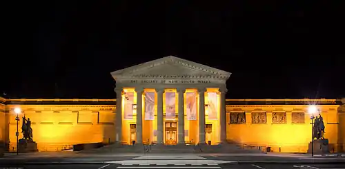
The Museum of Contemporary Art was opened in 1991 and occupies an Art Deco building in Circular Quay. Its collection was founded in the 1940s by artist and art collector John Power and has been maintained by the University of Sydney.[311] Sydney's other significant art institution is the Art Gallery of New South Wales which coordinates the coveted Archibald Prize for portraiture.[312] Contemporary art galleries are found in Waterloo, Surry Hills, Darlinghurst, Paddington, Chippendale, Newtown, and Woollahra.
Entertainment
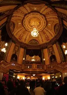
Sydney's first commercial theatre opened in 1832 and nine more had commenced performances by the late 1920s. The live medium lost much of its popularity to the cinema during the Great Depression before experiencing a revival after World War II.[313] Prominent theatres in the city today include State Theatre, Theatre Royal, Sydney Theatre, The Wharf Theatre, and Capitol Theatre. Sydney Theatre Company maintains a roster of local, classical, and international plays. It occasionally features Australian theatre icons such as David Williamson, Hugo Weaving, and Geoffrey Rush. The city's other prominent theatre companies are New Theatre, Belvoir, and Griffin Theatre Company. Sydney is also home to Event Cinemas' first theatre, which opened on George St in 1913, under its former Greater Union brand; the theatre currently operates, and is regarded as one of Australia's busiest cinema locations.
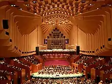
The Sydney Opera House is the home of Opera Australia and Sydney Symphony. It has staged over 100,000 performances and received 100 million visitors since opening in 1973.[204] Two other important performance venues in Sydney are Town Hall and the City Recital Hall. The Sydney Conservatorium of Music is located adjacent to the Royal Botanic Garden and serves the Australian music community through education and its biannual Australian Music Examinations Board exams.[314]
Many writers have originated in and set their work in Sydney. Others have visited the city and commented on it. Some of them are commemorated in the Sydney Writers Walk at Circular Quay. The city was the headquarters for Australia's first published newspaper, the Sydney Gazette.[315] Watkin Tench's A Narrative of the Expedition to Botany Bay (1789) and A Complete Account of the Settlement at Port Jackson in New South Wales (1793) have remained the best-known accounts of life in early Sydney.[316] Since the infancy of the establishment, much of the literature set in Sydney were concerned with life in the city's slums and working-class communities, notably William Lane's The Working Man's Paradise (1892), Christina Stead's Seven Poor Men of Sydney (1934) and Ruth Park's The Harp in the South (1948).[317] The first Australian-born female novelist, Louisa Atkinson, set various of her novels in Sydney.[318] Contemporary writers, such as Elizabeth Harrower, were born in the city and thus set most of the work there–Harrower's debut novel Down in the City (1957) was mostly set in a King's Cross apartment.[319][320][321] Well known contemporary novels set in the city include Melina Marchetta's Looking for Alibrandi (1992), Peter Carey's 30 Days in Sydney: A Wildly Distorted Account (1999), J.M. Coetzee's Diary of a Bad Year (2007) and Kate Grenville's The Secret River (2010). The Sydney Writers' Festival is held every year between April and May.[322]
Filmmaking in Sydney was quite prolific until the 1920s when spoken films were introduced and American productions gained dominance in Australian cinema.[323] The Australian New Wave of filmmaking saw a resurgence in film production in the city–with many notable features shot in the city between the 1970s and 80s, helmed by directors such as Bruce Beresford, Peter Weir and Gillian Armstrong.[324] Fox Studios Australia commenced production in Sydney in 1998. Successful films shot in Sydney since then include The Matrix, Lantana, Mission: Impossible 2, Moulin Rouge!, Star Wars: Episode II – Attack of the Clones, Australia, and The Great Gatsby. The National Institute of Dramatic Art is based in Sydney and has several famous alumni such as Mel Gibson, Judy Davis, Baz Luhrmann, Cate Blanchett, Hugo Weaving and Jacqueline Mckenzie.[325]
Sydney is the host of several festivals throughout the year. The city's New Year's Eve celebrations are the largest in Australia.[326] The Royal Easter Show is held every year at Sydney Olympic Park. Sydney Festival is Australia's largest arts festival.[327] The travelling rock music festival Big Day Out originated in Sydney. The city's two largest film festivals are Sydney Film Festival and Tropfest. Vivid Sydney is an annual outdoor exhibition of art installations, light projections, and music. In 2015, Sydney was ranked 13th for being the top fashion capitals in the world.[328] It hosts the Australian Fashion Week in autumn. The Sydney Mardi Gras has commenced each February since 1979.
Sydney's Chinatown has had numerous locations since the 1850s. It moved from George Street to Campbell Street to its current setting in Dixon Street in 1980.[329] Little Italy is located in Stanley Street.[243] Popular nightspots are found around the CBD and The Rocks, Oxford Street, Surry Hills and Newtown.[330][331] Kings Cross was previously considered the red-light district though the 2014 lockout laws affected this area most. The Star was the city's first casino and is situated next to another nightspot area Darling Harbour with the new Crown Sydney casino opening in nearby Barangaroo.[332]
Media
The Sydney Morning Herald is Australia's oldest newspaper still in print. Now a compact form paper owned by Fairfax Media, it has been published continuously since 1831.[333] Its competitor is the News Corporation tabloid The Daily Telegraph which has been in print since 1879.[334] Both papers have Sunday tabloid editions called The Sun-Herald and The Sunday Telegraph respectively. The Bulletin was founded in Sydney in 1880 and became Australia's longest running magazine. It closed after 128 years of continuous publication.[335] Sydney heralded Australia's first newspaper, the Sydney Gazette, published until 1842.
Each of Australia's three commercial television networks and two public broadcasters is headquartered in Sydney. Nine's offices and news studios are based in Willoughby,[336] Ten and Seven are based in Pyrmont, Seven has a news studio in the Sydney CBD in Martin Place[336][337] the Australian Broadcasting Corporation is located in Ultimo,[338] and the Special Broadcasting Service is based in Artarmon.[339] Multiple digital channels have been provided by all five networks since 2000. Foxtel is based in North Ryde and sells subscription cable television to most parts of the urban area.[340] Sydney's first radio stations commenced broadcasting in the 1920s. Radio became a popular tool for politics, news, religion, and sport and has managed to survive despite the introduction of television and the Internet.[341] 2UE was founded in 1925 and under the ownership of Fairfax Media is the oldest station still broadcasting.[341] Competing stations include the more popular 2GB, 702 ABC Sydney, KIIS 106.5, Triple M, Nova 96.9, and 2Day FM.[342]
Sport and outdoor activities
Sydney's earliest migrants brought with them a passion for sport but were restricted by the lack of facilities and equipment. The first organised sports were boxing, wrestling, and horse racing from 1810 in Hyde Park.[343] Horse racing remains popular to this day and events such as the Golden Slipper Stakes attract widespread attention. The first cricket club was formed in 1826 and matches were played within Hyde Park throughout the 1830s and 1840s.[343] Cricket is a favoured sport in summer and big matches have been held at the Sydney Cricket Ground since 1878. The New South Wales Blues compete in the Sheffield Shield league and the Sydney Sixers and Sydney Thunder contest the national Big Bash Twenty20 competition.
First played in Sydney in 1865, rugby grew to be the city's most popular football code by the 1880s. One-tenth of the state's population attended a New South Wales versus New Zealand rugby match in 1907.[343] Rugby league separated from rugby union in 1908. The New South Wales Waratahs contest the Super Rugby competition, while the Sydney Rays represent the city in the National Rugby Championship. The national Wallabies rugby union team competes in Sydney in international matches such as the Bledisloe Cup, Rugby Championship, and World Cup. Sydney is home to nine of the sixteen teams in the National Rugby League competition: Canterbury-Bankstown Bulldogs, Cronulla-Sutherland Sharks, Manly-Warringah Sea Eagles, Penrith Panthers, Parramatta Eels, South Sydney Rabbitohs, St George Illawarra Dragons, Sydney Roosters, and Wests Tigers. New South Wales contests the annual State of Origin series against Queensland.
Sydney FC and the Western Sydney Wanderers compete in the A-League (men's) and W-League (women's) soccer competitions and Sydney frequently hosts matches for the Australian national men's team, the Socceroos. The Sydney Swans and Greater Western Sydney Giants are local Australian rules football clubs that play in the Australian Football League. The Giants also compete in AFL Women's. The Sydney Kings compete in the National Basketball League. The Sydney Uni Flames play in the Women's National Basketball League. The Sydney Blue Sox contest the Australian Baseball League. The Waratahs are a member of the Australian Hockey League. The Sydney Bears and Sydney Ice Dogs play in the Australian Ice Hockey League. The Swifts are competitors in the national women's netball league.
Notable sporting venues
.jpg.webp)
.jpg.webp)
.jpg.webp)
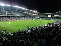 Allianz Stadium (being redeveloped)
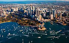
Women were first allowed to participate in recreational swimming when separate baths were opened at Woolloomooloo Bay in the 1830s. From being illegal at the beginning of the century, sea bathing gained immense popularity during the early 1900s and the first surf lifesaving club was established at Bondi Beach.[343][344] Disputes about appropriate clothing for surf bathing surfaced from time to time and concerned men as well as women. The City2Surf is an annual 14-kilometre (8.7-mile) running race from the CBD to Bondi Beach and has been held since 1971. In 2010, 80,000 runners participated which made it the largest run of its kind in the world.[345]
Sailing races have been held on Sydney Harbour since 1827.[346] Yachting has been popular amongst wealthier residents since the 1840s and the Royal Sydney Yacht Squadron was founded in 1862. The Sydney to Hobart Yacht Race is a 1,170-kilometre (727-mile) event that starts from Sydney Harbour on Boxing Day.[347] Since its inception in 1945 it has been recognised as one of the most difficult yacht races in the world.[348] Six sailors died and 71 vessels of the fleet of 115 failed to finish in the 1998 edition.[349]
.jpg.webp)
The Royal Sydney Golf Club is based in Rose Bay and since its opening in 1893 has hosted the Australian Open on 13 occasions.[343] Royal Randwick Racecourse opened in 1833 and holds several major cups throughout the year.[350]
Sydney benefitted from the construction of significant sporting infrastructure in preparation for its hosting of the 2000 Summer Olympics. The Sydney Olympic Park accommodates athletics, aquatics, tennis, hockey, archery, baseball, cycling, equestrian, and rowing facilities. It also includes the high capacity Stadium Australia used for rugby, soccer, and Australian rules football. Sydney Football Stadium was completed in 1988 and is used for rugby and soccer matches. Sydney Cricket Ground was opened in 1878 and is used for both cricket and Australian rules football fixtures.[343]
The Sydney International tennis tournament is held here at the beginning of each year as the warm-up for the Grand Slam in Melbourne. Two of the most successful tennis players in history: Ken Rosewall and Todd Woodbridge were born in and live in the city.
Sydney co-hosted the FIBA Oceania Championship in 1979, 1985, 1989, 1995, 2007, 2009 and 2011.
Government
Historical governance
Supreme_Court_of_New_South_Wales_042.jpg.webp)
During early colonial times, the presiding Governor and his military shared absolute control over the population.[44] This lack of democracy eventually became unacceptable for the colony's growing number of free settlers. The first indications of a proper legal system emerged with the passing of a Charter of Justice in 1814. It established three new courts, including the Supreme Court, and dictated that English law was to be followed.[351] In 1823 the British Parliament passed an act to create the Legislative Council in New South Wales and give the Supreme Court the right of review over new legislation.[352] From 1828 all of the common laws in force in England were to be applied in New South Wales wherever it was appropriate.[352] Another act from the British Parliament in 1842 provided for members of the Council to be elected for the first time.[352]
The Constitution Act of 1855 gave New South Wales a bicameral government. The existing Legislative Council became the upper house and a new body called the Legislative Assembly was formed to be the lower house.[353] An Executive Council was introduced and constituted five members of the Legislative Assembly and the Governor.[354] It became responsible for advising the ruling Governor on matters related to the administration of the state. The colonial settlements elsewhere on the continent eventually seceded from New South Wales and formed their own governments. Tasmania separated in 1825, Victoria did so in 1850, and Queensland followed in 1859.[353] With the proclamation of the Commonwealth of Australia in 1901 the status of local governments across Sydney was formalised and they became separate institutions from the state of New South Wales.[355]
Government in the present
Sydney is divided into local government areas (variously known as cities, councils, municipalities or shires). These local government areas have elected councils which are responsible for functions delegated to them by the New South Wales Government. The 31 local government areas making up Sydney according to the New South Wales Division of Local Government are:
- Bayside
- Canterbury-Bankstown
- Blacktown
- Burwood
- Camden
- Campbelltown
- Canada Bay
- Cumberland
- Fairfield
- Georges River
- Hawkesbury
- The Hills
- Hornsby
- Hunter's Hill
- Inner West
- Ku-ring-gai
- Lane Cove
- Liverpool
- Mosman
- North Sydney
- Northern Beaches
- Parramatta
- Penrith
- Randwick
- Ryde
- Strathfield
- Sutherland
- Sydney
- Waverley
- Willoughby
- Woollahra
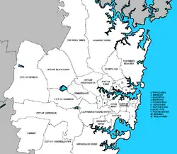
Sydney is the location of the secondary official residences of the Governor-General of Australia and the Prime Minister of Australia, Admiralty House and Kirribilli House respectively.[356] The Parliament of New South Wales sits in Parliament House on Macquarie Street. This building was completed in 1816 and first served as a hospital. The Legislative Council moved into its northern wing in 1829 and by 1852 had entirely supplanted the surgeons from their quarters.[351] Several additions have been made to the building as the Parliament has expanded, but it retains its original Georgian façade.[357] Government House was completed in 1845 and has served as the home of 25 Governors and 5 Governors-General.[358] The Cabinet of Australia also meets in Sydney when needed.
The highest court in the state is the Supreme Court of New South Wales which is located in Queen's Square in Sydney.[359] The city is also the home of numerous branches of the intermediate District Court of New South Wales and the lower Local Court of New South Wales.[360]
In common with other Australian capital cities, Sydney has no single local government covering its whole area. Local government areas have responsibilities such as local roads, libraries, child care, community services and waste collection, whereas the state government retains responsibility for main roads, traffic control, public transport, policing, education, and major infrastructure project.[361]
In the past, the state has tended to resist amalgamating Sydney's more populated local government areas as merged councils could pose a threat to its governmental power.[362] Established in 1842, the City of Sydney is one such local government area and includes the CBD and some adjoining inner suburbs.[363] It is responsible for fostering development in the local area, providing local services (waste collection and recycling, libraries, parks, sporting facilities), representing and promoting the interests of residents, supporting organisations that target the local community, and attracting and providing infrastructure for commerce, tourism, and industry.[364] The City of Sydney is led by an elected Council and Lord Mayor who has in the past been treated as a representative of the entire city.[365]
_sedan%252C_NSW_Police_Force_(18179928673).jpg.webp)
In federal politics, Sydney was initially considered as a possibility for Australia's capital city; the newly created city of Canberra ultimately filled this role.[366] Seven Australian Prime Ministers have been born in Sydney, more than any other city, including first Prime Minister Edmund Barton and current Prime Minister Scott Morrison.
Essential public emergency services are provided and managed by the State Government. Greater Sydney is served by:
Infrastructure
Education
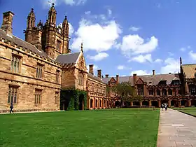
Education became a proper focus for the colony from the 1870s when public schools began to form and schooling became compulsory.[367] The population of Sydney is now highly educated. 90% of working age residents have completed some schooling and 57% have completed the highest level of school.[3] 1,390,703 people were enrolled in an educational institution in 2011 with 45.1% of these attending school and 16.5% studying at a university.[219] Undergraduate or postgraduate qualifications are held by 22.5% of working age Sydney residents and 40.2% of working age residents of the City of Sydney.[3][368] The most common fields of tertiary qualification are commerce (22.8%), engineering (13.4%), society and culture (10.8%), health (7.8%), and education (6.6%).[3]
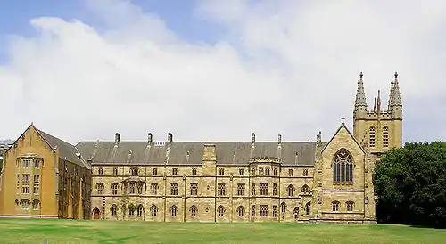
There are six public universities based in Sydney: The University of Sydney, University of New South Wales, University of Technology Sydney, Macquarie University, Western Sydney University, and Australian Catholic University. Five public universities maintain secondary campuses in the city for both domestic and international students: the University of Notre Dame Australia, Central Queensland University, Victoria University, University of Wollongong, and University of Newcastle. Charles Sturt University and Southern Cross University, both public universities, operate secondary campuses only designated for international students. In addition, four public universities offer programmes in Sydney through third-party education providers: University of the Sunshine Coast, La Trobe University, Federation University Australia and Charles Darwin University. 5.2% of residents of Sydney are attending a university.[369] The University of New South Wales and the University of Sydney are ranked top 50 in the world, the University of Technology Sydney is ranked 133, while Macquarie University is ranked 237, and Western Sydney University is ranked 474.[370] Sydney has public, denominational, and independent schools. 7.8% of Sydney residents are attending primary school and 6.4% are enrolled in secondary school.[369] There are 935 public preschool, primary, and secondary schools in Sydney that are administered by the New South Wales Department of Education.[371] 14 of the 17 selective secondary schools in New South Wales are based in Sydney.[372]
Public vocational education and training in Sydney are run by TAFE New South Wales and began with the opening of the Sydney Technical College in 1878. It offered courses in areas such as mechanical drawing, applied mathematics, steam engines, simple surgery, and English grammar.[198] The college became the Sydney Institute in 1992 and now operates alongside its sister TAFE facilities across the Sydney metropolitan area, namely the Northern Sydney Institute, the Western Sydney Institute, and the South Western Sydney Institute. At the 2011 census, 2.4% of Sydney residents are enrolled in a TAFE course.[369]
Health
The first hospital in the new colony was a collection of tents at The Rocks. Many of the convicts that survived the trip from England continued to suffer from dysentery, smallpox, scurvy, and typhoid. Healthcare facilities remained hopelessly inadequate despite the arrival of a prefabricated hospital with the Second Fleet and the construction of brand new hospitals at Parramatta, Windsor, and Liverpool in the 1790s.[373]
Governor Lachlan Macquarie arranged for the construction of Sydney Hospital and saw it completed in 1816.[373] Parts of the facility have been repurposed for use as Parliament House but the hospital itself still operates to this day. The city's first emergency department was established at Sydney Hospital in 1870. Demand for emergency medical care increased from 1895 with the introduction of an ambulance service.[373] The Sydney Hospital also housed Australia's first teaching facility for nurses, the Nightingale Wing, established with the input of Florence Nightingale in 1868.[374]
Healthcare gained recognition as a citizen's right in the early 1900s and Sydney's public hospitals came under the oversight of the Government of New South Wales.[373] The administration of healthcare across Sydney is handled by eight local health districts: Central Coast, Illawarra Shoalhaven, Sydney, Nepean Blue Mountains, Northern Sydney, South Eastern Sydney, South Western Sydney, and Western Sydney.[375] The Prince of Wales Hospital was established in 1852 and became the first of several major hospitals to be opened in the coming decades.[376] St Vincent's Hospital was founded in 1857,[145] followed by Royal Alexandra Hospital for Children in 1880,[377] the Prince Henry Hospital in 1881,[378] the Royal Prince Alfred Hospital in 1882,[379] the Royal North Shore Hospital in 1885,[380] the St George Hospital in 1894,[381] and the Nepean Hospital in 1895.[382] Westmead Hospital in 1978 was the last major facility to open.[383]
Transport
Roads
.jpg.webp)
The motor vehicle, more than any other factor, has determined the pattern of Sydney's urban development since World War II.[384] The growth of low density housing in the city's outer suburbs has made car ownership necessary for hundreds of thousands of households. The percentage of trips taken by car has increased from 13% in 1947 to 50% in 1960 and to 70% in 1971.[384] The most important roads in Sydney were the nine Metroads, including the 110-kilometre (68-mile) Sydney Orbital Network. Widespread criticism over Sydney's reliance on sprawling road networks, as well as the motor vehicle, have stemmed largely from proponents of mass public transport and high density housing.[385][386][387] The Light Horse Interchange in western Sydney is the largest in the southern hemisphere.[388]
There can be up to 350,000 cars using Sydney's roads simultaneously during peak hour, leading to significant traffic congestion.[384] 84.9% of Sydney households own a motor vehicle and 46.5% own two or more.[219] Car dependency is an ongoing issue in Sydney–of people that travel to work, 58.4% use a car, 9.1% catch a train, 5.2% take a bus, and 4.1% walk.[219] In contrast, only 25.2% of working residents in the City of Sydney use a car, whilst 15.8% take a train, 13.3% use a bus, and 25.3% walk.[389] With a rate of 26.3%, Sydney has the highest utilisation of public transport for travel to work of any Australian capital city.[390]
Buses
Bus services today are conducted by a mixture of Government and private operators. In areas previously serviced by trams, the government State Transit Authority operates, in other areas, there are private (albeit part funded by the state government) operators. Integrated tickets called Opal cards operate on both government and private bus routes. State Transit alone operated a fleet of 2,169 buses and serviced over 160 million passengers during 2014. In total, nearly 225 million boardings were recorded across the bus network[391] NightRide is a nightly bus service that operate between midnight and 5am, also replacing trains for most of this period.
Trams and light rail
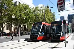
Sydney once had one of the largest tram networks in the British Empire after London.[392] It served routes covering 291 kilometres (181 miles). The internal combustion engine made buses more flexible than trams and consequently more popular, leading to the progressive closure of the tram network with the final tram operating in 1961.[384] From 1930 there were 612 buses across Sydney carrying 90 million passengers per annum.[393]
In 1997, the Inner West Light Rail (also known as the Dulwich Hill Line) opened between Central station and Wentworth Park. It was extended to Lilyfield in 2000 and then Dulwich Hill in 2014. It links the Inner West and Darling Harbour with Central station and facilitated 9.1 million journeys in the 2016–17 financial year.[394] A second, the CBD and South East Light Rail 12 km (7.5 mi) line serving the CBD and south-eastern suburbs opened partially in December 2019 and the remainder in April 2020.[395] A light rail line serving Western Sydney has also been announced, due to open in 2023.
Trains
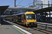
Sydney Trains is the suburban rail service. Its tracks form part of the New South Wales railway network. It serves 175 stations across the city and had an annual ridership of 359 million passenger journeys in 2017–18.[396] Sydney's railway was first constructed in 1854 with progressive extension to the network to serve both freight and passengers across the city, suburbs, and beyond to rural New South Wales. The main station is the Central railway station in the southern part of the CBD. In the 1850s and 1860s, the railway reached areas that are now outer suburbs of Sydney.[384]
Sydney Metro, a driverless rapid transit system separate from the suburban commuter network, commenced operation in May 2019 and will be extended into the city and down southwest by 2024 and through the inner west to Parramatta by 2030.[397][398] It currently serves 13 stations. A line to serve the greater west is planned for 2026 and will include a station for the second international airport.
Ferries
At the time the Sydney Harbour Bridge opened in 1932, the city's ferry service was the largest in the world.[399] Patronage declined from 37 million passengers in 1945 to 11 million in 1963 but has recovered somewhat in recent years.[384] From its hub at Circular Quay the ferry network extends from Manly to Parramatta.[399]
Airports
Sydney Airport, officially "Sydney Kingsford-Smith Airport", is located in the inner southern suburb of Mascot with two of the runways going into Botany Bay. It services 46 international and 23 domestic destinations.[34] As the busiest airport in Australia it handled 37.9 million passengers in 2013 and 530,000 tonnes of freight in 2011.[34] It has been announced that a new facility named Western Sydney Airport will be constructed at Badgerys Creek from 2016 at a cost of $2.5 billion.[400] Bankstown Airport is Sydney's second busiest airport, and serves general aviation, charter and some scheduled cargo flights. Bankstown is also the fourth busiest airport in Australia by the number of aircraft movements.[401] Port Botany has surpassed Port Jackson as the city's major shipping port. Cruise ship terminals are located at Sydney Cove and White Bay.
Environmental issues and pollution reduction
.jpg.webp)
As climate change, greenhouse gas emissions and pollution have become a major issue for Australia, Sydney has in the past been criticised for its lack of focus on reducing pollution, cutting back on emissions and maintaining water quality.[402] Since 1995, there have been significant developments in the analysis of air pollution in the Sydney metropolitan region. The development led to the release of the Metropolitan Air Quality Scheme (MAQS), which led to a broader understanding of the causation of pollution in Sydney, allowing the government to form appropriate responses to the pollution.[403] The 2019–20 Australian bushfire season significantly impacted outer Sydney, and consequently dramatically reduced the air quality of the Sydney metropolitan area leading to a smoky haze that has lingered for many days throughout December. The air quality was 11 times the hazardous level in some days,[404][405] even making it worse than New Delhi's,[406] where it was also compared to "smoking 32 cigarettes" by Associate Professor Brian Oliver, a respiratory diseases scientist at the University of Technology Sydney.[407]
Australian cities are some of the most car dependent cities in the world,[408] especially by world city standards, although Sydney's is the lowest of Australia's major cities at 66%.[409] Furthermore, the city also has the highest usage of public transport in an Australian city, at 27%–making it comparable with New York City, Shanghai and Berlin. Despite its high ranking for an Australian city, Sydney has a low level of mass-transit services, with a historically low-density layout and significant urban sprawl, thus increasing the likelihood of car dependency.[410][411] Strategies have been implemented to reduce private vehicle pollution by encouraging mass and public transit,[412] initiating the development of high density housing and introducing a fleet of 10 new Nissan LEAF electric cars, the largest order of the pollution-free vehicle in Australia.[413] Electric cars do not produce carbon monoxide and nitrous oxide, gases which contribute to climate change.[414][415] Cycling trips have increased by 113% across Sydney's inner-city since March 2010, with about 2,000 bikes passing through top peak-hour intersections on an average weekday.[416] Transport developments in the north-west and east of the city have been designed to encourage the use of Sydney's expanding public transportation system.
The City of Sydney became the first council in Australia to achieve formal certification as carbon-neutral in 2008.[417][418] The city has reduced its 2007 carbon emissions by 6% and since 2006 has reduced carbon emissions from city buildings by up to 20%.[416][419] The City of Sydney introduced a Sustainable Sydney 2030 program, with various targets planned and a comprehensive guide on how to reduce energy in homes and offices within Sydney by 30%.[416][420] Reductions in energy consumption have slashed energy bills by $30 million a year.[421] Solar panels have been established on many CBD buildings in an effort to minimise carbon pollution by around 3,000 tonnes a year.[422]
The city also has an "urban forest growth strategy", in which it aims to regular increase the tree coverage in the city by frequently planting trees with strong leaf density and vegetation to provide cleaner air and create moisture during hot weather, thus lowering city temperatures.[423] Sydney has also become a leader in the development of green office buildings and enforcing the requirement of all building proposals to be energy-efficient. The One Central Park development, completed in 2013, is an example of this implementation and design.[424][425][426][427]
Utilities
.jpg.webp)
Obtaining sufficient fresh water was difficult during early colonial times. A catchment called the Tank Stream sourced water from what is now the CBD but was little more than an open sewer by the end of the 1700s.[428] The Botany Swamps Scheme was one of several ventures during the mid 1800s that saw the construction of wells, tunnels, steam pumping stations, and small dams to service Sydney's growing population.[428]
The first genuine solution to Sydney's water demands was the Upper Nepean Scheme which came into operation in 1886 and cost over £2 million. It transports water 100 kilometres (62 miles) from the Nepean, Cataract, and Cordeaux rivers and continues to service about 15% of Sydney's total water needs.[428] Dams were built on these three rivers between 1907 and 1935.[428] In 1977 the Shoalhaven Scheme brought several more dams into service.[429]
The WaterNSW now manages eleven major dams: Warragamba one of the largest domestic water supply dams in the world,[430] Woronora, Cataract, Cordeaux, Nepean, Avon, Wingecarribee Reservoir, Fitzroy Falls Reservoir, Tallowa, the Blue Mountains Dams, and Prospect Reservoir.[431] Water is collected from five catchment areas covering 16,000 square kilometres (6,178 square miles) and total storage amounts to 2.6 teralitres (0.6 cubic miles).[431] The Sydney Desalination Plant came into operation in 2010.[428]
The two distributors which maintain Sydney's electricity infrastructure are Ausgrid and Endeavour Energy.[432][433] Their combined networks include over 815,000 power poles and 83,000 kilometres (52,000 miles) of electricity cables.
See also
Notes
- In accordance with the Australian Bureau of Statistics source, England, Scotland, Mainland China and the Special Administrative Regions of Hong Kong and Macau are listed separately
- As a percentage of 4,519,022 persons who nominated their ancestry at the 2016 census.
- The Australian Bureau of Statistics has stated that most who nominate "Australian" as their ancestry are part of the Anglo-Celtic group.[295]
- Of any ancestry. Includes those identifying as Aboriginal Australians or Torres Strait Islanders. Indigenous identification is separate to the ancestry question on the Australian Census and persons identifying as Aboriginal or Torres Strait Islander may identify any ancestry.
- Of any ancestry. Includes those identifying as Aboriginal Australians or Torres Strait Islanders. Indigenous identification is separate to the ancestry question on the Australian Census and persons identifying as Aboriginal or Torres Strait Islander may identify any ancestry.
References
- "3218.0 – Regional Population Growth, Australia, 2018–19". abs.gov.au. Australian Bureau of Statistics. Retrieved 28 March 2020.
- "New South Wales: Population Density". Australian Bureau of Statistics. 30 June 2018. Archived from the original on 18 May 2019. Retrieved 27 March 2019.
- "Greater Sydney: Basic Community Profile" (xls). 2011 Census Community Profiles. Australian Bureau of Statistics. 28 March 2013. Retrieved 9 April 2014.
- "Cumberland County". Geographical Names Register (GNR) of NSW. Geographical Names Board of New South Wales. Retrieved 20 September 2017.

- "Sydney (Observatory Hill)". Climate statistics for Australian locations. Bureau of Meteorology. Retrieved 15 December 2016.
- "The most populous cities in Oceania". Blatant Independent Media. 2010. Retrieved 13 September 2014.
- Mason, Herbert (2012). Encyclopaedia of Ships and Shipping. p. 266.
- "Complete official list of Sydney suburbs". Walk Sydney Streets. 2014. Retrieved 13 July 2014.
- "3218.0 – Regional Population Growth, Australia, 2018–19". Australian Bureau of Statistics. 25 March 2020. Archived from the original on 18 May 2019. Retrieved 25 April 2020.
- "3218.0 – Regional Population Growth, Australia, 2016–17: Main Features". Australian Bureau of Statistics. Australian Bureau of Statistics. 24 April 2018. Retrieved 13 October 2018. Estimated resident population, 30 June 2017.
- "Aboriginal history and the Gadigal people". City of Sydney. Retrieved 31 December 2020.
- "Manly Council – Manly Heritage & History". www.manly.nsw.gov.au. Retrieved 10 May 2016.
- "Sydney's melting pot of language". The Sydney Morning Herald. 2014. Archived from the original on 23 September 2014. Retrieved 13 September 2014.
- "Greater Sydney Language spoken at home". NSW Government. 2017. Retrieved 1 February 2019.
- "Census 2016: Migrants make a cosmopolitan country". The Australian. 15 July 2017. Retrieved 16 July 2017.
- "2016 Census QuickStats". Australian Bureau of Statistics. Retrieved 4 January 2019.
- Levy, Megan (2014). "Sydney, Melbourne more expensive than New York, says Living Index". The Sydney Morning Herald. Retrieved 20 July 2014.
- "Sydney retains #10 ranking in Mercer's global quality of living survey". www.mercer.com. 28 April 2018. Retrieved 28 April 2018.
- "World's most liveable cities: Vienna's win leaves Sydney and Melbourne in a spin". The Guardian. 4 September 2019. Retrieved 26 September 2019.
- "2018 Quality of Living Index". Mercer. 2018. Retrieved 28 April 2018.
- "The World According to GaWC 2020". GaWC - Research Network. Globalization and World Cities. Retrieved 31 August 2020.
- Global Power City Index 2010 (PDF) (Report). Tokyo, Japan: Institute for Urban Strategies at The Mori Memorial Foundation. October 2010. Retrieved 10 August 2011.
- "Cities of opportunity" (PDF). PricewaterhouseCoopers. 2012. Archived from the original (PDF) on 10 February 2013. Retrieved 21 July 2014.
- Wade, Matt (18 February 2012). "Tough week for a Sydney success story". The Sydney Morning Herald. Retrieved 12 January 2016.
- Irvine, Jessica (2008). "Another shot at making city a finance hub". The Sydney Morning Herald. Retrieved 26 July 2014.
- "Economic powerhouse". City of Sydney. 2014. Retrieved 21 July 2014.
- "Economic profile". City of Sydney. 2014. Retrieved 20 July 2014.
- "QS world university rankings 2016". Quacquarelli Symonds. 2016. Retrieved 19 September 2016.
- "History of the Library | State Library of New South Wales". State Library of New South Wales. Retrieved 7 February 2011.
- Dennis, Anthony (2013). ""Too expensive" Sydney slips from top 10 tourism list". The Sydney Morning Herald. Archived from the original on 25 September 2014. Retrieved 27 October 2016.
In this year's World's Best Awards, announced in New York this week, Sydney came in as the world's number 12 ranked best city.
- "Our global city". City of Sydney. 2014. Retrieved 21 July 2014.
- Benson, D. H. and Howell J. (1990) Taken for Granted: the Bushland of Sydney and Its Suburbs, Sydney
- "Hyde Park: Plan of Management and Masterplan" (PDF). Sydney City Council. October 2006. pp. 7–11. Retrieved 7 September 2012.
- "Overview". Sydney Airport. 2014. Archived from the original on 5 September 2014. Retrieved 10 August 2014.
- "Central Station". Sydney Trains. 2014. Archived from the original on 25 June 2014. Retrieved 10 August 2014.
- Macey, Richard (2007). "Settlers' history rewritten: go back 30,000 years". The Sydney Morning Herald. Retrieved 5 July 2014.
- Attenbrow, Val (2010). Sydney's Aboriginal Past: Investigating the Archaeological and Historical Records. Sydney: UNSW Press. pp. 152–153. ISBN 978-1-74223-116-7. Retrieved 11 November 2013.
- "Cook's landing site". Department of the Environment. 2014. Retrieved 5 July 2014.
- "Pages from the past". The Argus. 31 May 1919. p. 20.
- "Once were warriors". The Sydney Morning Herald. 2002. Retrieved 5 July 2014.
- "Aboriginal people and place". Sydney Barani. 2013. Retrieved 5 July 2014.
- Stockton, Eugene D.; Nanson, Gerald C. (April 2004). "Cranebrook Terrace Revisited". Archaeology in Oceania. 39 (1): 59–60. doi:10.1002/j.1834-4453.2004.tb00560.x. JSTOR 40387277.
- "Sydney's history". City of Sydney. 2013. Retrieved 5 July 2014.
- "Early European settlement". Parliament of New South Wales. 2014. Retrieved 17 August 2014.
- "Arthur Phillip". State Library of New South Wales. 2014. Archived from the original on 3 February 2013. Retrieved 6 July 2014.
- McGillick, Paul; Bingham-Hall, Patrick (2005). Sydney architecture. p. 14 to 15.
- Phillip, Arthur (1738–1814) by B. H. Fletcher
- "History and heritage". The Rocks. 2014. Archived from the original on 25 June 2014. Retrieved 5 July 2014.
- Lambert, Tim (2014). "A Brief History of Sydney". LocalHistories.org. Retrieved 12 July 2014.
- "Early sufferings of the colony". History of Australia Online. 2007. Retrieved 12 July 2014.
- Mear, Craig (2008). "The origin of the smallpox outbreak in Sydney in 1789". Journal of the Royal Australian Historical Society. Archived from the original on 31 August 2011. Retrieved 5 July 2014.
- "Lachlan Macquarie". Dictionary of Sydney. 2008. Retrieved 14 September 2014.
- Broomham, Rosemary (2001), Vital connections: a history of NSW roads from 1788, Hale & Iremonger in association with the Roads and Traffic Authority NSW, p. 25, ISBN 978-0-86806-703-2
- "Phillip, Arthur (1738–1814)". Arthur Phillip. Australian National University. 2014. Retrieved 6 July 2014.
- Connor, John (2002). The Australian frontier wars, 1788–1838. Sydney: UNSW Press. ISBN 0-86840-756-9.
- Kohen, J. L. (2005). "Pemulwuy (1750–1802)". Pemulwuy (c. 1750 – 1802). Australian Dictionary of Biography. Australian National University. Retrieved 12 July 2009.
- Dale, David (16 February 2008). "WHO WE ARE: The man who nearly changed everything". The Sun Herald. Archived from the original on 23 June 2012. Retrieved 26 April 2018.
- "Catholic Australia – Home". Archived from the original on 24 March 2012. Retrieved 2 September 2010.
- Australian Encyclopaedia. 2. 1926. p. 524. Missing or empty
|title=(help) - The Grand Central Coffee Palace visitors' guide to Sydney, and the various health and pleasure resorts in the vicinity. National Library of Australia. Sydney : Grand Central Coffee Palace Company. 1890. Retrieved 15 May 2019.
- Noyce, Diana Christine (2012). "Coffee Palaces in Australia: A Pub with No Beer". M/C Journal. 15 (2). doi:10.5204/mcj.464.
- Hunwick, Heather (2018). The Food and Drink of Sydney: A History. Rowman & Littlefield. p. 153. ISBN 9-781-44225204-2.
- "Sydney". Postcardz.com.au. 2014. Archived from the original on 11 March 2014. Retrieved 6 July 2014.
- "Emerald City rewatched – Melbourne-Sydney rivalry in a screwball dramedy". The Guardian. 14 February 2016. Retrieved 28 January 2017.
- "History of the Art Gallery of NSW". Art Gallery of New South Wales. Retrieved 28 January 2017.
- "Melbourne vs Sydney". SBS. 23 July 2017. Retrieved 28 January 2017.
- "Linking a nation". Department of the Environment. 2014. Retrieved 4 October 2014.
- "Surviving the Great Depression". Australian Broadcasting Corporation. 2010. Retrieved 6 July 2014.
- "Sydney Harbour Bridge". Commonwealth of Australia. 2014. Archived from the original on 12 May 2012. Retrieved 6 July 2014.
- "Remembering 1942: Sydney under attack". Australian War Memorial. 2014. Retrieved 6 July 2014.
- "Royal visits". The official website of The British Monarchy. Archived from the original on 29 May 2010. Retrieved 8 December 2009.
- "Biography: Harry Seidler AC OBE LFRAIA". architecture.com.au. The Australian Institute of Architects. 6 May 2005. Archived from the original on 23 July 2008. Retrieved 2 May 2008.
- Longman, Jere (2000). "Sydney 2000: Closing Ceremony; A Fond Farewell From Australia". The New York Times. Retrieved 6 July 2014.
- "Sydney inner city: region data summary". Australian Bureau of Statistics. 2006. Retrieved 12 July 2014.
- "Greater Sydney: region data summary". Australian Bureau of Statistics. 2014. Retrieved 12 July 2014.
- "Census of population and housing: selected characteristics for urban centres, Australia" (PDF). Australian Bureau of Statistics. 2003. Retrieved 5 October 2014.
- "Green streets: which city has the most trees?". The Guardian. 5 November 2019. Retrieved 31 October 2020.
- "Sydney Basin". Office of Environment and Heritage. 2014. Retrieved 12 July 2014.
- Latta, David (2006). "Showcase destinations Sydney, Australia: the harbour city". Archived from the original on 9 April 2014. Retrieved 12 July 2014.
- "Soils for nature". Office of Environment and Heritage. 7 November 2019. Retrieved 26 September 2020.
- Herbert, Chris; Helby, Robin (1980). A Guide to the Sydney basin (1 ed.). Maitland: Geological Survey of New South Wales. p. 582. ISBN 0-7240-1250-8.
- William, E and Airey, DW. A Review of the Engineering Properties of the Wianamatta Group Shales [online]. In: Vitharana, Nihal Dhamsiri (Editor); Colman, Randal (Editor). Proceedings 8th Australia New Zealand Conference on Geomechanics: Consolidating Knowledge. Barton, ACT: Australian Geomechanics Society, 1999: 641-647. Availability: <https://search.informit.com.au/documentSummary;dn=736896154066797;res=IELENG Archived 14 August 2008 at the Wayback Machine> ISBN 1864450029.
- "Coastal Valley Grassy Woodlands". NSW Environment & Heritage. Retrieved 15 December 2019.
- "Dry sclerophyll forests (shrub/grass sub-formation)". NSW Environment & Heritage. Retrieved 15 October 2016.
- "Dry sclerophyll forests (shrubby sub-formation)". NSW Environment & Heritage. Retrieved 16 December 2019.
- "Wet sclerophyll forests (grassy sub-formation)". NSW Environment & Heritage. Retrieved 16 March 2017.
- Hindwood, K. A. and McCill, A. R., 1958. The Birds of Sydney (Cumberland Plain) New South Wales. Royal Zoological Society New South Wales.
- Dolby, Tim; Clarke, Rohan (2014). Finding Australian Birds. CSIRO Publishing. ISBN 9780643097667.
- Cogger, H.G. (2000). Reptiles and Amphibians of Australia. Reed New Holland.
- Green, D., 1973. -Re reptiles of the outer north-western suburbs of Sydney. Herpetofauna 6 (2): 2–5.
- "Sydney's flying foxes now Bundy's problem". North Queensland Register. 2 August 2012. Archived from the original on 30 December 2012. Retrieved 22 February 2014.
- Whyte, Robert; Anderson, Greg (2017). A Field Guide to Spiders of Australia. Clayton VIC: CSIRO Publishing.
- Falkner, Inke; Turnbull, John (2019). Underwater Sydney. Clayton South, Victoria: CSIRO Publishing. ISBN 9781486311194.
- "Modelling and simulation of seasonal rainfall" (PDF). Centre for Computer Assisted Research Mathematics and its Applications (CARMA). 20 May 2014. Retrieved 25 February 2016.
Brisbane and Sydney each have a humid sub-tropical or temperate climate with no pronounced dry season...the classification is Cfa
- "Climate and the Sydney 2000 Olympic Games". Australian Government. Australian Bureau of Statistics. 24 September 2007. Archived from the original on 10 June 2008. Retrieved 21 December 2008.
- "Sydney (Observatory Hill)". Climate statistics for Australian locations. Bureau of Meteorology. Retrieved 15 November 2013.
- Bureau of Meteorology. 2006. Climate summary for Sydney, January 2006
- Creagh, Sunanda. "Sydney smashes temperature records but heatwave nearly over". The Conversation. The Conversation Media Group. Retrieved 21 January 2013.
- "Climate statistics for Australian locations". Bureau of Meteorology. Retrieved 15 November 2013.
- Torok, S. and Nicholls, N. 1996. A historical annual temperature dataset for Australia. Aust. Met. Mag., 45, 251–60.
- "Penrith hits record temperature of 48.9C as heatwave strikes NSW". Daily Telegraph. Retrieved 6 January 2020.
- Sydney Sea Temperature – seatemperature.org
- "Climate statistics for Australian locations Sydney Airport AMO". Bureau of Meteorology.
- "Sydney (Observatory Hill) Period 1991-2020". Bureau of Meteorology. Retrieved 14 April 2020.
- "Sydney area an 'urban heat island' vulnerable to extreme temperatures". The Sydney Morning Herald. 14 January 2016. Retrieved 14 January 2016.
- Santamouris, Mat; Haddad, Shamila; Fiorito, Francesco; Osmond, Paul; Ding, Lan; Prasad, Deo; Zhai, Xiaoqiang; Wang, Ruzhu (2017). "Urban Heat Island and Overheating Characteristics in Sydney, Australia. An Analysis of Multiyear Measurements". Sustainability. University of New South Wales. 9 (5): 712. doi:10.3390/su9050712.
- "Special Climate Statement 43 – extreme heat in January 2013" (PDF). Bureau of Meteorology. 1 February 2013. Retrieved 2 February 2013.
- Batt, K, 1995: Sea breezes on the NSW coast, Offshore Yachting, Oct/Nov 1995, Jamieson Publishing.
- ""Southerly Buster" Relieves City". The Sydney Morning Herald. National Library of Australia. 17 December 1953. p. 1. Retrieved 27 March 2015.
- Sharples, J.J. Mills, G.A., McRae, R.H.D., Weber, R.O. (2010) Elevated fire danger conditions associated with foehn-like winds in southeastern Australia. Journal of Applied Meteorology and Climatology.
- Sharples, J.J., McRae, R.H.D., Weber, R.O., Mills, G.A. (2009) Foehn-like winds and fire danger anomalies in southeastern Australia. Proceedings of the 18th IMACS World Congress and MODSIM09. 13–17 July, Cairns.
- MacDonnell, Freda. Thomas Nelson (Australia) Limited, 1967. Before King's Cross
- Sydney has coldest June in 24 years in Sydney Monthly Climate Summary – NSW Regional Office, Bureau of Meteorology. Retrieved 21 October 2007.
- "Sydney – Greater Sydney in 2008". Bom.gov.au. 5 January 2009. Retrieved 10 February 2012.
- "Sydney in 2009". Bom.gov.au. 4 January 2010. Retrieved 10 February 2012.
- "Sydney in 2010". Bom.gov.au. 4 January 2011. Retrieved 10 February 2012.
- "Southern Annular Mode: The climate 'influencer' you may not have heard of". ABC News. Retrieved 29 September 2020.
- "Special Climate Statement 71—severe fire weather conditions in southeast Queensland and northeast New South Wales in September 2019" (PDF). Bureau of Meteorology. 24 September 2019. Retrieved 5 January 2020.
- "The 10 Sydney regions most exposed to bushfire risk". Sydney Morning Herald. Retrieved 7 November 2020.
- "The Sydney suburbs in bushfire danger on a day of 'catastrophic' conditions". News.com.au. Retrieved 7 November 2020.
- "Sydney future: high temps, erratic rain". The Sydney Morning Herald.
- "Commuters in Sydney and eastern NSW brace for erratic weather". News.com.au.
- Drosdowsky, Wasyl (16 March 2005). "The latitude of the subtropical ridge over Eastern Australia: TheL index revisited". INTERNATIONAL JOURNAL OF CLIMATOLOGY, Bureau of Meteorology Research Centre. 25 (10): 1291–1299. Bibcode:2005IJCli..25.1291D. doi:10.1002/joc.1196. Retrieved 29 September 2020.
- Australian Bureau of Meteorology. 2005. Ellyard, D. 1994. Droughts and Flooding Rains. Angus & Robertson ISBN 0-207-18557-3
- "Average annual thunder-day map". Archived from the original on 12 February 2017. Retrieved 17 March 2017.
- "About East Coast Lows". Bureau of Meteorology. Retrieved 6 April 2013.
- "Black Nor-Easter". The Sydney Morning Herald. National Library of Australia. 30 October 1911. p. 7. Retrieved 27 March 2015.
- Power, S., Tseitkin, F., Torok, S., Lavery, B., Dahni, R. and McAvaney, B. 1998. Australian temperature, Australian rainfall and the Southern Oscillation, 1910–1992: coherent variability and recent changes. Aust. Met. Mag., 47, 85–101
- "Sydney winter not snow, just hail". Sydney Morning Herald. 27 July 2008. Retrieved 15 November 2013.
Mr Zmijewski doubted the 1836 snow report, saying weather observers of the era lacked the expertise of today. "We are almost in the sub-tropics in Sydney", he said.
- "The Sydney Hailstorm – 14 April 1999". Bureau of Meteorology. Retrieved 5 October 2006.
- "Sydney (Observatory Hill) Period 1991-2020". Bureau of Meteorology. Retrieved 14 April 2020.
- "Sydney (Observatory Hill): all years". Bureau of Meteorology. Retrieved 4 June 2018.
- "Climate statistics for Australian locations Sydney Airport AMO". Bureau of Meteorology.
- "Sydney, Australia - Climate data". Weather Atlas. Retrieved 2 December 2020.
- "District Plans | Greater Sydney Commission". www.greater.sydney. Retrieved 23 April 2018.
- "Greater Sydney GCCSA". Australian Bureau of Statistics Data by Region.
- "2016 Census QuickStats". Australian Bureau of Statistics. Retrieved 24 April 2020.
- "Update on restrictions – effective midnight 30 December". NSW Government. 30 December 2020. Retrieved 10 January 2021.
- "Sydney unprepared for terror attack". The Australian. 4 September 2007. Retrieved 3 June 2017.
- "The Strand". The Sydney Morning Herald (16, 858). New South Wales, Australia. 2 April 1892. p. 5. Retrieved 27 October 2016 – via National Library of Australia.
- "The largest shopping centres in Australia". worldatlas.com. Retrieved 24 April 2020.
- "Ultimo and Pyrmont: a decade of renewal" (PDF). Sydney Harbour Foreshore Authority. 2004. Retrieved 13 July 2014.
- "Business-friendly boost for Oxford St lane way". City of Sydney. 2014. Retrieved 13 July 2014.
- Dick, Tim (2014). "At the crossroads". The Sydney Morning Herald. Retrieved 13 July 2014.
- Dunn, Mark (1970). "Darlinghurst". Dictionary of Sydney. Retrieved 9 August 2014.
- "Green Square". City of Sydney. 2014. Retrieved 13 July 2014.
- "Discover Barangaroo". Barangaroo Delivery Authority. 2013. Retrieved 13 July 2014.
- Wotherspoon, Garry (2012). "Paddington". Dictionary of Sydney. Retrieved 9 August 2014.
- "Strathfield Station".
- NSW, Transport for (21 April 2017). "Parramatta light rail to connect communities". www.transport.nsw.gov.au. Retrieved 23 April 2018.
- "Newtown". www.marrickville.nsw.gov.au. Retrieved 23 April 2018.
- "Eastern City District Plan | Greater Sydney Commission". www.greater.sydney. Retrieved 22 April 2018.
- Badkar, Mamta (2011). "The 10 most expensive streets in the world". Business Insider. Retrieved 13 July 2014.
- "Labor, Greens, Howard's battlers: Explore the politics of disadvantage". ABC News. 6 April 2018. Retrieved 21 April 2018.
- Sydney Morning Herald, 1 January 2009, p.18
- https://gsc-public-1.s3.amazonaws.com/s3fs-public/forecasting_the_distribution_of_stand_alone_office_employment_across_sydney_to_2035_bis_shrapnel_2015_08_0.pdf
- https://gsc-public-1.s3-ap-southeast-2.amazonaws.com/s3fs-public/eastern-district-plan-0318.pdf
- Sydney’s new light rail is now open from Circular Quay to Kingsford Transport for NSW 3 April 2020
- "Sydney's light rail one year behind schedule". ABC News. 19 April 2018. Retrieved 21 April 2018.
- The Book of Sydney Suburbs, Compiled by Frances Pollon, Angus & Robertson Publishers, 1990, Published in Australia ISBN 0-207-14495-8, page 149
- "Liveable Sydney: The lower north shore's suburbs ranked by liveability". 28 July 2016.
- National Regional Profile: Northern Beaches Sydney
- "Old Windsor and Windsor Road".
- "Parramatta". Parramatta Chamber of Commerce. 2014. Archived from the original on 6 August 2014. Retrieved 13 July 2014.
- "Home – WSROC Region". Profile.id.com.au. Retrieved 10 January 2019.
- McClymont, John; Kass, Terry (2010). "Old Toongabbie and Toongabbie". Dictionary of Sydney. Dictionary of Sydney Trust. Retrieved 30 July 2019.
- "Water theme park planned for Sydney". ABC News. 11 September 2010. Retrieved 11 September 2010.
- "Auburn Botanical Gardens". chah.gov.au. Archived from the original on 6 October 2009. Retrieved 4 October 2009.
- "Nature reserves: Central Gardens". Your facilities. Holroyd City Council. Retrieved 19 September 2014.
- "Visitor Information – How to Get Here". Sydney Motorsport Park. Archived from the original on 10 April 2013. Retrieved 21 February 2013.
- "Boothtown Aqueduct Aqueduct Valve House No 1 & 2". New South Wales State Heritage Register. Office of Environment and Heritage. Retrieved 27 March 2018.
- O'Maley, Christine (23 November 2009). "Featherdale beats Opera House to claim major tourism award". Blacktown Advocate. Retrieved 18 March 2012.
- "Westfield Has 44 Shopping Centres Across Every Major Metropolitan Market". Westfield Group. Archived from the original on 12 September 2009.
- Chalmers, Emma; Martin, Saray (1 August 2010). "World Heritage Committee approves Australian Convict Sites as places of importance". The Courier–Mail. Australia. Retrieved 17 April 2018.
- Energy, Department of the Environment and (17 April 2018). "National Heritage Places – Old Government House and Government Domain, Parramatta". www.environment.gov.au.
- Jones, I., and Verdel, C. (2015). Basalt distribution and volume estimates of Cenozoic volcanism in the Bowen Basin region of eastern Australia: Implications for a waning mantle plume. Australian Journal of Earth Sciences, 62(2), 255–263.
- Prospect Hill | NSW Environment & Heritage
- Degotardi, Peter (1 February 2004). The Month in Review (PDF) (Report). Herron Todd White Property Advisors. Archived from the original (PDF) on 20 August 2006.
- "Bankstown Reservoir (Elevated)". New South Wales State Heritage Register. Office of Environment and Heritage. Retrieved 27 March 2018.
- Boulous, Chris (20 April 2018). "Nothing Bland about our Oak tree". Fairfield City Champion. FAIRFAX REGIONAL MEDIA. Retrieved 29 August 2018.
- "Sydney - The Skyscraper Center". www.skyscrapercenter.com. Retrieved 16 July 2020.
- "Australia's World Heritage List". Department of the Environment. 2014. Retrieved 19 July 2014.
- "Australia's National Heritage List". Department of the Environment. 2014. Retrieved 19 July 2014.
- "Australian Heritage Database". Department of the Environment. 2014. Retrieved 19 July 2014.
- "Macquarie Lighthouse". Department of the Environment. 2014. Retrieved 20 July 2014.
- "Macquarie Lightstation". Sydney Harbour Federation Trust. 2001. Archived from the original on 9 February 2006. Retrieved 20 July 2014.
- "Hyde Park Barracks". Department of the Environment. 2014. Retrieved 20 July 2014.
- Judd, Stephen; Cable, Kenneth (2000). Sydney Anglicans – a history of the diocese. p. 12.
- "Chronology of styles in Australian architecture". Sydney Architecture. 2014. Archived from the original on 8 September 2014. Retrieved 19 July 2014.
- "Government House". Department of Premier and Cabinet. 2014. Retrieved 20 July 2014.
- "Changes not music to purists' ears". The Sydney Morning Herald. 8 September 2008. Retrieved 14 November 2016.
- "Kirribilli House". Department of the Environment. 2014. Retrieved 20 July 2014.
- "A short history of the Australian Museum". Australian Museum. Australia Museum. 20 July 2014. Archived from the original on 21 August 2020. Retrieved 21 August 2020.
- "General Post Office". Department of the Environment. 2014. Retrieved 20 July 2014.
- "Sydney Customs House". Department of the Environment. 2014. Retrieved 20 July 2014.
- "Construction of Sydney Town Hall". Sydney Town Hall. 2014. Retrieved 20 July 2014.
- "Features of Sydney Town Hall". Sydney Town Hall. 2014. Retrieved 20 July 2014.
- Freyne, Catherine (2010). "Sydney Technical College". Dictionary of Sydney. Retrieved 10 August 2014.
- "History of Queen Victoria Building". Queen Victoria Building. 2014. Retrieved 20 July 2014.
- Ellmoos, Laila (2008). "Queen Victoria Building". Dictionary of Sydney. Retrieved 9 August 2014.
- "Commercial Travellers Club". Sydney Architecture Images. Archived from the original on 23 October 2016. Retrieved 14 December 2018.
- McGillick, Paul; Bingham-Hall, Patrick (2005). Sydney architecture. p. 14 to 15.
- "Sydney Harbour Bridge". Department of the Environment. 2014. Retrieved 20 July 2014.
- "Sydney Opera House". Department of the Environment. 2014. Retrieved 20 July 2014.
- "Citigroup Centre". Emporis. 2014. Retrieved 20 July 2014.
- "Aurora Place". Emporis. 2014. Retrieved 20 July 2014.
- "Chifley Tower". Emporis. 2014. Retrieved 20 July 2014.
- Ellmoos, Laila (2008). "Chifley Tower". Dictionary of Sydney. Retrieved 8 August 2014.
- "Reserve Bank". Department of the Environment. 2014. Retrieved 20 July 2014.
- "Deutsche Bank Place". Emporis. 2014. Retrieved 20 July 2004.
- "MLC Centre". Emporis. 2014. Retrieved 20 July 2014.
- "Castlereagh Centre". Emporis. 2014. Retrieved 20 July 2014.
- Dunn, Mark (2008). "Centrepoint Tower". Dictionary of Sydney. Retrieved 8 August 2014.
- "'It's held Sydney back': Council reveals plan to raise CBD skyline by 100 metres". www.abc.net.au. 25 February 2020. Retrieved 30 May 2020.
- "Unlocked: Demolished Sydney". SydneyLivingMuseums.com.au. Retrieved 14 December 2018.
- "Sydney houses are so 'severely unaffordable', it's cheaper to buy in New York". Business Insider (Australia). 24 January 2017. Retrieved 25 January 2017.
- "How Sydney house prices compare with other global cities". Domain Group. 25 July 2015. Retrieved 25 January 2017.
- C. Delmendo, Lalaine (15 August 2019). "Australia's house prices are now in free fall". globalpropertyguide.com. Retrieved 8 April 2020.
- "2016 Census QuickStats: Greater Sydney". Australian Bureau of Statistics. 2016. Retrieved 25 October 2018.
- Darcy, Michael (2008). "Housing Sydney". Dictionary of Sydney. Retrieved 9 August 2014.
- "Services offered". Housing New South Wales. 2012. Archived from the original on 19 October 2014. Retrieved 19 October 2014.
- Hasham, Nicole (2014). "Sydney waterfront public housing properties to be sold off". The Sydney Morning Herald. Retrieved 19 October 2014.
- "Sydney Housing Ratio 14 Times Annual Pre-Tax Salary". 2017.
- Irving, Terry; Irving, Terrence H.; Cahill, Rowan J. (2010). Radical Sydney: Places, Portraits and Unruly Episodes. UNSW Press. p. 306. ISBN 9781742230931.
- "A public housing terrace in Sydney sold for a staggering $2.2 million above reserve". Business Insider. 10 December 2016. Retrieved 23 January 2017.
- Kimmorley, Sarah (15 April 2016). "This $13 million Sydney property is the most expensive terrace in Australia". Business Insider. Retrieved 23 January 2017.
- "Sydney's culture of place". Charles Sturt University. 2014. Archived from the original on 25 October 2014. Retrieved 26 July 2014.
- "ANZAC Memorial, Sydney Archived 9 May 2015 at the Wayback Machine", ANZAC Day Commemoration Committee (Qld) Incorporated, 1998.
- "Royal Botanic Garden, Sydney". Royal Botanic Garden, Sydney.
- "Major parks". City of Sydney. 2014. Retrieved 19 July 2014.
- "Royal National Park". Office of Environment and Heritage. 2014. Retrieved 13 July 2014.
- "Ku-ring-gai Chase National Park history". Office of Environment and Heritage. 2014. Retrieved 19 July 2014.
- "Ku-ring-gai Chase National Park heritage". Office of Environment and Heritage. 2014. Retrieved 19 July 2014.
- "Royal Botanic Gardens history". Office of Environment and Heritage. 2014. Archived from the original on 8 July 2014. Retrieved 19 July 2014.
- "Royal Botanic Gardens". Dictionary of Sydney. 2008. Retrieved 9 August 2014.
- "Royal Botanic Gardens fast facts". Office of Environment and Heritage. 2014. Archived from the original on 8 July 2014. Retrieved 19 July 2014.
- "Hyde Park plan of management and masterplan" (PDF). City of Sydney. 2006. Retrieved 19 July 2014.
- "Hyde Park". City of Sydney. 2014. Retrieved 19 July 2014.
- "Financial Centres of the World: Sydney, Australia". www.ecdconference.org. Retrieved 16 July 2020.
- "The world according to GaWC 2012". Loughborough University. 2012. Retrieved 31 August 2014.
- Florida, Richard (2014). "The 25 most economically powerful cities in the world". CityLab. Retrieved 20 July 2014.
- "2014 Global Cities Index" (PDF). AT Kearney. 2014. Archived from the original (PDF) on 16 October 2014. Retrieved 20 July 2014.
- Wotherspoon, Garry (2008). "Economy". Dictionary of Sydney. Retrieved 9 August 2014.
- http://www.sgsep.com.au/publications/gdp-major-capital-city-2015-2016
- "Australian cities accounts" (PDF). SGS Economics and Planning. 2014. Archived from the original (PDF) on 5 October 2014. Retrieved 31 August 2014.
- "Creative and digital". City of Sydney. 2014. Retrieved 22 July 2014.
- Wade, Matt (2014). "NSW dominates creative industries: report". The Sydney Morning Herald. Retrieved 26 July 2014.
- "Economic profile". Regional Development Australia. 2010. Archived from the original on 16 October 2014. Retrieved 26 July 2014.
- "Global connections: a study of multinational companies in Sydney" (PDF). Australian Business Foundation. 2009. Archived from the original (PDF) on 26 August 2014. Retrieved 26 July 2014.
- "Multinational companies regional headquarters". Parliament of New South Wales. 2000. Retrieved 26 July 2014.
- City of Sydney, Street Names 22 May 2009
- "Prices and earnings". UBS. 2012. Retrieved 20 July 2014.
- "Employment status, Greater Sydney". ID: The Population Experts. Archived from the original on 18 November 2016. Retrieved 30 March 2018.
- "Employment status". City of Sydney. 2014. Retrieved 26 July 2014.
- "Industry sector of employment". City of Sydney. 2016. Archived from the original on 3 November 2012. Retrieved 28 March 2018.
- "Individual income | Greater Sydney | profile.id". profile.id.com.au. Retrieved 29 March 2018.
- "2016 Census QuickStats: Greater Sydney". www.censusdata.abs.gov.au. Retrieved 29 March 2018.
- Wade, Matt (2014). "The daily exodus from western Sydney". The Sydney Morning Herald. Retrieved 26 July 2014.
- Abelson, Peter; Chung, Demi (2004). "Housing prices in Australia: 1970 to 2003" (PDF). Macquarie University. Retrieved 26 July 2014.
- "Residential property price indexes: eight capital cities". Australian Bureau of Statistics. 2014. Retrieved 26 July 2014.
- "Home value index results" (PDF). RP Data. 2014. Archived from the original (PDF) on 15 April 2014. Retrieved 26 July 2014.
- Rebecca, Thistleton. "Housing land: so scarce so expensive". Australian Financial Review.
- "A city's heart builds on a sense of place". The Sydney Morning Herald. 1 October 2007. Retrieved 18 July 2020.
- "Australia's banking history". Australian Broadcasting Corporation. 1998. Archived from the original on 30 July 2014. Retrieved 26 July 2014.
- "Bank of New South Wales". Dictionary of Sydney. 2008. Retrieved 8 August 2014.
- "History". ASX. 2014. Retrieved 31 August 2014.
- Murray, Lisa (2005). "Sydney's niche in global finance". The Sydney Morning Herald. Retrieved 26 July 2014.
- "The Global Financial Centres Index 21" (PDF). Long Finance. March 2017. Archived from the original (PDF) on 11 June 2017.
- "Financial services". Department of Trade and Investment. 2014. Archived from the original on 21 June 2014. Retrieved 26 July 2014.
- "List of authorised deposit-taking institutions". Australian Prudential Regulation Authority. 2014. Archived from the original on 30 July 2014. Retrieved 26 July 2014.
- Fitzgerald, Shirley (2011). "Sydney". Dictionary of Sydney. Retrieved 9 August 2014.
- "Sydney takes manufacturing capital crown from Melbourne". Sydney Morning Herald. 8 February 2014. Retrieved 4 April 2020.
- Wade, Matt (2014). "Sydney takes manufacturing capital crown from Melbourne". The Sydney Morning Herald. Retrieved 20 July 2014.
- Don’t forget the Southern Hemisphere’s Largest Industrial Zone by Marie Hogg and Simon Benson, The Daily Telegraph, 13 November 2015
- "Travel to Sydney" (PDF). Destination New South Wales. 2014. Retrieved 26 July 2014.
- "Tourism". City of Sydney. 2013. Retrieved 21 July 2014.
- Greenwood, Justine; White, Richard (2011). "Tourism". Dictionary of Sydney. Retrieved 10 August 2014.
- "For the good of Sydney, back this plan". Sydney Morning Herald.
- "Barangaroo timeline". Barangaroo Delivery Authority.
- "BEA – Business Events Australia Newsletter – March 2015". Archived from the original on 10 June 2015.
- Smith, Alexandra (2014). "Sydney named top destination in the world for international students". The Sydney Morning Herald. Retrieved 26 July 2014.
- "International education". City of Sydney. 2014. Retrieved 23 July 2014.
- "Error 400". www.censusdata.abs.gov.au. Archived from the original on 20 June 2016. Retrieved 10 May 2016.
- Jupp, James (2008). "Immigration". Dictionary of Sydney. Retrieved 9 August 2014.
- "Australian historical population statistics, 2006". Australian Bureau of Statistics. 2006. Retrieved 27 July 2014.
- "Australian historical population statistics, 2008". Australian Bureau of Statistics. 2008. Retrieved 27 July 2014.
- "Sydney population hits 5 million". Australian Bureau of Statistics. 30 March 2017. Archived from the original on 28 July 2017. Retrieved 5 April 2017.
- "Population projections, Australia, 2012 to 2101". Australian Bureau of Statistics. 2013. Retrieved 27 July 2014.
- Sakkal, Shane Wright, Paul (27 March 2019). "Booming Melbourne to become nation's largest city by 2026". The Sydney Morning Herald. Retrieved 6 March 2020.
- Wade, Matt (2014). "Why Sydney is on course to lose its status as Australia's biggest city". The Sydney Morning Herald. Retrieved 27 July 2014.
- "Regional population growth, Australia, 2011 to 2012". Australian Bureau of Statistics. 2013. Retrieved 18 October 2014.
- https://quickstats.censusdata.abs.gov.au/census_services/getproduct/census/2016/communityprofile/1GSYD?opendocument
- http://www.censusdata.abs.gov.au/CensusOutput/copsub2016.NSF/All%20docs%20by%20catNo/2016~Community%20Profile~1GSYD/$File/GCP_1GSYD.zip?OpenElement
- "How big is the Lebanese community in Australia?". CulturalPulse. 15 May 2019. Retrieved 30 September 2020.
- Statistics, c=AU; o=Commonwealth of Australia; ou=Australian Bureau of. "Feature Article – Ethnic and Cultural Diversity in Australia (Feature Article)". www.abs.gov.au.
- https://quickstats.censusdata.abs.gov.au/census_services/getproduct/census/2016/quickstat/1GSYD?opendocument
- Carey, Hilary (2008). "Religion". Dictionary of Sydney. Retrieved 9 August 2014.
- http://quickstats.censusdata.abs.gov.au/census_services/getproduct/census/2016/quickstat/UCL101001?opendocument
- "Tokyo ranks as the world's safest city for the third time". independent.co.uk. 30 August 2019. Retrieved 1 September 2019.
- O'Farrell, Barry (5 February 2014). "Lockout to commence from 24 February" (Press release). NSW Government. Archived from the original on 15 June 2016.
- "Bars, clubs celebrate as Sydney's lockout laws get lifted". ABC News. 14 January 2020. Retrieved 6 March 2020.
- "Aboriginal heritage". Office of Environment and Heritage. Government of New South Wales. Retrieved 7 May 2011.
- Hema Maps (1997). Discover Australia's National Parks. Milsons Point, New South Wales: Random House Australia. pp. 116–7. ISBN 1-875992-47-2.
- Basedow, H. 1914. "Aboriginal rock carvings of great antiquity in S.A." J. R. Anthropol. Inst., 44, 195–211.
- Ellmoos, Laila (2008). "Australian Museum". Dictionary of Sydney. Retrieved 8 August 2014.
- Ellmoos, Laila; Walden, Inara (2011). "Museum of Sydney". Dictionary of Sydney. Retrieved 9 August 2014.
- "About the Powerhouse Museum". Powerhouse Museum. 2014. Retrieved 11 October 2014.
- "Our Museum: history and vision". Australian National Maritime Museum. 2014. Retrieved 11 October 2014.
- Tyler, Peter (2010). "Royal Society of New South Wales". Dictionary of Sydney. Retrieved 9 August 2014.
- Ellmoos, Laila (2008). "Sydney Observatory building". Dictionary of Sydney. Retrieved 10 August 2014.
- Ellmoos, Laila (2008). "Museum of Contemporary Art". Dictionary of Sydney. Retrieved 9 August 2014.
- "About us". Art Gallery of New South Wales. 2014. Retrieved 11 October 2014.
- McPherson, Ailsa (2008). "Theatre". Dictionary of Sydney. Retrieved 10 August 2014.
- "History". Sydney Conservatorium of Music. 2014. Retrieved 11 October 2014.
- Isaacs, Victor (2003). Two hundred years of Sydney newspapers: a short history (PDF). North Richmond: Rural Press. pp. 3–5.
- "The Dictionary of Sydney". Retrieved 3 March 2018.
- Maunder, Patricia (17 December 2010). "Novelist shone a light on slums". Sydney Morning Herald. Retrieved 6 March 2018.
- Maguire, M., 'Atkinson, (Caroline) Louisa Waring', in R. Aitken and M. Looker (eds), Oxford Companion to Australian Gardens, South Melbourne, Oxford University Press, 2002, p. 35.
- "Rediscovering Elizabeth Harrower". The New Yorker. 20 October 2014. Retrieved 6 March 2018.
- Harrower, Elizabeth (23 October 2013). Text Publishing – Down in the City. Text Publishing. ISBN 9781922147042. Retrieved 22 March 2018.
- "Review: Down in the City by Elizabeth Harrower". Readings.com.au. 25 October 2013. Retrieved 22 March 2018.
- "About Us". Sydney Writers' Festival (SWF) Official Site. Retrieved 25 March 2018.
- Balint, Ruth; Dolgopolov, Greg (2008). "Film". Dictionary of Sydney. Retrieved 9 August 2014.
- "Australian pride is its 'new wave' of films". The New York Times. 1981. Retrieved 25 March 2018.
- "History". National Institute of Dramatic Art. 2014. Retrieved 11 October 2014.
- Kaur, Jaskiran (2013). "Where to party in Australia on New Year's Eve". International Business Times. Archived from the original on 8 July 2014. Retrieved 27 July 2014.
- "About us". Sydney Festival. 2014. Archived from the original on 27 September 2014. Retrieved 11 October 2014.
- The Top Global Fashion Capitals for 2016 – The Global Language Monitor, 2016
- Fitzgerald, Shirley (2008). "Chinatown". Dictionary of Sydney. Retrieved 9 August 2014.
- "Nightlife Archives". Concrete Playground. Retrieved 28 January 2021.
- "The best clubs in Sydney". Time Out Sydney. Retrieved 28 January 2021.
- "Discover the best of Crown Sydney". Crown Sydney. Archived from the original on 25 October 2020. Retrieved 28 January 2021.
- Lagan, Bernard (2012). "Breaking: news and hearts at the Herald". The Global Mail. Archived from the original on 23 June 2012. Retrieved 27 July 2014.
- Clancy, Laurie (2004). "The media and cinema". Culture and Customs of Australia: 126.
- Wotherspoon, Garry (2010). "The Bulletin". Dictionary of Sydney. Retrieved 27 July 2014.
- "Network contacts". Free TV. 2014. Retrieved 24 August 2014.
- "Contact us". Network Ten. 2014. Retrieved 24 August 2014.
- "ABC offices". Australian Broadcasting Corporation. 2014. Retrieved 24 August 2014.
- "Contact". Special Broadcasting Service. 2014. Retrieved 24 August 2014.
- "Contact Foxtel". Foxtel. 2014. Retrieved 24 August 2014.
- Griffen-Foley, Bridget (2008). "Commercial radio". Dictionary of Sydney. Retrieved 27 July 2014.
- Bodey, Michael (2010). "Major players maintain leading shares in second radio ratings survey of 2010". The Australian. Retrieved 27 July 2014.
- Cashman, Richard (2008). "Sport". Dictionary of Sydney. Retrieved 27 July 2014.
- Fenner, Peter (2005). "Surf Life Saving Australia". South Pacific Underwater Medicine Society Journal: 33–43.
- "Timeline". City2Surf. 2014. Archived from the original on 22 February 2014. Retrieved 27 July 2014.
- de Montfort, Carlin (2010). "Sailing". Dictionary of Sydney. Retrieved 9 August 2014.
- "Sydney to Hobart Yacht Race". About.com. 2014. Archived from the original on 12 July 2014. Retrieved 27 July 2014.
- "Tough legacy of a Sydney classic". British Broadcasting Corporation. 2001. Retrieved 27 July 2014.
- "Sydney to Hobart yacht race". Dictionary of Sydney. 2008. Retrieved 10 August 2014.
- "Randwick Race Course". Royal Randwick Racecourse. 2014. Retrieved 30 August 2014.
- "Governor Lachlan Macquarie". Parliament of New South Wales. 2014. Retrieved 17 August 2014.
- "The first Legislature". Parliament of New South Wales. 2014. Retrieved 17 August 2014.
- "Towards responsible government". Parliament of New South Wales. 2014. Retrieved 17 August 2014.
- "Responsible government and colonial development". Parliament of New South Wales. 2014. Retrieved 17 August 2014.
- "Towards federation". Parliament of New South Wales. 2014. Retrieved 17 August 2014.
- "Official Residences". Governor-General of Australia. Archived from the original on 30 May 2017. Retrieved 1 June 2017.
- Ellmoos, Laila (2008). "Parliament House". Dictionary of Sydney. Retrieved 9 August 2014.
- "Behold a palace". Sydney Living Museums. 2014. Retrieved 23 August 2014.
- "Court locations". Supreme Court of New South Wales. 2014. Archived from the original on 25 November 2014. Retrieved 17 August 2014.
- "Find a court". New South Wales Courts. 2014. Retrieved 17 August 2014.
- "Three levels of government". Australian Electoral Commission. 2014. Retrieved 27 July 2014.
- Golder, Hilary (2004). Sacked: removing and remaking the Sydney City Council.
- "History of Sydney City Council" (PDF). City of Sydney. 2005. Archived from the original (PDF) on 9 July 2005. Retrieved 13 July 2014.
- "About Council". City of Sydney. 2014. Retrieved 17 August 2014.
- "Organisation detail". State Records. 2014. Retrieved 12 October 2014.
- Davison, Graeme; Hirst, John; Macintyre, Stuart, eds. (1998). The Oxford Companion to Australian History. Oxford University Press. pp. 464–465, 662–663. ISBN 9780195535976.
- Campbell, Craig; Sherington, Geoffrey (2008). "Education". Dictionary of Sydney. Retrieved 9 August 2014.
- "Educational qualifications". .id. 2014. Retrieved 27 July 2014.
- "Education institution attending". .id. 2014. Retrieved 27 July 2014.
- "QS World University Rankings 2021". Top Universities. 5 June 2019. Retrieved 2 January 2020.
- "School locator". Department of Education and Communities. 2014. Archived from the original on 9 July 2014. Retrieved 27 July 2014.
- "List of selective and agricultural high schools". Department of Education and Communities. 2014. Archived from the original on 13 June 2014. Retrieved 27 July 2014.
- Godden, Judith (2008). "Hospitals". Dictionary of Sydney. Retrieved 9 August 2014.
- Judith Godden, Lucy Osburn, A Lady Displaced, Sydney: Sydney University Press, 2006
- "Local health districts". Government of New South Wales. 2014. Retrieved 23 August 2014.
- "Prince of Wales Hospital". South Eastern Sydney Local Health District. 2014. Archived from the original on 19 October 2014. Retrieved 23 August 2014.
- "Our history". The Children's Hospital at Westmead. 2014. Archived from the original on 21 June 2014. Retrieved 23 August 2014.
- "Prince Henry Hospital". South Eastern Sydney Local Health District. 2014. Archived from the original on 19 October 2014. Retrieved 23 August 2014.
- "Royal Prince Alfred Hospital". Sydney Local Health District. 2014. Retrieved 23 August 2014.
- "About us". Northern Sydney Local Health District. 2014. Retrieved 23 August 2014.
- "About us". South Eastern Sydney Local Health District. 2014. Archived from the original on 16 August 2014. Retrieved 23 August 2014.
- "About Nepean Hospital". Nepean Blue Mountains Local Health District. 2014. Retrieved 23 August 2014.
- "Our history". Western Sydney Local Health District. 2014. Retrieved 23 August 2014.
- Wotherspoon, Garry (2008). "Transport". Dictionary of Sydney. Retrieved 10 August 2014.
- "Australian Social Trends, July 2013". Australian Bureau of Statistics. 5 March 2014. Retrieved 21 August 2016.
- Wade, Matt (4 April 2015). "Sydney is Australia's most valuable location, but public transport is its weakness". The Sydney Morning Herald. Retrieved 21 August 2016.
- "Sydney not yet a true global city". The Sydney Morning Herald. 14 April 2014. Retrieved 21 August 2016.
- "Fact Sheet – Light Horse Interchange" (PDF). Westlink Motorway Limited. May 2006. Archived from the original (PDF) on 3 March 2016. Retrieved 3 September 2019.
- "Method of travel to work". .id. 2014. Retrieved 27 July 2014.
- "Australian social trends". Australian Bureau of Statistics. 2008. Retrieved 10 August 2014.
- Transport for NSW (2014). TfNSW 2013–2014 Annual Report (PDF) (Report). pp. 35, 36. Archived from the original (PDF) on 29 May 2015. Retrieved 29 April 2015.
- "Shooting Through: Sydney by Tram". Sydney Living Museums. 12 May 2014. Retrieved 31 May 2019.
- Wotherspoon, Garry (2008). "Buses". Dictionary of Sydney. Retrieved 8 August 2014.
- "Light Rail Patronage – Monthly Comparison". www.transport.nsw.gov.au. 8 June 2017. Retrieved 25 August 2017.
- "CBD and South East Light Rail contract awarded with earlier delivery date". Sydney Light Rail. Transport for NSW. Archived from the original on 13 May 2015.
- "Facts and stats". Sydney Trains. 2014. Retrieved 10 August 2014.
- "Transport minister Andrew Constance says new Sydney Metro train line a 'massive city shaping project'". The Sydney Morning Herald. 16 June 2015. Retrieved 20 June 2015.
- "New metro train stations in Sydney could be built in Crows Nest or St Leonards and Artarmon by 2024". The Daily Telegraph. 11 June 2015. Retrieved 20 June 2015.
- "Sydney Ferries". Transport for New South Wales. 2014. Retrieved 10 August 2014.
- Cox, Lisa; Massola, James (2014). "Tony Abbott confirms Badgerys Creek as site of second Sydney airport". The Age. Retrieved 24 August 2014.
- "Movements at Australian Airports" (PDF). Airservices Australia. Airservices Australia. 17 February 2012. Archived from the original (PDF) on 30 May 2012. Retrieved 6 November 2016.
- "Look who's polluting: Sydney Water's shame". 23 October 2011. Retrieved 3 February 2015.
- "Air Pollution in Sydney: An Update Briefing Paper" (PDF). August 1998. Retrieved 3 February 2015.
- "Sydney smoke haze reaches 11 times the hazardous level". Retrieved 1 January 2020.
- "Sydney smoke: bushfires haze smothers landmarks – in pictures". Retrieved 1 January 2020.
- "Bushfire smoke makes Sydney air quality worse than Delhi". Retrieved 1 January 2020.
- "Sydney fire haze equal to 'smoking 32 cigarettes'". Retrieved 1 January 2020.
- "Car dependence in Australian cities: a discussion of causes, environmental impact and possible solutions" (PDF). Flinders University study. Archived from the original (PDF) on 1 March 2011. Retrieved 3 February 2015.
- Charting Transport, retrieved 27 October 2017
- "Sydney not yet a true global city". The Sydney Morning Herald. 12 April 2014. Retrieved 3 February 2015.
- "CBDs turning into no-car zones as the great divide grows". The Australian. 11 October 2015. Retrieved 3 February 2015.
- "Buses and the Environment". statetransit.info. Retrieved 3 February 2015.
- "City clears the way on pollution-free car fleet" (Press release). City of Sydney. 15 February 2013. Archived from the original on 4 May 2013. Retrieved 3 February 2015.
- "Causes of Climate Change". epa.gov. Retrieved 10 February 2015.
- IPCC (2013). "Summary for Policymakers" (PDF). In Stocker TF, Qin D, Plattner GK, Tignor M, Allen SK, Boschung J, Nauels A, Xia Y, Bex V, Midgley PM (eds.). Climate Change 2013: The Physical Science Basis. Contribution of Working Group I to the Fifth Assessment Report of the Intergovernmental Panel on Climate Change. Cambridge, United Kingdom and New York, NY, USA: Cambridge University Press.
«It is extremely likely that human influence has been the dominant cause of the observed warming since the mid-20th century» (page 15) and the following terms have been used to indicate the assessed likelihood of an outcome or a result: «(...) extremely likely: 95–100%» (page 2)
- "Achievements: City of Sydney". cityofsydney.nsw.gov.au. Retrieved 3 February 2015.
- "Sydney Water to become carbon neutral". The Age. 19 July 2007. Retrieved 3 February 2015.
- "Sydney Becomes Australia's First Carbon-Neutral Government Body". treehugger.com. 5 September 2008. Retrieved 3 February 2015.
- "It's official, Sydney is first carbon neutral council" (Press release). City of Sydney. 9 November 2011. Archived from the original on 5 February 2015. Retrieved 3 February 2015.
- "Building owners applaud city's ambitious master plan". climatecontrolnews.com.au. 25 February 2015. Retrieved 18 March 2015.
- "Sydney businesses cotton on: climate change action is good for the bottom line". The Guardian (UK). 18 March 2015. Retrieved 19 March 2015.
- "City of Sydney extends solar roll out to historic Rocks". RenewEconomy.com. 16 June 2014. Retrieved 3 February 2015.
- "Urban Forest Strategy" (PDF). Retrieved 6 May 2015.
- "'Greenest' Sydney building using rainforest timber". Sydney Morning Herald. 27 July 2011. Retrieved 3 February 2015.
- "One Central Park Gardens". Frasers Property. Archived from the original on 23 September 2013. Retrieved 3 February 2015.
- "Central Park Sydney – Architecture". Frasers Property. Archived from the original on 5 October 2013. Retrieved 3 February 2015.
- "Sydney Central Park project shows sustainable living". Financial Review. 28 November 2013. Retrieved 3 February 2015.
- North, MacLaren (2011). "Water". Dictionary of Sydney. Retrieved 10 August 2014.
- "Sydney Water timeline". Sydney Water. 2014. Archived from the original on 30 June 2014. Retrieved 10 August 2014.
- "Sydney's Largest Water Supply Dam". Water NSW. Retrieved 15 February 2016.
- "Dams and reservoirs". Sydney Catchment Authority. 2014. Archived from the original on 26 September 2014. Retrieved 10 August 2014.
- "About Ausgrid". Ausgrid. 2014. Archived from the original on 19 October 2014. Retrieved 12 October 2014.
- "About us". Endeavour Energy. 2014. Retrieved 12 October 2014.
External links
- Official Sydney, NSW government site
- Official Sydney tourism site
- Historical film clips of Sydney on the National Film and Sound Archive of Australia's australianscreen online
- Qantas Farewell Flight B747-400 Queen of the Skies - Sydney Final Flight QF747 on YouTube - includes a low-level joyflight around Sydney showing various aspects of the city on 13 July 2020 (starts at 05:20)
- 13766899 Sydney on OpenStreetMap
- Dictionary of Sydney – the history of Sydney
- Sydney Official History Archives
- State Records New South Wales
- National Archives of Australia
- Understanding Society Through its Records – John Curtin Library
- Directory of Archives in Australia
|
| ||||||||||||||||||||