Tapjeong-dong
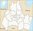
Tapjeong-dong was an administrative dong or a neighbourhood in the administrative subdivisions of the Gyeongju City, North Gyeongsang province, South Korea until January 2009. It consisted of four legal dong including Tap-dong, Sajeong-dong, Yul-dong, and Bae-dong.[1]
Tapjeong-dong | |
|---|---|
| Korean transcription(s) | |
| • Hangul | 탑정동 |
| • Hanja | 塔正洞 |
| • Revised Romanization | Tapjeong-dong |
| • McCune–Reischauer | T'apchong-tong |
| Country | South Korea |
| Region | Gyeongju |
| Government | |
| • Type | Gyeongju City |
| Area | |
| • Total | 19.68 km2 (7.60 sq mi) |
| Population (2008)[1] | |
| • Total | 5,630 |
| • Density | 290/km2 (740/sq mi) |
| Dialect | Gyeongsang dialect |
It was bordered by Jungang-dong and Hwangnam-dong on the east, Seondo-dong and Geoncheon-eup on the west, Naenam-myeon on the south and Seonggeon-dong on the north. Its 19.68 square kilometers were home to about 5,630 people. The Poseokjeong and Hongnyunsa temple sites were situated in the district.[1]
References
- "탑정동 Tapjeong-dong 塔正洞" (in Korean). Doosan Encyclopedia. Retrieved 2009-08-17.
This article is issued from Wikipedia. The text is licensed under Creative Commons - Attribution - Sharealike. Additional terms may apply for the media files.
