Tawang Chu
Tawang Chu is one of the two main rivers of the Tawang district of Arunachal Pradesh in India. The other major river Nyamjang Chu joins it just before Tawang Chu enters Bhutan. In Bhutan the river merges with various other rivers to emerge as the Manas River in the Indian plains to the south.
| Tawang Chu | |
|---|---|
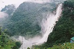 | |
 Confluence of Tawang Chu and Kulong Chu in Bhutan 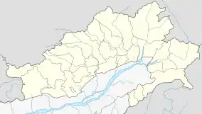 Tawang Chu (Arunachal Pradesh) | |
| Location | |
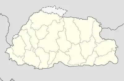
| Country | India; Bhutan |
| District | Tawang district (Arunachal Pradesh); Trashiyangtse and Trashigang |
| Physical characteristics | |
| Source | Nyukcharong Chu |
| • location | Cona County, Tibet |
| • coordinates | 28.090°N 92.059°E |
| 2nd source | Mago Chu |
| • location | Tawang district, Arunachal Pradesh |
| • coordinates | 27.855°N 92.283°E |
| • elevation | 3,360 m (11,020 ft) |
| Mouth | Kulong Chu |
• location | Duksum, Trashiyangtse District, Bhutan |
• coordinates | 27.434°N 91.574°E |
• elevation | 1,040 m (3,410 ft) |
| Basin features | |
| Progression | Drangme Chhu (Manas River) |
| River system | Brahmaputra |
Tawang Chu is formed by the joining of Nyukcharang Chu, which originates in Tibet and flows south, and Mago Chu, which originates within the Tawang district near Tulung La and the glaciers of Gori Chen. The river is called Tawang Chu after the confluence of the two rivers near Kyelatongbo at an elevation of 2,240 metres (7,350 ft). The combined river flows west in a narrow valley passing by the main population centres of the district.[1]
Tawang Chu enters Bhutan after passing the Dudunghar Circle. At Duksum, it merges with the Kulong Chu river from the north, after which the combined river is called Drangme Chhu (or Manas River).
References
- Tawang District Census Handbook, Part A (PDF), Directorate of Census Operations, Arunachal Pradesh, 2011, p. 3