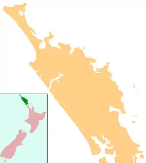
Te Hāpua
Te Hāpua is a community on the shores of the Parengarenga Harbour in Northland, New Zealand. The road to Te Hāpua leaves State Highway 1 at Waitiki Landing.[1]
Te Hāpua | |
|---|---|
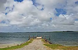 Te Hapua Wharf | |
 Te Hāpua | |
| Coordinates: 34°31′2″S 172°54′45″E | |
| Country | New Zealand |
| Region | Northland Region |
| District | Far North District |
Te Hāpua is the most northerly settlement in the North Island of New Zealand.
The New Zealand Ministry for Culture and Heritage gives a translation of "the lagoon" for Te Hāpua.[2]
Matiu Rata, Cabinet Minister in the Third Labour Government in the 1970s and founder of the Mana Motuhake party, was born in Te Hāpua in 1934.[3]
The 1975 Māori land march left Te Hāpua for Wellington on 14 September 1975 (Maori Language Day).[4]
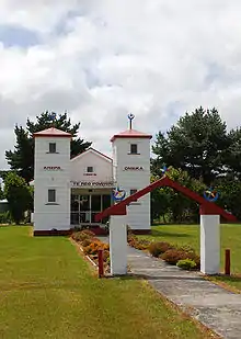
Te Hāpua's Te Reo Mihi Marae is a traditional meeting ground for Ngāti Kurī,[5] and includes Te Reo Mihi meeting house.[6]
Education
Te Hāpua School is a coeducational full primary (years 1–8) school with a decile rating of 1 and a roll of 34.[7] It is New Zealand's northernmost school.
Climate
| Climate data for Te Hāpua, Northland, 4 m | |||||||||||||
|---|---|---|---|---|---|---|---|---|---|---|---|---|---|
| Month | Jan | Feb | Mar | Apr | May | Jun | Jul | Aug | Sep | Oct | Nov | Dec | Year |
| Average high °C (°F) | 24.4 (75.9) |
24.9 (76.8) |
23.4 (74.1) |
21.4 (70.5) |
19.1 (66.4) |
17.1 (62.8) |
16.4 (61.5) |
16.5 (61.7) |
17.5 (63.5) |
18.7 (65.7) |
20.3 (68.5) |
22.5 (72.5) |
20.2 (68.4) |
| Daily mean °C (°F) | 20.3 (68.5) |
20.7 (69.3) |
19.4 (66.9) |
17.6 (63.7) |
15.4 (59.7) |
13.6 (56.5) |
12.9 (55.2) |
12.9 (55.2) |
13.9 (57.0) |
15.1 (59.2) |
16.7 (62.1) |
18.5 (65.3) |
16.4 (61.5) |
| Average low °C (°F) | 16.2 (61.2) |
16.5 (61.7) |
15.4 (59.7) |
13.9 (57.0) |
11.8 (53.2) |
10.1 (50.2) |
9.4 (48.9) |
9.3 (48.7) |
10.3 (50.5) |
11.6 (52.9) |
13.1 (55.6) |
14.6 (58.3) |
12.7 (54.9) |
| Average precipitation mm (inches) | 61.0 (2.40) |
65.0 (2.56) |
75.0 (2.95) |
95.0 (3.74) |
85.0 (3.35) |
115.0 (4.53) |
116.0 (4.57) |
107.0 (4.21) |
88.0 (3.46) |
66.0 (2.60) |
63.0 (2.48) |
62.0 (2.44) |
998.0 (39.29) |
| Source: Climate-data.org[8] | |||||||||||||
Notes
- Peter Dowling (editor) (2004). Reed New Zealand Atlas. Reed Books. pp. map 2. ISBN 0-7900-0952-8.CS1 maint: extra text: authors list (link)
- "1000 Māori place names". New Zealand Ministry for Culture and Heritage. 6 August 2019.
- David Barber (28 July 1997). "Obituary: Matiu Rata". The Independent.
- Metge, Joan (2004). Rautahi: The Maoris of New Zealand. p. 112. ISBN 0415330572.
- "Te Kāhui Māngai directory". tkm.govt.nz. Te Puni Kōkiri.
- "Māori Maps". maorimaps.com. Te Potiki National Trust.
- Education Counts: Te Hapua School
- "Climate Data for Cities Worldwide". openstreetmap.org. Retrieved 19 December 2019.