Tenmabayashi, Aomori
Tenmabayashi (天間林村, Tenmabayashi-mura) was a village located in Kamikita District in central Aomori Prefecture, Japan.
Tenmabayashi
天間林村 | |||||||||||||
|---|---|---|---|---|---|---|---|---|---|---|---|---|---|
Former municipality | |||||||||||||
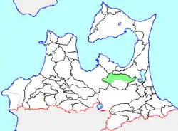 Location of Tenmabayashi in Aomori Prefecture | |||||||||||||
 Tenmabayashi Location in Japan | |||||||||||||
| Coordinates: 40°44′40.7″N 141°09′27.3″E | |||||||||||||
| Country | Japan | ||||||||||||
| Region | Tōhoku | ||||||||||||
| Prefecture | Aomori Prefecture | ||||||||||||
| District | Kamikita | ||||||||||||
| Merged | March 31, 2005 (now part of Shichinohe) | ||||||||||||
| Area | |||||||||||||
| • Total | 202.59 km2 (78.22 sq mi) | ||||||||||||
| Population (1 January 2005) | |||||||||||||
| • Total | 8,354 | ||||||||||||
| • Density | 41.23/km2 (106.8/sq mi) | ||||||||||||
| Time zone | UTC+09:00 (JST) | ||||||||||||
| |||||||||||||
History
The village of Tenmabayashi was founded in 1889 from the merger of seven small hamlets. On 31 March 2005, Tenmabayashi was merged into the neighboring and expanding town of Shichinohe, and thus no longer exists as an independent municipality.
At the time of its merger, the village had an estimated population of 8,354 and a density of 41.23 persons per km2. The total area was 202.59 km2.
Economy
Located in central Aomori Prefecture, the village of Tenmabayashi had an economy based on primarily on agriculture, with the village's principal crops including rice, garlic, and Japanese yam.
Transportation
Tenmabayashi was served by the highways National Route 4 and National Route 394, but had no railway service at the time of its merger with Shichinohe. It was formerly served by the Nanbu Jūkan Railway, a railbus service that stopped at Ushirotai, Tenmabayashi, Tsubo, Tsubogawa, Michinokami, Tenmabayashi, and Nakano stations in the village.[1]
References
- "青森朝日放送/ローカル線の旅/南部縦貫鉄道" [Asahi Broadcasting Aomori Local Travel Nanbu Jūkan Railway]. Retrieved 20 February 2020.
| Authority control |
|---|