Thorsborne Trail
The Thorsborne Trail is a popular long-distance bushwalking trail in Queensland. It runs along the east coast of Hinchinbrook Island National Park and is 32 kilometres (20 mi) long. It has been described as "iconic" by Australian Geographic [1] and one of the best multi-day hiking trails across Australia by The Guardian.[2] The track is accessed by private ferry services to/from Ramsay Bay (from Cardwell) or George Point (from Lucinda) – the schedule varies based on tides.
| Thorsborne Trail | |
|---|---|
| Length | 32 km (20 mi) |
| Location | Hinchinbrook Island, Queensland, Australia |
| Designation | Long-Distance Walk Trail |
| Use | Hiking |
| Hiking details | |
| Trail difficulty | Grade 4 |
| Season | After the wet season, in the cooler months. |
| Waymark | Yellow and orange trail marker |
| Hazards |
|
| Right of way | Pedestrian |
| Maintained by |
|
| Website | parks |
| Trail map | |
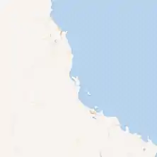
The Thorsborne Trail, shown in red, is a long-distance walk trail on Hinchinbrook Island from the north to south. | |
History
Margaret Thorsborne, and her husband Arthur Thorsborne, were Australian naturalist, conservationist and environmental activist who are commemorated by the Thorsborne Trail.[3]
Track sections
There are seven campsites located along the Thorsborne Track, which cater for bushwalkers (additional sites are avaiable for sea kayakers). The track is typically done over three or fours days, using two or three of the campsites. All campsites have composting toilets and either steel bins or hooks to hang food (to protect against native rats). Some campsites have picnic tables. All campsites have water, except for the southernmost site at George Point.
The Thorsborne Track can be walked north to south, or south to north (starting at the north is most common). The route is broken down into six sections:[4]
- Ramsay Bay to Nina Bay (Grade: difficult) - 4km ( 2.5hr hiking time)
- Nina Bay to Little Ramsay Bay (Grade: difficult) - 2.5km (2 hours)
- Little Ramsay Bay to Zoe Bay (Grade: difficult) - 10.5km (6 hours)
- Zoe Bay to Diamantina Creek (Grade: difficult) - 6.5km (4 hours)
- Diamantina Creek to Mulligan Falls camp (Grade: difficult) - 1km (30min)
- Mulligan Falls to George Point (Grade: difficult) - 7.5km (2.5 hours)
There are waterholes suitable for swimming at Zoe Falls (near Zoe Bay) and Mullign Falls.
Walkers are required to follow the seven "leave no trace" principles:[5]
Track maps
The Thorsborne Track is well sign-posted, and bushwalkers may find the Thorsborne Trail Map from the Queensland Government Department of Environment and Science is sufficient[6]
The topographical map covering the Thornsborne Trail is Hillock Point (1:50,000 topographical map).
References
- "Trekking tropical Hinchbrook Island's Thorsborne Trail". Australian Geographic. Retrieved 1 November 2020.
- "Boots on! Five of the best multi-day hiking trails across Australia". The Guardian. Retrieved 1 November 2020.
- "About the Thorsborne Trail". Queensland Government Department of Environment and Science. Retrieved 1 November 2020.
- "Thorsborne Trail track notes". Queensland Government Department of Environment and Science. Retrieved 1 November 2020.
- "7 Principles of Leave No Trace". Leave No Trace Australia. 2011. Retrieved 12 October 2018.
- "Thorsborne Trail Map" (PDF). Queensland Government Department of Environment and Science. Retrieved 1 November 2020.