Thung Wa District
Thung Wa (Thai: ทุ่งหว้า, pronounced [tʰûŋ wâː]) is a district (amphoe) of Satun Province, southern Thailand.
Thung Wa
ทุ่งหว้า | |
|---|---|
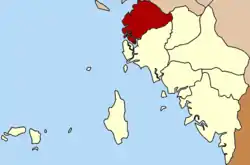 District location in Satun Province | |
| Coordinates: 7°6′33″N 99°45′21″E | |
| Country | Thailand |
| Province | Satun |
| Seat | Thung Wa |
| Area | |
| • Total | 452.33 km2 (174.65 sq mi) |
| Population (2005) | |
| • Total | 20,683 |
| • Density | 45.75/km2 (118.5/sq mi) |
| Time zone | UTC+7 (ICT) |
| Postal code | 91120 |
| Geocode | 9106 |
History
Thung Wa was one of the three original districts of Satun. The main industry at the beginning of the 20th century was pepper production. When the production declined in the 1910s, many natives moved to the farmland of La-ngu minor district, while foreign merchants left the area completely. In 1930 the government adjusted the administrative structure to the changed economic situation, making La-ngu a district and reducing Thung Wa to a minor district (king amphoe) under La-ngu.[1] In 1973 Thung Wa regained district status.[2]
Geography
Neighboring districts are (from the north clockwise) Palian of Trang Province. Manang and La-ngu of Satun Province. To the west is the Andaman Sea.
A big part of the shoreline of the district as well as several islands are part of the Mu Ko Phetra National Park.
Ethnic groups
The Maniq people, from the Negrito ethnic group which immigrated from the northern states of Malaysia, inhabit tambon Thung Wa of Thung Wa District.[3]
Administration
The district is divided into five sub-districts (tambon), which are further subdivided into 35 villages (muban). Thung Wa is a township (thesaban tambon) which covers parts of tambon Thung Wa. There are a further five tambon administrative organizations (TAO).
| No. | Name | Thai name | Villages | Pop. | |
|---|---|---|---|---|---|
| 1. | Thung Wa | ทุ่งหว้า | 10 | 6,242 | |
| 2. | Na Thon | นาทอน | 9 | 6,316 | |
| 3. | Khon Klan | ขอนคลาน | 4 | 2,305 | |
| 4. | Thung Bulang | ทุ่งบุหลัง | 5 | 2,174 | |
| 5. | Pakae Bohin | ป่าแก่บ่อหิน | 7 | 3,646 |
References
- ประกาศกระทรวงมหาดไทย เรื่อง ย้ายสับเปลี่ยนที่ว่าการอำเภอ (PDF). Royal Gazette (in Thai). 47 (0 ก): 193. 1930-09-14.
- พระราชกฤษฎีกาตั้งอำเภอเขาพนม อำเภอสนามชัยเขต อำเภอแม่อาย อำเภอขามสะแกแสง อำเภอเก้าเลี้ยว อำเภอโพธิ์ประทับช้าง อำเภอหนองพอก อำเภอละอุ่น อำเภอทุ่งหว้า และอำเภอศรีธาตุ พ.ศ. ๒๕๑๖ (PDF). Royal Gazette (in Thai). 90 (75 ก special): 32–36. June 28, 1973.
- Laohong, King-Oua (23 December 2017). "Sea gypsies want a chance to settle down". Bangkok Post. Retrieved 23 December 2017.