Tillamook River
The Tillamook River is a stream, about 17 miles (27 km) long, near the coast of northwest Oregon in the United States. It drains an oceanside valley in the foothills of the Northern Oregon Coast Range west of Portland and empties into the Pacific Ocean via Tillamook Bay.[3] It is one of five rivers—the Tillamook, the Trask, the Wilson, the Kilchis, and the Miami—that flow into the bay.[4]
| Tillamook River | |
|---|---|
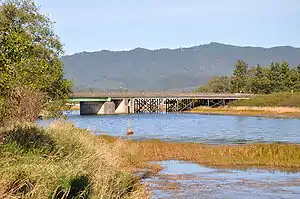 Lower Tillamook River at Oregon Route 131 bridge | |
 Location of the mouth of the Tillamook River in Oregon | |
| Location | |
| Country | United States |
| State | Oregon |
| County | Tillamook County |
| Physical characteristics | |
| Source | Northern Oregon Coast Range |
| • location | low coastal hills southwest of Tillamook |
| • coordinates | 45°21′50″N 123°54′58″W[1] |
| • elevation | 744 ft (227 m)[2] |
| Mouth | Tillamook Bay |
• location | Oregon |
• coordinates | 45°29′15″N 123°54′06″W[1] |
• elevation | 0 ft (0 m)[1] |
| Length | 17 mi (27 km)[3] |
| Basin size | 61 sq mi (160 km2)[3] |
Rising in southern Tillamook County about 4 miles (6.4 km) east of Cape Lookout, it flows initially east, then generally north, through a long broadening farming valley, passing west of Tillamook and entering the south end of Tillamook Bay. For its lower 1 mile (1.6 km), it shares a channel with the Trask River.[3][5]
Although much of the upper watershed of about 61 square miles (160 km2) is forested, much of the lower valley consists of drained pasture land.[3] Home of the Tillamook County Creamery Association, the county has been called "a natural cow pasture" by Sunset Magazine".[6]
Tributaries
Named tributaries from source to mouth are Mills, Munson, Joe, Simmons, Fawcett, Killam, and Bewley creeks. Then come Sutton, Beaver, Anderson, Fagan, Esther, Tomlinson, Memaloose, and Dick creeks.[7]
See also
References
- "Tillamook River". Geographic Names Information System (GNIS). United States Geological Survey. November 28, 1980. Retrieved November 11, 2009.
- Source elevation derived from Google Earth search using GNIS source coordinates.
- "Tillamook River Basin". Tillamook Bay Watershed Council. Archived from the original on July 24, 2011. Retrieved November 11, 2009.
- "Five Rivers". Tillamook Bay Watershed Council. Archived from the original on August 7, 2008. Retrieved November 14, 2009.
- Oregon Atlas and Gazetteer (Map) (2008 ed.). DeLorme Mapping. § 26. ISBN 978-0-89933-347-2.
- "Sunset" (Google books online reprint). 31. Passenger Department, Southern Pacific Co. 1913: 572. Cite journal requires
|journal=(help) - "United States Topographic Map". United States Geological Survey. Retrieved January 30, 2016 – via ACME Mapper.