Tin Zaouatine
Tin Zaouatine (Arabic: تين زاوتين) (also spelled Tinzouatine) is a commune, coextensive with the district of Tin Zaouatine, in In Guezzam Province, Algeria. According to the 2008 census it has a population of 4,157,[1] up from 2,314 in 1998,[2] with an annual growth rate of 6.2%, the highest rate in the province.[1] Its postal code is 11150 and its municipal code is 1107.
Tin Zaouatine
تين زاوتين | |
|---|---|
Town and commune | |
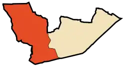 Location of Tin Zaouatine commune within In Guezzam Province | |
 Tin Zaouatine Location of Tin Zaouatine within Algeria | |
| Coordinates: 19°57′12″N 2°58′0″E | |
| Country | |
| Province | In Guezzam |
| District | Tin Zaouatine (coextensive) |
| Government | |
| • PMA Seats | 7 |
| Area | |
| • Total | 41,313 km2 (15,951 sq mi) |
| Elevation | 630 m (2,070 ft) |
| Population (2008)[1] | |
| • Total | 4,157 |
| • Density | 0.10/km2 (0.26/sq mi) |
| Time zone | UTC+01 (CET) |
| Postal code | 11150 |
| ONS code | 1107 |
Geography
Tin Zaouatine lies at an elevation of 630 metres (2,070 ft) in the far north-western part of the Adrar des Ifoghas mountain range, which lies mostly in Mali. A series of long, rocky ridges run from north-south to the west of the town.
Climate
Tin Zaouatine has a hot desert climate (Köppen climate classification BWh), with long, extremely hot summers and short, very warm winters. Despite an extremely dry climate, some occasional rainfall occur during the months of August and September due to the influence of the far northern edge of the West African Monsoon, unlike most of the Algerian Desert. Averages high temperatures soar during the height of the long summer season, with daytime highs always over 40 °C (104 °F) during nearly 4 months and even above 45 °C (113 °F), despite the high elevation of the site.
Education
1.9% of the population has a tertiary education, and another 3.6% has completed secondary education.[3] The overall literacy rate is 47.2%, and is 58.1% among males and 35.3% among females; all three figures are the second lowest in the province (after In Guezzam).[4]
Localities
The commune is composed of four localities:[5]
- Tinzaouatene
- Hassi In Tafouk (eastern part)
- Oued Tassamak (western part)
- Taouandart
References
- "Population: Wilaya de Tamanrasset" (PDF) (in French). Office National des Statistiques Algérie. Retrieved 30 May 2013.
- "Algeria Communes". Statoids. Retrieved 8 March 2013.
- "Structure relative de la population résidente des ménages ordinaires et collectifs âgée de 6 ans et plus selon le niveau d'instruction et la commune de résidence" (PDF) (in French). Office National des Statistiques Algérie. Retrieved 30 May 2013.
- "Taux d'analphabétisme et taux d'alphabétisation de la population âgée de 15 ans et plus, selon le sexe et la commune de résidence " (PDF) (in French). Office National des Statistiques Algérie. Retrieved 30 May 2013.
- "Décret n° 84-365, fixant la composition, la consistance et les limites territoriale des communes. Wilaya de Tamanghasset" (PDF) (in French). Journal officiel de la République Algérienne. 19 December 1984. p. 1496. Archived from the original (PDF) on 2 March 2013 or before. Retrieved 2 March 2013. Check date values in:
|archivedate=(help)
Places adjacent to Tin Zaouatine | ||||||||||
|---|---|---|---|---|---|---|---|---|---|---|
| ||||||||||