Tinogasta
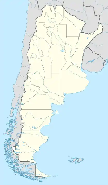
Tinogasta (Spanish pronunciation: [tinoˈɣasta]) is a city in the west of the province of Catamarca, Argentina, on the right-hand shore of the Abaucán River, about 280 km from the provincial capital San Fernando del Valle de Catamarca. It had about 11,500 inhabitants at the 2010 census [INDEC]. It is the head town of the department of the same name. The name of the city comes from the Kakana words tino ("meeting") and gasta ("town").
Tinogasta | |
|---|---|
 Tinogasta Location of Tinogasta in Argentina | |
| Coordinates: 28°4′S 67°34′W | |
| Country | |
| Province | |
| Department | Tinogasta |
| Government | |
| • Mayor | Hugo Ávila (Justicialist Party) |
| Elevation | 1,500 m (4,900 ft) |
| Population (2010 census) | |
| • Total | 11,485 |
| Time zone | UTC-3 (ART) |
| CPA base | K5340 |
| Dialing code | +54 3837 |
Tinogasta is a tourist site. It has access to the mountains for adventure tourism, hot springs, and archaeological museums. The basis of the local economy is agriculture, focused on vine.
Climate
The Köppen Climate Classification subtype for this climate is "BSk". (Tropical and Subtropical Steppe Climate).[1]
| Climate data for Tinogasta (1981–2010, extremes 1961–2016) | |||||||||||||
|---|---|---|---|---|---|---|---|---|---|---|---|---|---|
| Month | Jan | Feb | Mar | Apr | May | Jun | Jul | Aug | Sep | Oct | Nov | Dec | Year |
| Record high °C (°F) | 44.0 (111.2) |
44.8 (112.6) |
40.5 (104.9) |
39.2 (102.6) |
37.6 (99.7) |
40.0 (104.0) |
39.2 (102.6) |
38.4 (101.1) |
40.0 (104.0) |
41.5 (106.7) |
42.5 (108.5) |
43.5 (110.3) |
44.8 (112.6) |
| Average high °C (°F) | 33.5 (92.3) |
32.4 (90.3) |
30.9 (87.6) |
26.9 (80.4) |
22.6 (72.7) |
19.9 (67.8) |
19.8 (67.6) |
23.1 (73.6) |
25.7 (78.3) |
30.2 (86.4) |
32.5 (90.5) |
33.9 (93.0) |
27.6 (81.7) |
| Daily mean °C (°F) | 25.6 (78.1) |
24.4 (75.9) |
22.9 (73.2) |
18.3 (64.9) |
13.5 (56.3) |
10.3 (50.5) |
10.0 (50.0) |
13.2 (55.8) |
16.2 (61.2) |
21.3 (70.3) |
23.9 (75.0) |
25.9 (78.6) |
18.8 (65.8) |
| Average low °C (°F) | 18.7 (65.7) |
17.3 (63.1) |
16.0 (60.8) |
10.1 (50.2) |
4.5 (40.1) |
0.8 (33.4) |
0.2 (32.4) |
2.5 (36.5) |
5.9 (42.6) |
11.2 (52.2) |
15.1 (59.2) |
17.9 (64.2) |
10.0 (50.0) |
| Record low °C (°F) | 6.1 (43.0) |
4.4 (39.9) |
2.2 (36.0) |
−2.6 (27.3) |
−6.5 (20.3) |
−9.7 (14.5) |
−10.6 (12.9) |
−9.9 (14.2) |
−6.3 (20.7) |
0.0 (32.0) |
2.4 (36.3) |
5.3 (41.5) |
−10.6 (12.9) |
| Average precipitation mm (inches) | 63 (2.5) |
46 (1.8) |
21 (0.8) |
13 (0.5) |
1 (0.0) |
1 (0.0) |
2 (0.1) |
2 (0.1) |
1 (0.0) |
4 (0.2) |
5 (0.2) |
24 (0.9) |
183 (7.2) |
| Average precipitation days | 9 | 6 | 5 | 2 | 0.4 | 0.7 | 0.4 | 0.9 | 0.8 | 1 | 2 | 5 | 33.2 |
| Average relative humidity (%) | 56.9 | 58.3 | 60.8 | 61.6 | 63.2 | 60.0 | 55.4 | 47.7 | 47.3 | 46.5 | 48.6 | 51.6 | 54.8 |
| Source: Servicio Meteorológico Nacional (precipitation 1971–1980)[2][3][4] | |||||||||||||
External links
- Municipal information: Municipal Affairs Federal Institute (IFAM), Municipal Affairs Secretariat, Ministry of Interior, Argentina. (in Spanish)
- Departamento Tinogasta
- WelcomeArgentina.com
References
- Climate Summary for Tinogasta
- "Datos Estadísticos (Período 1971-1980)" (in Spanish). National Meteorological Service of Argentina. Retrieved August 21, 2012.
- "Estadísticas Climatológicas Normales - período 1981-2010" (in Spanish). Servicio Meteorológico Nacional. Retrieved January 20, 2018.
- "Clima en la Argentina: Guia Climática por Tinogasta". Caracterización: Estadísticas de largo plazo (in Spanish). Servicio Meteorológico Nacional. Retrieved 4 October 2017.
This article is issued from Wikipedia. The text is licensed under Creative Commons - Attribution - Sharealike. Additional terms may apply for the media files.