Tomahawk, Tasmania
Tomahawk is a rural locality in the local government area (LGA) of Dorset in the North-east LGA region of Tasmania. The locality is about 65 kilometres (40 mi) north-east of the town of Scottsdale. The 2016 census provides a population of 48 for the state suburb of Tomahawk.[1]
| Tomahawk Tasmania | |||||||||||||||
|---|---|---|---|---|---|---|---|---|---|---|---|---|---|---|---|
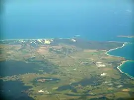 Tomahawk is just below the lower point on the right | |||||||||||||||
 Tomahawk | |||||||||||||||
| Coordinates | 40°52′S 147°46′E | ||||||||||||||
| Population | 48 (2016 census)[1] | ||||||||||||||
| Postcode(s) | 7262 | ||||||||||||||
| Location |
| ||||||||||||||
| LGA(s) | Dorset Council | ||||||||||||||
| Region | North-east | ||||||||||||||
| State electorate(s) | Bass | ||||||||||||||
| Federal Division(s) | Bass | ||||||||||||||
| |||||||||||||||
The town has a caravan park with a small shop. There is a boat ramp[2] and the area is known for its fishing.[3][4]
History
Tomahawk was gazetted as a locality in 1965. Previous names were “Portland” (from 1845) and “Du Cane” (after Governor Charles Du Cane, until 1934)[5]
Geography
The waters of Ringarooma Bay, an inlet of Bass Strait, form most of the northern boundary. The Tomahawk River forms the south-western boundary before flowing through to the north.[6]
Road infrastructure
Route B82 (Waterhouse Road) passes through from west to east. Route C836 (Tomahawk Road) starts at an intersection with B82 and runs north-west to the village, where it ends. Route C840 (Banca Road) starts at an intersection with B82 and runs south until it exits.[5][7]
References
- "2016 Census Quick Stats Tomahawk (Tas.)". quickstats.censusdata.abs.gov.au. Australian Bureau of Statistics. 23 October 2017. Retrieved 13 September 2020.
- Digital, Ionata. "Tomahawk Boat Ramp". MAST. Retrieved 15 June 2020.
- "Tasmanian Fishing and Boating News". tasfish.com. Retrieved 15 June 2020.
- "Fishing around the North East Coast and Flinders Island | Department of Primary Industries, Parks, Water and Environment, Tasmania". dpipwe.tas.gov.au. Retrieved 15 June 2020.
- "Placenames Tasmania – Tomahawk". Placenames Tasmania. Retrieved 13 September 2020.
Select “Search”, enter 5649H, click “Search”, select row, map is displayed, click “Details”
- Google (13 September 2020). "Tomahawk, Tasmania" (Map). Google Maps. Google. Retrieved 13 September 2020.
- "Tasmanian Road Route Codes" (PDF). Department of Primary Industries, Parks, Water & Environment. May 2017. Archived from the original (PDF) on 1 August 2017. Retrieved 13 September 2020.