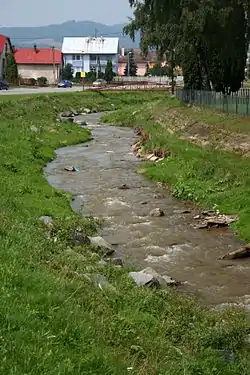
Topľa
Topľa (Hungarian: Tapoly, German: Töpl) is a river in eastern Slovakia and right tributary of the Ondava. It is 129.8 km long and its basin covers an area of 1,544 km2 (596 sq mi).[1]:22 It rises in the Čergov mountains, flows through Ondava Highlands, Beskidian Piedmont, Eastern Slovak Hills and Eastern Slovak Flat and flows into the Ondava in the cadastral area of Parchovany. It flows through the towns of Bardejov, Giraltovce, Hanušovce nad Topľou and Vranov nad Topľou.
| Topľa | |
|---|---|
 | |
| Location | |
| Country | Slovakia |
| Physical characteristics | |
| Source | |
| • location | Čergov mountains |
| Mouth | |
• location | Ondava at Parchovany |
• coordinates | 48.7435°N 21.7578°E |
| Length | 129.8 km (80.7 mi) |
| Basin size | 1,544 km2 (596 sq mi) |
| Basin features | |
| Progression | Ondava→ Bodrog→ Tisza→ Danube→ Black Sea |
Etymology
The name come from Slavic (Slovak) Teplá: warm (river). The name was adopted by Hungarians and then it was adopted back (in the modified form) by Slovaks, probably in the 13th century.[2]
References
- Analysis of the Tisza River Basin 2007, IPCDR
- Varsik, Branislav (1990). Slovanské (slovenské) názvy riek na Slovensku a ich prevzatie Maďarmi v 10.-12. storočí (in Slovak). Bratislava: Slovenská akadémia vied. p. 146. ISBN 80-224-0163-3.
This article is issued from Wikipedia. The text is licensed under Creative Commons - Attribution - Sharealike. Additional terms may apply for the media files.