Troughton Island
Troughton Island is an island located off the Kimberley coast of Western Australia, about 80 kilometres (50 mi) north-west of Kalumburu and 45 kilometres (28 mi) north-west of the Mungalalu Truscott Airbase. Troughton Island is used as a helicopter base for the Timor Sea oil rigs approximately 500 kilometres (300 mi) west of Darwin.
| Troughton Island Western Australia | |||||||||
|---|---|---|---|---|---|---|---|---|---|
 Troughton Island | |||||||||
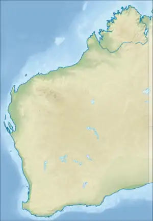
| Coordinates | 13°45′S 126°08′E | ||||||||
| Elevation | 27 m (89 ft) | ||||||||
| Area | 0.93 km2 (0.4 sq mi) | ||||||||
| Time zone | AWST (UTC+8) | ||||||||
| Location |
| ||||||||
| State electorate(s) | Kimberley | ||||||||
| Federal Division(s) | Durack | ||||||||
| |||||||||
History
The island was found and named in 1819 by Phillip Parker King. The Sir Graham Moore Islands Airline company ShoreAir Pty Ltd has opened and operated an airport on the island since the 1960s.[1] It is a reference point for hydrographic surveys.[2]
Climate
Under the Köppen climate classification, Troughton Island has a hot semi-arid climate (BSh); despite being in the tropics, it does not get enough annual rainfall to be classified as a Tropical savanna climate.
| Climate data for Troughton Island | |||||||||||||
|---|---|---|---|---|---|---|---|---|---|---|---|---|---|
| Month | Jan | Feb | Mar | Apr | May | Jun | Jul | Aug | Sep | Oct | Nov | Dec | Year |
| Record high °C (°F) | 36.3 (97.3) |
35.2 (95.4) |
35.4 (95.7) |
36.3 (97.3) |
35.4 (95.7) |
33.9 (93.0) |
32.0 (89.6) |
35.6 (96.1) |
34.4 (93.9) |
35.6 (96.1) |
35.6 (96.1) |
36.4 (97.5) |
36.4 (97.5) |
| Average high °C (°F) | 31.8 (89.2) |
31.6 (88.9) |
32.1 (89.8) |
32.8 (91.0) |
31.2 (88.2) |
29.1 (84.4) |
28.3 (82.9) |
28.9 (84.0) |
30.4 (86.7) |
31.9 (89.4) |
33.0 (91.4) |
33.0 (91.4) |
31.2 (88.2) |
| Average low °C (°F) | 26.4 (79.5) |
26.3 (79.3) |
26.6 (79.9) |
27.0 (80.6) |
25.4 (77.7) |
23.4 (74.1) |
22.3 (72.1) |
22.6 (72.7) |
24.6 (76.3) |
26.4 (79.5) |
27.6 (81.7) |
27.4 (81.3) |
25.5 (77.9) |
| Record low °C (°F) | 20.0 (68.0) |
20.0 (68.0) |
21.1 (70.0) |
22.3 (72.1) |
17.2 (63.0) |
15.5 (59.9) |
15.0 (59.0) |
18.2 (64.8) |
20.5 (68.9) |
18.4 (65.1) |
22.2 (72.0) |
20.6 (69.1) |
15.0 (59.0) |
| Average precipitation mm (inches) | 276.0 (10.87) |
188.1 (7.41) |
130.2 (5.13) |
31.8 (1.25) |
38.4 (1.51) |
5.9 (0.23) |
2.6 (0.10) |
0.5 (0.02) |
0.3 (0.01) |
2.7 (0.11) |
11.1 (0.44) |
124.8 (4.91) |
812.0 (31.97) |
| Source: Bureau of Meteorology[3] | |||||||||||||
References
- "LIFE ON A TROPICAL ISLAND". The Australian Women's Weekly. 13 December 1967. p. 85. Retrieved 16 January 2016 – via National Library of Australia.
- Australia. Royal Australian Navy. Hydrographic Service (1969), Lesueur Island to Troughton Island, Australia – north-west coast, Western Australia (Provisional [ed.] ed.), Australian Hydrographic Service, retrieved 16 January 2016
- "Climate statistics for Australian locations: Troughton Island". Bureau of Meteorology. Retrieved 19 January 2021.