Tuktoyaktuk
Tuktoyaktuk English: /tʌktəˈjæktʌk/, or Tuktuyaaqtuuq IPA: [təktujaːqtuːq] (Inuvialuktun: it looks like a caribou),[4] is an Inuvialuit hamlet located in the Inuvik Region of the Northwest Territories, Canada, at the northern terminus of the Inuvik–Tuktoyaktuk Highway.[8][9] Tuktoyaktuk, often called Tuk is one of six Inuvialuit communities in the Inuvialuit Settlement Region. Tuktoyaktuk is commonly referred to simply by its first syllable, Tuk /tʌk/.[10] The settlement lies north of the Arctic Circle on the shores of the Arctic Ocean, and is the only community in Canada on the Arctic Ocean that is connected to the rest of Canada by road.[8] Formerly known as Port Brabant, the community was renamed in 1950 and was the first place in Canada to revert to the traditional Indigenous name.[11]
Tuktoyaktuk
Tuktuyaaqtuuq formerly Port Brabant | |
|---|---|
Hamlet | |
 North Warning System radar station at Tuktoyaktuk | |
| Nickname(s): Tuk | |
 Tuktoyaktuk  Tuktoyaktuk | |
| Coordinates: 69°26′34″N 133°01′52″W | |
| Country | Canada |
| Territory | Northwest Territories |
| Region | Inuvik Region |
| Electoral district | Nunakput |
| Census division | Region 1 |
| Settled | 1928 |
| Incorporated | 1 April 1970 |
| Government | |
| • Mayor | Erwin Elias |
| • Senior Administrative Officer | Shawn Stuckey |
| • MLA | Jackie Jacobson |
| • Member of Parliament | Michael McLeod |
| • Senator | Margaret Dawn Anderson |
| Area | |
| • Land | 14.00 km2 (5.41 sq mi) |
| Elevation | 5 m (15 ft) |
| Population (2016)[1] | |
| • Total | 898 |
| • Density | 64.1/km2 (166/sq mi) |
| Time zone | UTC−07:00 (MST) |
| • Summer (DST) | UTC−06:00 (MDT) |
| Canadian Postal code | X0E 1C0 |
| Area code(s) | 867 |
| Telephone exchange | 977 |
| – Living cost | 162.5A |
| – Food price index | 162.0B |
| Website | http://www.tuktoyaktuk.ca |
| Sources: Department of Municipal and Community Affairs,[3] Prince of Wales Northern Heritage Centre,[4] Canada Flight Supplement[2] Northwestel[5] Natural Resources Canada[6] ^A 2013 figure based on Edmonton = 100[7] ^B 2015 figure based on Yellowknife = 100[7] | |
History
Tuktoyaktuk is the anglicized form of the native Inuvialuit place-name, meaning "resembling a caribou". According to legend, a woman looked on as some caribou, common at the site, waded into the water and turned into stone, or became petrified. Today, reefs resembling these petrified caribou are said to be visible at low tide along the shore of the town.[12]
No formal archaeological sites exist today, but the settlement has been used by the native Inuvialuit for centuries as a place to harvest caribou and beluga whales. In addition, Tuktoyaktuk's natural harbour was historically used as a means to transport supplies to other Inuvialuit settlements.
Between 1890 and 1910, a sizeable number of Tuktoyaktuk's native families were wiped out in flu epidemics brought in by American whalers. In subsequent years, the Dene people, as well as residents of Herschel Island, settled here. By 1937, the Hudson's Bay Company had established a trading post. On 9 September 1944, a serious fall windstorm blew through the community and severely damaged several buildings and schooners docked at the harbour, also killing 11 people en route back from a reindeer station on the Anderson River on the schooner Cally.[13]
Radar domes were installed beginning in the 1950s as part of the Distant Early Warning Line, to monitor air traffic and detect possible Soviet intrusions during the Cold War. The settlement's location (and harbour) made Tuk important in resupplying the civilian contractors and Air Force personnel along the DEW Line. In 1947, Tuktoyaktuk became the site of one of the first government day schools, designed to civilize Inuit youth into 'mainstream' Canadian culture.[14][15]
The community of Tuktoyaktuk eventually became a base for the oil and natural gas exploration of the Beaufort Sea. Large industrial buildings remain from the busy period following the Organization of Arab Petroleum Exporting Countries 1973 oil embargo and 1979 summertime fuel shortage. This brought many more outsiders into the region.
In late 2010, the Canadian Environmental Assessment Agency announced that an environmental study would be undertaken on a proposed all-weather road between Inuvik and Tuktoyaktuk.[16] Work on the Inuvik–Tuktoyaktuk Highway officially started on 8 January 2014, and the highway was officially opened on 15 November 2017.[8]
Geography
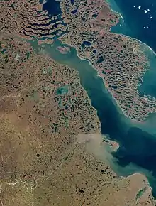
Tuktoyaktuk is set on Kugmallit Bay, near the Mackenzie River Delta, and is located on the Arctic tree line.
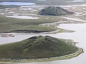
Tuktoyaktuk is the gateway for exploring Pingo National Landmark, an area protecting eight nearby pingos in a region which contains approximately 1,350 of these Arctic ice-dome hills. The landmark comprises an area roughly 16 km2 (6.2 sq mi), just a few miles west of the community, and includes Canada's highest (the world's second-highest) pingo, at 49 m (161 ft).[17]
Employment
Many locals still hunt, fish, and trap. Locals rely on caribou in the autumn, ducks and geese in both spring and autumn, and fishing year-round. Other activities include collecting driftwood, berrypicking and reindeer herding. Most wages today, however, come from tourism and transportation. Marine Transportation Services (MTS) is a major employer in this region. In addition, the oil and gas industry continues to employ explorers and other workers.
Demographics

At the 2016 Census, the Hamlet of Tuktoyaktuk had a population of 898, up 5.2% from the 2011 census total of 854. There are 283 private dwellings, and a population density of 64.1 inhabitants per square kilometre (166/sq mi).The average annual personal income in 2015 was $21,984 Canadian and the average family income was $55,424. Local languages are Inuinnaqtun (Inuvialuktun) and English with a few North Slavey and Tłı̨chǫ (Dogrib) speakers. Tuktoyaktuk is predominately Indigenous (90.8%) with Inuit (Inuvialuit) making up 88.0%, 9.2% non-Aboriginal, 1.7% First Nations and 1.1% giving multiple Indigenous backgrounds.[1]
In 2017 the Government of the Northwest Territories reported that the population was 1,026 with an average yearly growth rate of 1.3 from 2007.[7]
|
| ||||||||||||||||||||||||||||||||||||||||||||||||||||||||||||||||||||||||
| Sources: NWT Bureau of Statistics (2001–2017)[18] | |||||||||||||||||||||||||||||||||||||||||||||||||||||||||||||||||||||||||
Climate
Tuktoyaktuk displays a subarctic climate (Dfc), just short of a polar (tundra) climate, as the July mean temperature is barely above 10 °C (50 °F). Since the Arctic Ocean freezes over for much of the year, the maritime influence is minimized, resulting in cold winters and a strong seasonal lag in spring. This results in April being much colder than October and May much colder than September. March is also colder than December, and is the only month yet to record a temperature above freezing at any point. Due to the dominance of cold air, Tuktoyaktuk has a lower precipitation rate than many desert climates. In spite of this, the cold temperatures mean it receives more than a metre of snow a year on average. Thanks to its landmass link many thousands of kilometres to the south, temperatures way above average can occur in summer in spite of the cold surrounding waters. As of 2018, this is still yet to result in any high above 29.4 °C (84.9 °F). Tuktoyaktuk's climate stands in stark contrast to those of Northern Norway on similar latitudes, but is in many ways less extreme in comparison with Eastern Canada on higher latitudes, where summers are colder.
| Climate data for Tuktoyaktuk/James Gruben Airport | |||||||||||||
|---|---|---|---|---|---|---|---|---|---|---|---|---|---|
| Month | Jan | Feb | Mar | Apr | May | Jun | Jul | Aug | Sep | Oct | Nov | Dec | Year |
| Record high humidex | 3.8 | 0.7 | −0.5 | 6.4 | 23.3 | 29.6 | 34.1 | 32.9 | 21.6 | 16.4 | 2.1 | 0.6 | 34.1 |
| Record high °C (°F) | 0.6 (33.1) |
0.7 (33.3) |
−0.5 (31.1) |
4.8 (40.6) |
20.9 (69.6) |
28.2 (82.8) |
29.4 (84.9) |
27.6 (81.7) |
20.9 (69.6) |
17.4 (63.3) |
2.2 (36.0) |
0.8 (33.4) |
29.4 (84.9) |
| Average high °C (°F) | −23.0 (−9.4) |
−22.4 (−8.3) |
−21.1 (−6.0) |
−11.3 (11.7) |
−1.1 (30.0) |
11.0 (51.8) |
15.1 (59.2) |
12.3 (54.1) |
5.8 (42.4) |
−4.7 (23.5) |
−17.3 (0.9) |
−20.1 (−4.2) |
−6.4 (20.5) |
| Daily mean °C (°F) | −26.6 (−15.9) |
−26.4 (−15.5) |
−25.1 (−13.2) |
−15.7 (3.7) |
−4.7 (23.5) |
6.4 (43.5) |
11.0 (51.8) |
8.9 (48.0) |
3.3 (37.9) |
−7.4 (18.7) |
−20.7 (−5.3) |
−23.8 (−10.8) |
−10.1 (13.8) |
| Average low °C (°F) | −30.4 (−22.7) |
−30.6 (−23.1) |
−29.2 (−20.6) |
−20.1 (−4.2) |
−8.2 (17.2) |
1.7 (35.1) |
6.9 (44.4) |
5.4 (41.7) |
0.7 (33.3) |
−9.9 (14.2) |
−24.0 (−11.2) |
−27.5 (−17.5) |
−13.8 (7.2) |
| Record low °C (°F) | −48.9 (−56.0) |
−46.6 (−51.9) |
−45.5 (−49.9) |
−42.8 (−45.0) |
−28.9 (−20.0) |
−8.9 (16.0) |
−1.7 (28.9) |
−2.5 (27.5) |
−12.8 (9.0) |
−28.5 (−19.3) |
−40.1 (−40.2) |
−46.7 (−52.1) |
−48.9 (−56.0) |
| Record low wind chill | −70.8 | −61.2 | −58.1 | −55.5 | −40.1 | −16.5 | −6.5 | −8.9 | −20.9 | −46.9 | −50.8 | −58.9 | −70.8 |
| Average precipitation mm (inches) | 10.5 (0.41) |
8.9 (0.35) |
7.2 (0.28) |
8.3 (0.33) |
6.8 (0.27) |
11.0 (0.43) |
22.3 (0.88) |
25.7 (1.01) |
23.3 (0.92) |
18.4 (0.72) |
9.6 (0.38) |
8.7 (0.34) |
160.7 (6.33) |
| Average rainfall mm (inches) | 0.0 (0.0) |
0.0 (0.0) |
0.0 (0.0) |
0.0 (0.0) |
1.4 (0.06) |
9.7 (0.38) |
22.2 (0.87) |
24.4 (0.96) |
15.5 (0.61) |
1.3 (0.05) |
0.0 (0.0) |
0.3 (0.01) |
74.9 (2.95) |
| Average snowfall cm (inches) | 13.4 (5.3) |
10.2 (4.0) |
9.0 (3.5) |
9.4 (3.7) |
6.2 (2.4) |
1.3 (0.5) |
0.1 (0.0) |
1.2 (0.5) |
8.9 (3.5) |
20.1 (7.9) |
12.1 (4.8) |
11.2 (4.4) |
103.1 (40.6) |
| Average precipitation days (≥ 0.2 mm) | 8.4 | 7.3 | 7.1 | 5.5 | 4.9 | 5.1 | 10.1 | 12.7 | 12.7 | 13.3 | 9.6 | 8.9 | 105.6 |
| Average rainy days (≥ 0.2 mm) | 0.1 | 0.1 | 0.0 | 0.0 | 1.1 | 4.3 | 10.0 | 12.4 | 9.0 | 1.1 | 0.0 | 0.1 | 38.1 |
| Average snowy days (≥ 0.2 cm) | 8.6 | 7.4 | 7.5 | 5.8 | 4.2 | 1.0 | 0.1 | 0.9 | 5.0 | 13.0 | 9.9 | 9.1 | 72.5 |
| Average relative humidity (%) | 74.2 | 73.0 | 73.9 | 81.5 | 81.5 | 68.4 | 68.7 | 73.9 | 77.9 | 85.7 | 79.5 | 76.1 | 76.2 |
| Source: Environment Canada Canadian Climate Normals 1981–2010[19] | |||||||||||||
Transportation
Tuktoyaktuk/James Gruben Airport links Tuktoyaktuk to Inuvik. This 30-minute flight costs a few hundred dollars per passenger. Formerly in winter time, the Tuktoyaktuk Winter Road provided road access to Inuvik. The $300-million Inuvik–Tuktoyaktuk Highway opened in November 2017,[20][8] which provides all-season access to Inuvik, which connects to the rest of the highway networks in Canada.[21]
In popular culture
- In the third episode of Jesse James Is a Dead Man, originally aired on 14 June 2009 on Spike TV, Jesse James rides his motorcycle from Inuvik to Tuktoyaktuk to drop off medical supplies.[22]
- Tuktoyaktuk is mentioned often as familiar territory to Benton Fraser in the TV show Due South. At one point, Ray Vecchio, Fraser's partner, confuses the name of this real town with a fictitious town he calls "Runamokluk".
- Tuktoyaktuk is referenced numerous times in the Stompin' Tom Connors song "Mukluk Shoe".
- The song "Canadian Girls" by Dean Brody briefly mentions Tuktoyaktuk.
- Tuktoyaktuk is the subject of the song "Time Before Bones", Dana Sipos's winning song from CBC Radio 2's 2009 Great Canadian Song Quest competition.
- On 3 September 1995, the Molson Brewing Company arranged for several popular rock bands to give a concert in Tuktoyaktuk as a publicity stunt promoting their new ice-brewed beer. During the months leading up to concert, radio stations across North America ran contests in which they gave away free tickets. Dubbed The Molson Ice Polar Beach Party, it featured Hole, Metallica,[23] Moist, Cake and Veruca Salt. Canadian filmmaker Albert Nerenberg made a documentary about this concert entitled Invasion of the Beer People.[24]
References
- "Census Profile, 2016 Census Tuktoyaktuk, Hamlet [Census subdivision], Northwest Territories and Northwest Territories [Territory]". 2016 Census. Statistics Canada.
- Canada Flight Supplement. Effective 0901Z 16 July 2020 to 0901Z 10 September 2020.
- "NWT Communities - Tuktoyaktuk". Government of the Northwest Territories: Department of Municipal and Community Affairs. Retrieved 16 January 2014.
- "Prince of Wales Northern Heritage Centre – official names" (PDF). Retrieved 27 December 2011.
- Northwestel 2008 phone directory
- Canadian Geographical Names Database – Native names for Native places Archived 1 October 2006 at Archive.today
- Tuktoyaktuk – Statistical Profile at the GNWT
- Montgomery, Marc. "Canada now officially connected by road-coast to coast to coast", CBC Radio, 15 November 2017. Retrieved on 15 November 2017.
- Lamb, David. "Driving to the top of the world: Exploring Canada's new Arctic highway", CBC, 18 April 2017. Retrieved on 15 November 2017.
- Welcome To The Hamlet of Tuktoyaktuk Website
- "Infofile Detail – Native Names for Native Places". Edmonton Public Library. Archived from the original on 30 July 2013. Retrieved 12 December 2012.
- "Tourist guide". Tuk.ca. Archived from the original on 24 September 2008.
- The Moccasin Telegraph, March 1945
- Keith J. Crowe, A History of the Original Peoples of Northern Canada, Arctic Institute of North America, McGill-Queen's University Press, Montreal and London – 1974. ISBN 0-7735-0220-3
- https://thecanadianencyclopedia.ca/en/article/racial-segregation-of-indigenous-peoples-in-canada
- "Canadian Environmental Assessment Registry – Environmental Assessment Home Page". Ceaa.gc.ca. 27 September 2010. Retrieved 27 December 2011.
- Parks Canada (2005). "Pingo National Landmark". Archived from the original on 3 June 2007. Retrieved 5 January 2008.
- Population Estimates By Community from the GNWT
- "Tuktoyaktuk A" (CSV (3069 KB)). Canadian Climate Normals 1981–2010. Environment Canada. Climate ID: 2203912. Retrieved 9 January 2014.
- "Official Opening Ceremonies". Inuvik Tuktoyaktuk Highway. Government of Northwest Territories. Retrieved 24 October 2017.
- Stewart, Brian (23 October 2017). "New Arctic coast highway opens up remote Tuktoyaktuk". CBC News.
- https://www.imdb.com/title/tt1436160/?ref_=tt_cl_i1
- "It took heart surgery for this man to open this giant bottle of wine after 2 decades | CBC News". CBC. Retrieved 22 October 2020.
- "Website for Invasion of the Beer People". Nutaaq.com. Retrieved 27 December 2011.
External links
| Wikimedia Commons has media related to Tuktoyaktuk. |
| Dehcho Region | |
|---|---|
| Inuvik Region | |
| North Slave Region | |
| Sahtu Region | |
| South Slave Region | |
| |