U.S. Route 7 in Massachusetts
U.S. Route 7 (US 7) is a north–south U.S. Highway extending from southern Connecticut to the northernmost part of Vermont. In Massachusetts, the route extends for 54 miles (87 km) through western Berkshire County.
| ||||
|---|---|---|---|---|
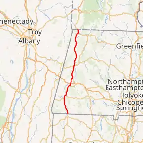
US 7 highlighted in red | ||||
| Route information | ||||
| Maintained by MassDOT | ||||
| Length | 53.85 mi[1] (86.66 km) | |||
| Major junctions | ||||
| South end | ||||
| ||||
| North end | ||||
| Location | ||||
| Counties | Berkshire | |||
| Highway system | ||||
| ||||

Route description
US 7 enters Massachusetts in the town of Sheffield and remains a two-lane road until Lenox. There, a four-lane bypass of Lenox was built in two pieces, and the old US 7 is now Route 7A. US 7 continues on as a four-lane road to Pittsfield, where it is then a three-lane road, narrowing to two lanes for a short time, then widening to four lanes in downtown Pittsfield. US 7 leaves downtown Pittsfield as a two-lane surface arterial, and continues as a rural highway with occasional three-lane stretches for climbing the grades along the Berkshires. It passes west of Mount Greylock before passing through Williamstown, connecting the Taconic Trail with the Mohawk Trail. The road passes Williams College before entering Vermont.'
Like Connecticut, Massachusetts planned an interstate-grade freeway (proposed I-89) in the US-7 corridor. The only portions of this plan to be completed were the short "Super-2" freeway section from the Connecticut border to Sheffield, and the 4-lane section south of Lenox, although land takings for additional freeway sections occurred. The highway was ultimately canceled due to environmental and community opposition.
In Massachusetts, US 7 passes through the towns of Sheffield, Great Barrington, Stockbridge, Lee, Lenox, Pittsfield, Lanesborough, New Ashford, and Williamstown, before crossing into Pownal, Vermont.
Major intersections
The entire route is in Berkshire County. [1]
| Location[1] | mi[1] | km | Destinations | Notes | |
|---|---|---|---|---|---|
| Sheffield | 0.000 | 0.000 | Continuation into Connecticut | ||
| 1.906 | 3.067 | Housatonic River | |||
| 2.958 | 4.760 | Northern terminus of Route 7A (southern section) | |||
| Great Barrington | 10.481 | 16.868 | Southern end of concurrency with Routes 23 and 41 | ||
| 11.451 | 18.429 | Northern end of concurrency with Route 41 | |||
| 11.451 | 18.429 | Housatonic River | |||
| 11.944 | 19.222 | Northern end of concurrency with Route 23; southern end of concurrency with Route 183 | |||
| 13.328 | 21.449 | Northern end of concurrency with Route 183 | |||
| Stockbridge | 17.806 | 28.656 | Housatonic River | ||
| 18.049 | 29.047 | Southern end of concurrency with Route 102 | |||
| 18.405 | 29.620 | Northern end of concurrency with Route 102 | |||
| Lenox | 22.551 | 36.292 | Southern terminus of Route 7A (northern section) | ||
| 23.415 | 37.683 | Southern end of concurrency with US 20 | |||
| 23.713 | 38.162 | Northern terminus of Route 183 | |||
| 25.565 | 41.143 | Northern terminus of Route 7A (northern section) | |||
| Pittsfield | 30.814 | 49.590 | Northern end of concurrency with US 20 | ||
| 31.004 | 49.896 | Southern end of concurrency with Route 9 | |||
| 31.157 | 50.142 | Northern end of concurrency with Route 9 | |||
| Williamstown | 47.205 | 75.969 | |||
| 49.084 | 78.993 | Southern end of concurrency with Route 2 | |||
| 51.405 | 82.728 | Northern end of concurrency with Route 2 | |||
| 52.572 | 84.606 | Hoosic River | |||
| 53.85 | 86.66 | Continuation into Vermont | |||
1.000 mi = 1.609 km; 1.000 km = 0.621 mi
| |||||
See also
 United States portal
 U.S. Roads portal
References
- MassDOT Planning Division. "Massachusetts Route Log Application". Massachusetts Department of Transportation. Retrieved January 22, 2016.