Utah State Route 31
State Route 31 (SR-31) is a state highway in Sanpete and Emery Counties in the U.S. state of Utah. It runs for 47.746 miles (76.840 km) from US-89 at Fairview to SR-10 in Huntington. The highway has been designated as part of The Energy Loop, a National Scenic Byway.
| ||||
|---|---|---|---|---|
| Huntington Canyon Scenic Byway | ||||
| Route information | ||||
| Defined by Utah Code §72-4-109 | ||||
| Maintained by UDOT | ||||
| Length | 47.746 mi[1] (76.840 km) | |||
| Existed | 1915 as a state highway; 1927 as SR-31–present | |||
| Major junctions | ||||
| West end | ||||
| East end | ||||
| Highway system | ||||
| ||||

Route description
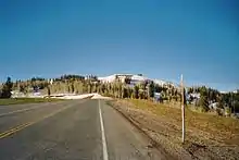
SR-31 begins at an intersection with US‑89 at Fairview and runs east northeast for approximately 10 miles (16 km), then turns southeast for the remainder of the route, terminating at an intersection with SR‑10 at Huntington.[1]
Just off State Route 31, about 15 miles (24 km) west north-west of Huntington, is Crandall Canyon, location of the Crandall Canyon coal mine. On Monday, August 6, 2007, at 2:48 A.M., the mine collapsed, trapping and killing six workers inside. A second collapse on August 16, 2007, killed a Mine Safety and Health Administration investigator and two more miners, bringing the total to nine.[2]
History
The road from SR-32 (by 1926 US-89) in Fairview east to the Sanpete-Emery County line, near the present north end of Electric Lake, was added to the state highway system in 1915. It was extended southeast to SR-10 in Huntington in 1918,[3] and in 1927 the state legislature numbered the Fairview-Huntington highway as SR-31.[4] A major realignment was made in 1976, when Electric Lake was created and a new route was built to the west. The old route in Sanpete County became a county road, and is now part of SR-264, but the majority of the road in Emery County was beneath the lake and thus abandoned.[3]
Major intersections
| County | Location | mi[1] | km | Destinations | Notes |
|---|---|---|---|---|---|
| Sanpete | Fairview | 0.000 | 0.000 | Western terminus | |
| 0.085 | 0.137 | ||||
| | 8.576 | 13.802 | |||
| Emery | Huntington | 47.746 | 76.840 | Eastern terminus | |
| 1.000 mi = 1.609 km; 1.000 km = 0.621 mi | |||||
See also
References
- UDOT Highway Reference, SR-31
- "Report on the August 6, 2007 Disaster at Crandall Canyon Mine" (PDF). United States Senate Health, Education, Labor and Pensions Committee.
- Utah Department of Transportation, Highway Resolutions: "Route 31". (2.01 MB), updated October 2007, accessed May 2008
- Utah State Legislature (1927). "Chapter 21: Designation of State Roads". Session Laws of Utah.
31. From Fairview southeasterly to Huntington.