Utah State Route 52
State Route 52 (SR-52) is a state highway in the U.S. state of Utah, connecting I-15 with US-189 along Orem's 800 North.
| ||||
|---|---|---|---|---|
 | ||||
| Route information | ||||
| Defined by Utah Code §72-4-111 | ||||
| Maintained by UDOT | ||||
| Length | 4.122 mi[1] (6.634 km) | |||
| Existed | 1931–present | |||
| Major junctions | ||||
| West end | ||||
| East end | ||||
| Highway system | ||||
| ||||

The road became a state highway in 1923, and was numbered as a spur of SR-7 in 1927 before being assigned its own number (52). The west end was at US-89 until 1959, when it was extended to I-15; a further extension took it to SR-114 in 1964.
Route description
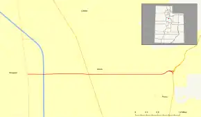
SR-52 begins at the intersection of Geneva Road (SR-114) and 800 North in western Orem, across from the former Geneva Steel Plant, which was on the shore of Utah Lake. 800 North continues west of Geneva Road as SR-176, while SR-52 heads east, passing through a single-point urban interchange at I-15. For its entire length, SR-52 gradually ascends through the Utah Valley along 800 North, ending at US-189 where the valley gives way to the Wasatch Range and that highway enters Provo Canyon.[2] A mid-1980s flyover takes traffic directly from SR-52 onto US-189 north in the canyon.[3]
SR-52 is in the National Highway System as a connection between I-15 and US-189.[4] A project to widen about half the length of the road through Orem from four to six lanes was completed in October 2008.[5]
History
The road from SR-1 (US-91, now US-89) in Orem east to SR-7 (now US-189) at the mouth of Provo Canyon became a state highway in 1923.[6] It was numbered as a spur of SR-7 in 1927,[7] but in 1931 it was split off as State Route 52.[8] In order to serve the planned Interstate 15, SR-52 was extended west to that road in 1959, and in 1964 the extension was continued to SR-114 (simultaneously with a similar extension of SR-265).[6]
Major intersections
The entire route is in Orem, Utah County.
| mi[1] | km | Destinations | Notes | ||
|---|---|---|---|---|---|
| 0.000 | 0.000 | Western terminus; 800 North continues west as SR-176 | |||
| 0.464 | 0.747 | Exit 272 on I-15, single-point urban interchange | |||
| 1.758 | 2.829 | ||||
| 4.122 | 6.634 | Interchange | |||
| 1.000 mi = 1.609 km; 1.000 km = 0.621 mi | |||||
References
- Utah Department of Transportation, Highway Reference Information: "SR-52". (84.5 KB), updated 2008-05-01, accessed 2019-07-26
- Google Maps street maps and USGS topographic maps, accessed July 2008 via ACME Mapper
- Federal Highway Administration, National Bridge Inventory database, 2007
- Federal Highway Administration, National Highway System: Provo--Orem UT, January 2004, accessed July 2008
- Utah Department of Transportation, 800 North Area Schedule, accessed July 2008
- Utah Department of Transportation, Highway Resolutions: "Route 52". (0.99 MB), updated October 2007, accessed May 2008
- Utah State Legislature (1927). "Chapter 21: Designation of State Roads". Session Laws of Utah.
7. From Heber southwesterly via Olmstead to Provo and from Olmstead to Orem, Utah County.
- Utah State Legislature (1931). "Chapter 55: Designation of State Roads". Session Laws of Utah.
(52) From Olmstead on route 7 to Orem on route 1.