Vegetation Index
A Vegetation Index (VI) is a spectral transformation of two or more bands designed to enhance the contribution of vegetation properties and allow reliable spatial and temporal inter-comparisons of terrestrial photosynthetic activity and canopy structural variations.[2]
There are many Vegetation Indices (VIs), with many being functionally equivalent. Many of the indices make use of the inverse relationship between red and near-infrared reflectance associated with healthy green vegetation. Since the 1960s scientists have used satellite remote sensing to monitor fluctuation in vegetation at the Earth's surface. Measurements of vegetation attributes include leaf area index (LAI), percent green cover, chlorophyll content, green biomass and absorbed photosynthetically active radiation (APAR).
Vegetation Indices (VIs) have been historically classified based on a range of attributes, including the number of spectral bands (2 or greater than 2); the method of calculations (ratio or orthogonal), depending on the required objective; or by their historical development (classified as first generation VIs or second generation VIs).[3] For the sake of comparison of the effectiveness of different VIs, Lyon, Yuan et al. (1998)[4] classified 7 VIs based on their computation methods (Subtraction, Division or Rational Transform). Due to advances in hyperspectral remote sensing technology, high-resolution reflectance spectrums are now available, which can be used with traditional multispectral VIs. In addition, VIs have been developed to be used specifically with hyperspectral data, such as the use of Narrow Band Vegetation Indices.
Uses
Vegetation indices have been used to:
List of Vegetation Indices
Multispectral Vegetation Indices

- Simple Ratio
- Normalised Difference Vegetation Index (NDVI)
- Kauth-Thomas Tasseled Cap Transformation
- Infrared Index
- Perpendicular Vegetation Index
- Greenness Above Bare Soil
- Moisture Stress Index
- Leaf Water Content Index (LWCI) [16]
- MidIR Index
- Soil-Adjusted Vegetation Index (SAVI)
- Modified SAVI
- Atmospherically Resistant Vegetation Index
- Soil and Atmospherically Resistant Vegetation Index
- Enhanced Vegetation Index (EVI)
- New Vegetation Index
- Aerosol Free Vegetation Index
- Triangular Vegetation Index
- Reduced Simple Ratio
- Visible Atmospherically Resistant Index
- Normalised Difference Built-Up Index
- Weighted Difference Vegetation Index (WDVI)
- Fraction of absorbed photosynthetically active radiation (FAPAR)
- Normalised Difference Greenness index (NDGI)[17]
Hyperspectral Vegetation Indices
With the advent of hyperspectral data, vegetation indices have been developed specifically for hyperspectral data.
- Discrete-Band Normalised Difference Vegetation Index
- Yellowness Index
- Photochemical Reflectance Index
- Descrete-Band Normalised Difference Water Index
- Red Edge Position Determination
- Crop Chlorophyll Content Prediction
- Moment distance index (MDI)
References
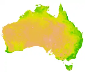
- Data downloaded from "Australian Bureau of Meteorology". on 13 June 2018, mapped in R 14 June 2018
- Huete, A.; Didan, K.; Miura, T.; Rodriguez, E.P; Gao, X.; Ferreira, L.G (2002). "Overview of the radiometric and biophysical performance of the MODIS vegetation indices". Remote Sensing of Environment. 83 (1–2): 195–213. Bibcode:2002RSEnv..83..195H. doi:10.1016/S0034-4257(02)00096-2.
- Bannari, A.; Morin, D.; Bonn, F.; Huete, A. R. (1995-08-01). "A review of vegetation indices". Remote Sensing Reviews. 13 (1–2): 95–120. doi:10.1080/02757259509532298. ISSN 0275-7257.
- Lyon, John G (1998). "A change detection experiment using vegetation indices". Photogrammetric Engineering and Remote Sensing: 143–150. CiteSeerX 10.1.1.462.2056.
- Eklundh, L.; Olsson, L. (2003). "Vegetation index trends for the African Sahel 1982-1999". Geophysical Research Letters. 30 (8): 1430. Bibcode:2003GeoRL..30.1430E. doi:10.1029/2002GL016772. ISSN 0094-8276.
- Gillies, R. R.; Kustas, W. P.; Humes, K. S. (1997). "A verification of the 'triangle' method for obtaining surface soil water content and energy fluxes from remote measurements of the Normalized Difference Vegetation Index (NDVI) and surface e". International Journal of Remote Sensing. 18 (15): 3145–3166. Bibcode:1997IJRS...18.3145G. doi:10.1080/014311697217026. ISSN 0143-1161.
- Sandholt, Inge; Rasmussen, Kjeld; Andersen, Jens (2002). "A simple interpretation of the surface temperature/vegetation index space for assessment of surface moisture status". Remote Sensing of Environment. 79 (2–3): 213–224. Bibcode:2002RSEnv..79..213S. doi:10.1016/S0034-4257(01)00274-7. ISSN 0034-4257.
- Peters, A.J.; Walter-Shea, E.A.; Ji, L.; Vliia, A.; Hayes, M.; Svoboda, M.D. (2002). "Drought Monitoring with NDVI-Based Standardized Vegetation Index" (PDF). Photogrammetric Engineering & Remote Sensing. 68 (1): 71–75. Retrieved 16 May 2018.
- Kogan, F.N. (1995). "Application of vegetation index and brightness temperature for drought detection". Advances in Space Research. 15 (11): 91–100. Bibcode:1995AdSpR..15k..91K. doi:10.1016/0273-1177(95)00079-T. ISSN 0273-1177.
- Wan, Z.; Wang, P.; Li, X. (2004). "Using MODIS Land Surface Temperature and Normalized Difference Vegetation Index products for monitoring drought in the southern Great Plains, USA". International Journal of Remote Sensing. 25 (1): 61–72. Bibcode:2004IJRS...25...61W. doi:10.1080/0143116031000115328. ISSN 0143-1161. S2CID 129234540.
- Jones, H. G. (2004). "Irrigation scheduling: advantages and pitfalls of plant-based methods". Journal of Experimental Botany. 55 (407): 2427–2436. doi:10.1093/jxb/erh213. ISSN 1460-2431. PMID 15286143.
- Pinter, Jr., Paul J.; Hatfield, Jerry L.; Schepers, James S.; Barnes, Edward M.; Moran, M. Susan; Daughtry, Craig S.T.; Upchurch, Dan R. (2003). "Remote Sensing for Crop Management". Photogrammetric Engineering & Remote Sensing. 69 (6): 647–664. doi:10.14358/PERS.69.6.647. ISSN 0099-1112.
- Kustas, W. P.; Norman, J. M. (2009). "Use of remote sensing for evapotranspiration monitoring over land surfaces". Hydrological Sciences Journal. 41 (4): 495–516. doi:10.1080/02626669609491522. ISSN 0262-6667.
- Pettorelli, Nathalie; Ryan, Sadie; Mueller, Thomas; Bunnefeld, Nils; Jędrzejewska, Bogumiła; Lima, Mauricio; Kausrud, Kyrre (2011). "The Normalized Difference Vegetation Index (NDVI): unforeseen successes in animal ecology" (PDF). Climate Research. 46 (1): 15–27. Bibcode:2011ClRes..46...15P. doi:10.3354/cr00936. ISSN 0936-577X. JSTOR 24872307.
- Lloyd, Daniel (1990). "A phenological classification of terrestrial vegetation cover using shortwave vegetation index imagery". International Journal of Remote Sensing. 11 (12): 2269–2279. Bibcode:1990IJRS...11.2269L. doi:10.1080/01431169008955174. ISSN 0143-1161.
- LWCI entry in the Index Database, https://www.indexdatabase.de/db/i-single.php?id=129
- Nedkov, S. (2017). "Normalized Differential Greenness Index for vegetation dynamics assessment". Comptes Rendus de l'Académie Bulgare des Sciences. 70 (8): 1143–1146.