Vestre Hestlægerhøe
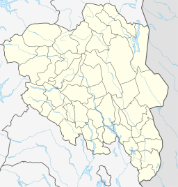
Vestre Hestlægerhøe, also written as Vestre Hestlægerhø, is a mountain in southern Norway.[1][2][6] It is located on the municipal boundary of Lom and Vågå, both in the county of Innlandet.[2] Vestre Hestlægerhøe is part of the Jotunheimen mountain range and is located within the Jotunheimen National Park.[4]
| Vestre Hestlægerhøe | |
|---|---|
| Vestre Hestlægerhø | |
| Highest point | |
| Elevation | 1,758 m (5,768 ft) [1] |
| Prominence | 53 m (174 ft) [2] |
| Coordinates | 61°35′35″N 8°39′27″E |
| Geography | |
| Location | Lom and Vågå, Innlandet, Norway |
| Parent range | Jotunheimen |
| Climbing | |
| Easiest route | path from Glitterheim[3][4][5] then up ±70 vertical meters on mountain's mildest spur. |
The peak of Vestre Hestlægerhøe rises to a height of 1758 meters and has a topographic prominence of 53 meters.[2] Adjacent mountains are Styggehøe (1883 m) to the west and Austre Hestlægerhøe (1950 m) to the east.[7] All three mountains are drained by the Veo to the north and the Russa to the south, both tributaries of the Sjoa.[8]
References
- "Norgeskart". norgeskart.no (in Norwegian). Hønefoss: Norwegian Mapping and Cadastre Authority. Retrieved 4 August 2018.
- "Vestre Hestlægerhøe – 1,758m". Peakbook (in Norwegian). Skrautvål: peakbook.org. Retrieved 4 August 2018.
- Bjerke, Synne Seiertun (8 July 2010). "Skåbu til Glittertind" [Skåbu to Glittertind] (in Norwegian). Namsos: Statskog. Retrieved 4 August 2018.
Fra Russvassbu går du videre forbi Nautgardstind (2258 moh) og du har valget mellom å gå gjennom Tjørnholet, eller mellom Austre- og Vestre Hestlægerhø for å komme til Glitterheim. Det letteste å gå er mellom Austre- og Vestre Hestlægerhø. Sør for Vestre Hestlægerhø er det fine teltplasser, ellers kan man overnatte på Glitterheim.
- Pollmann, Bernhard (2017). Norwegen: Jotunheimen - Rondane. 52 Touren. Mit GPS-Tracks. Rother Wanderführer (in German). Oberhaching, Upper Bavaria: Bergverlag Rother. p. 75. ISBN 978-3-7633-4435-2. Retrieved 4 August 2018 – via Google Books.
Die T-Markierungen leiten rechts hinauf zum aussichtsreichen Pass zwischen den Hestlægerhøe-Kuppen und folgen dann mit Glittertinden-Panorama dem Bach Hestbekkenins Veodalen hinab. Nach Nach Überqueren des breiten Gletscherflusses auf der Ganzjahresbrücke ist der Heberger Glitterheim (7) erreicht.
- Hohle, Per (1968). Til fots i Jotunheimen og tilgrensende fjellområder. Gyldendals ferie- og fritidsbøker (in Norwegian). Oslo: Gyldendal. Norwegian Trekking Association. p. 126. OCLC 14110871.
- "Faktaark" [Fact Sheet] (in Norwegian). Hønefoss: Norwegian Mapping and Cadastre Authority.
- Fossnes, Arne Magnus (6 July 2016). "Over paller og Høer". Peakbook (in Norwegian). Skrautvål: peakbook.org. Retrieved 4 August 2018.
Fulgte deretter steinrøysryggen østover, først over Styggehøe 1883, Vestre Hestlægerhø 1758, og opp på Austre Hestlægerhø 1950.
- Hesthagen, Trygve; Jonsson, Bror; Skurdal, Jostein (October 1989). "Survival, exploitation and movement of takeable size brown trout, Salmo trutta L., in a Norwegian river". Aquaculture Research. Hoboken, New Jersey: John Wiley & Sons. 20 (4): 475–484. doi:10.1111/j.1365-2109.1989.tb00374.x. ISSN 1355-557X.
Two main tributaries drain into the River Sjoa, the River Russa and the River Veo.
External links
- Images of the Vestre Hestlægerhøe at Fjellet i Bilder
- Weather at the Vestre Hestlægerhøe at YR
This article is issued from Wikipedia. The text is licensed under Creative Commons - Attribution - Sharealike. Additional terms may apply for the media files.

