Voldsfjorden
Voldsfjorden or Voldafjorden is a fjord in Volda Municipality in Møre og Romsdal county, Norway. The 18-kilometre (11 mi) long fjord begins at the confluence of the Austefjorden and the Kilsfjorden.[1]
| Voldsfjorden | |
|---|---|
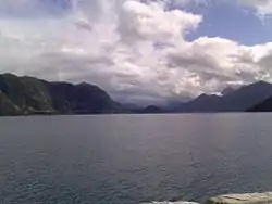 View of the fjord | |
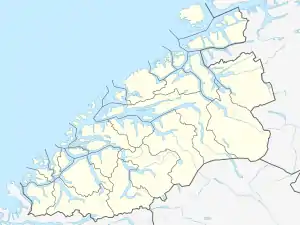 Voldsfjorden Location of the fjord  Voldsfjorden Voldsfjorden (Norway) | |
| Location | Møre og Romsdal county, Norway |
| Coordinates | 62.153637°N 5.995045°E |
| Type | Fjord |
| Native name | Voldafjorden |
| Primary inflows | Austefjorden, Kilsfjorden, Dalsfjorden |
| Primary outflows | Vartdalsfjorden, Rovdefjorden |
| Basin countries | Norway |
| Max. length | 18 kilometres (11 mi) |
| Max. depth | 697 metres (2,287 ft) |
| Settlements | Volda |
The Voldsfjorden reaches a maximum depth of 697 metres (2,287 ft) below sea level, making it the deepest fjord in all of Sunnmøre. The fjord cuts into the mainland of Norway and it is surrounded by the Sunnmørsalpene mountains. The Dalsfjorden branches off the Voldsfjorden just south of the village of Lauvstad.
The main urban area along the fjord is the village of Volda, located on the east side of the fjord. The European route E39 highway runs along the shore of part of the fjord. The fjord is crossed by two ferries going from Lauvstad to Volda, and Folkestad to Volda.
See also
References
- Store norske leksikon. "Austefjorden – del av Voldafjorden" (in Norwegian). Retrieved 2013-08-16.