Waskerley
Waskerley is a village in County Durham, England.[1] It is situated six miles to the southwest of Consett and three miles southwest of Castleside and the A68. Stanhope in the Durham Dales is a further six miles to the southwest and the Derwent Reservoir and the village of Edmundbyers is approximately five miles to the north. The village of Muggleswick is three miles to the north.
Waskerley sits on top of Waskerley Moor, straddling a road between Castleside and Stanhope. The Sea to Sea Cycle Route passes close by to the north - the section crossing Waskerley Moor was formerly known as the Waskerley Way. The main landmark was the Moorcock pub, used by local farmers and users of the Sea to Sea Cycle Route. This pub closed some years ago, and is now a private house.
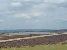
Waskerley, Smiddy Shaw (photographed) and Hishope Reservoirs are situated on Waskerley Moor near Waskerley.
References
- Ordnance Survey: Landranger map sheet 87 Hexham & Haltwhistle (Map). Ordnance Survey. 2009. ISBN 9780319231678.