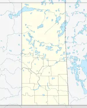
Waskesiu Lake, Saskatchewan
Waskesiu Lake, also referred to as Waskesiu, is a hamlet in Prince Albert National Park, Saskatchewan, Canada.[2] The hamlet is the only town within the park, located on the southern shore of Waskesiu Lake, is about 90 km (56 mi) north of Prince Albert.[3]
Waskesiu Lake
Waskesiu | |
|---|---|
Unincorporated community | |
 Waskesiu Lake  Waskesiu Lake | |
| Coordinates: 53°55′0″N 106°5′2″W | |
| Country | Canada |
| Province | Saskatchewan |
| Census division | 18 |
| Rural Municipality | Prince Albert National Park |
| Government | |
| • Type | Unincorporated |
| • Governing body | Parks Canada |
| Population (2011)[1] | |
| • Total | 10 |
| Time zone | CST |
| Postal code | |
| Area code(s) | 306 |
| Highways | Hwy 263, Hwy 264 |
Most facilities and services one would expect to find in a multi-use park are available, such as souvenir shops, small grocery stores, a gas station, a laundromat, restaurants, hotels and motels, rental cabins, a small movie theatre (which adds showings on rainy and cold days), Royal Canadian Mounted Police (RCMP) detachment, camp grounds, three marinas, many beaches, picnic areas, tennis courts and lawn bowling greens. The facilities and services combine recreational and nature experiences. Notably, the park contains the Waskesiu Golf Course designed by famed golf course architect Stanley Thompson who also designed the course in Banff National Park.[4]
Demographics
In 2011, Waskesiu had a population of 10 year-round residents.[1]
Climate
Waskesiu experiences a humid continental climate (Köppen Dfb) bordering on a subarctic climate (Dfc). The highest temperature ever recorded in Waskesiu was 36.5 °C (98 °F) on 5 June 1988.[5] The coldest temperature ever recorded was −48.3 °C (−55 °F) on 21 January 1935.[5]
| Climate data for Waskesiu Lake, 1981−2010 normals, extremes 1934–present | |||||||||||||
|---|---|---|---|---|---|---|---|---|---|---|---|---|---|
| Month | Jan | Feb | Mar | Apr | May | Jun | Jul | Aug | Sep | Oct | Nov | Dec | Year |
| Record high °C (°F) | 12.1 (53.8) |
15.0 (59.0) |
19.0 (66.2) |
27.8 (82.0) |
33.5 (92.3) |
36.5 (97.7) |
36.1 (97.0) |
35.0 (95.0) |
31.7 (89.1) |
28.3 (82.9) |
17.5 (63.5) |
10.5 (50.9) |
36.5 (97.7) |
| Average high °C (°F) | −11.7 (10.9) |
−6.3 (20.7) |
−1.0 (30.2) |
8.8 (47.8) |
15.1 (59.2) |
19.9 (67.8) |
23.5 (74.3) |
21.7 (71.1) |
15.5 (59.9) |
7.5 (45.5) |
−2.4 (27.7) |
−8.0 (17.6) |
6.9 (44.4) |
| Daily mean °C (°F) | −16.5 (2.3) |
−11.8 (10.8) |
−7.0 (19.4) |
2.7 (36.9) |
9.0 (48.2) |
14.4 (57.9) |
17.7 (63.9) |
16.2 (61.2) |
10.4 (50.7) |
2.9 (37.2) |
−6.1 (21.0) |
−12.3 (9.9) |
1.6 (34.9) |
| Average low °C (°F) | −21.1 (−6.0) |
−17.3 (0.9) |
−12.9 (8.8) |
−3.4 (25.9) |
2.8 (37.0) |
8.8 (47.8) |
12.0 (53.6) |
10.7 (51.3) |
5.2 (41.4) |
−1.5 (29.3) |
−9.8 (14.4) |
−16.5 (2.3) |
−3.6 (25.5) |
| Record low °C (°F) | −48.3 (−54.9) |
−47.0 (−52.6) |
−40.0 (−40.0) |
−30.0 (−22.0) |
−13.7 (7.3) |
−7.8 (18.0) |
−4.4 (24.1) |
−3.9 (25.0) |
−10.0 (14.0) |
−23.0 (−9.4) |
−35.0 (−31.0) |
−42.2 (−44.0) |
−48.3 (−54.9) |
| Average precipitation mm (inches) | 15.6 (0.61) |
16.0 (0.63) |
21.7 (0.85) |
27.0 (1.06) |
46.9 (1.85) |
71.3 (2.81) |
86.1 (3.39) |
64.7 (2.55) |
57.9 (2.28) |
31.3 (1.23) |
19.0 (0.75) |
22.2 (0.87) |
479.7 (18.89) |
| Average rainfall mm (inches) | 0.02 (0.00) |
0.3 (0.01) |
5.5 (0.22) |
18.5 (0.73) |
45.6 (1.80) |
71.3 (2.81) |
86.1 (3.39) |
64.7 (2.55) |
57.5 (2.26) |
22.5 (0.89) |
3.5 (0.14) |
0.0 (0.0) |
375.4 (14.78) |
| Average snowfall cm (inches) | 13.5 (5.3) |
17.1 (6.7) |
15.6 (6.1) |
8.5 (3.3) |
1.3 (0.5) |
0.0 (0.0) |
0.0 (0.0) |
0.0 (0.0) |
0.4 (0.2) |
8.8 (3.5) |
15.6 (6.1) |
23.5 (9.3) |
104.2 (41.0) |
| Source: Environment Canada[6][5][7] | |||||||||||||
References
- "Evaluation of Parks Canada's Townsite Management Sub-Program" (PDF). Parks Canada. January 11, 2017. p. 47. Retrieved April 16, 2020.
- "Waskesiu Community Council". Retrieved 2010-02-11.
- "Waskesiu Lake, Saskatchewan". Geographic Place names. Government of Canada. Retrieved February 8, 2018.
- "Course History". Waskesiu Golf Club. Retrieved 2010-02-11.
- "Waskesiu Lake". Environment Canada. 22 June 2016. Retrieved 28 September 2016.
- "Waskesiu Lake". Environment Canada. 22 June 2016. Retrieved 28 September 2016.
- "Waskesiu Lake". Environment Canada. 22 June 2016. Retrieved 28 September 2016.