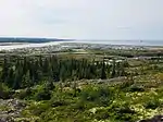
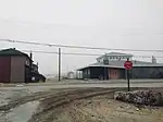
Whapmagoostui (Cree village municipality)
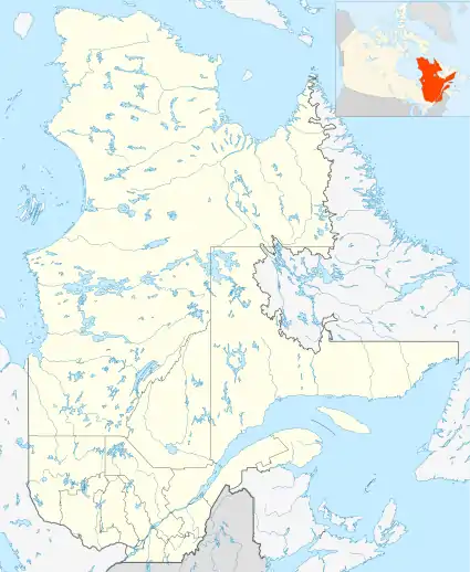
Whapmagoostui is a Cree village municipality in the territory of Eeyou Istchee in northern Quebec; it has a distinct legal status and classification from other kinds of village municipalities in Quebec: Naskapi village municipalities, northern villages (Inuit communities), and ordinary villages.
Whapmagoostui | |
|---|---|
 Whapmagoostui | |
| Coordinates: 55°15′N 77°45′W[1] | |
| Country | Canada |
| Province | Quebec |
| Region | Nord-du-Québec |
| RCM | None |
| Constituted | June 28, 1978 |
| Government | |
| • Mayor | Losty Mamianskum |
| • Prov. riding | Ungava |
| Area | |
| • Total | 115.10 km2 (44.44 sq mi) |
| • Land | 122.53 km2 (47.31 sq mi) |
| There is an apparent contradiction between two authoritative sources | |
| Population (2011)[3] | |
| • Total | 0 |
| • Density | 0.0/km2 (0/sq mi) |
| • Change (2006–11) | N/A |
| • Dwellings | 0 |
| Time zone | UTC−05:00 (EST) |
| • Summer (DST) | UTC−04:00 (EDT) |
| Postal code(s) | J0M 1G0 |
| Area code(s) | 819 |
| Website | www |
As with all other Cree village municipalities in Quebec, there is a counterpart Cree reserved land of the same name located nearby: Whapmagoostui.
Despite the title of "village municipality" and the formalities that go along with it (for instance, having a mayor), Statistics Canada lists it (and all other Cree village municipalities in Quebec) as having no resident population or residential infrastructure (dwellings); it is the Cree reserved lands that are listed as having population and residential dwellings in the 2011 census, the 2006 census, and earlier censuses.