White Oak Run (Loyalhanna Creek tributary)
White Oak Run is a 4.58 mi (7.37 km) long 3rd order tributary to Loyalhanna Creek in Westmoreland County, Pennsylvania.
| White Oak Run Tributary to Loyalhanna Creek | |
|---|---|
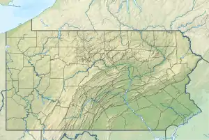 Location of White Oak Run mouth  White Oak Run (Loyalhanna Creek tributary) (the United States) | |
| Location | |
| Country | United States |
| State | Pennsylvania |
| County | Westmoreland |
| Physical characteristics | |
| Source | Indian Creek divide |
| • location | about 0.25 miles northeast of Kregar, Pennsylvania[1] |
| • coordinates | 40°07′33″N 079°18′03″W[2] |
| • elevation | 1,740 ft (530 m)[1] |
| Mouth | Loyalhanna Creek |
• location | about 0.25 miles north of Weaver Mill, Pennsylvania[1] |
• coordinates | 40°09′43″N 079°16′26″W[2] |
• elevation | 1,266 ft (386 m)[2] |
| Length | 4.58 mi (7.37 km)[3] |
| Basin size | 9.15 square miles (23.7 km2)[4] |
| Discharge | |
| • location | Loyalhanna Creek |
| • average | 19.87 cu ft/s (0.563 m3/s) at mouth with Loyalhanna Creek[4] |
| Basin features | |
| Progression | northeast |
| River system | Loyalhanna Creek |
| Tributaries | |
| • left | unnamed tributaries |
| • right | Laurel Run Powdermill Run |
Variant names
According to the Geographic Names Information System, it has also been known historically as:[2]
- Whiteoak Run
Course
White Oak Run rises on the Indian Creek divide about 0.25 miles northeast of Kregar in Westmoreland County. White Oak Run then flows northeast to meet Loyalhanna Creek about 0.25 miles north of Weaver Mill, Pennsylvania.[1]
Watershed
White Oak Run drains 9.15 square miles (23.7 km2) of area, receives about 49.9 in/year of precipitation, has a topographic wetness index of 378.29, and has an average water temperature of 8.74 °C.[4] The watershed is 92% forested.[4]
Additional Images
.jpg.webp)
Course of White Oak Run (Loyalhanna Creek tributary) in Westmoreland County, Pennsylvania
.jpg.webp)
Watershed of White Oak Run (Loyalhanna Creek tributary) in Westmoreland County, Pennsylvania
References
- "White Oak Run Topo Map, Westmoreland County PA (Stahlstown Area)". TopoZone. Locality, LLC. Retrieved 30 December 2019.
- "GNIS Detail - White Oak Run". geonames.usgs.gov. US Geological Survey. Retrieved 30 December 2019.
- "ArcGIS Web Application". epa.maps.arcgis.com. US EPA. Retrieved 29 December 2019.
- "White Oak Run Watershed Report". Waters Geoviewer. US EPA. Retrieved 30 December 2019.
This article is issued from Wikipedia. The text is licensed under Creative Commons - Attribution - Sharealike. Additional terms may apply for the media files.