Yser
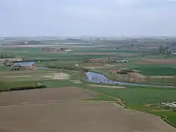
The Yser (US: /iːˈzɛər/ ee-ZAIR,[1] French: [izɛʁ]; Dutch: IJzer [ˈɛizər] (![]() listen)) is a river that rises in French Flanders (the north of France), enters the Belgian province of West Flanders and flows through the Ganzepoot and into the North Sea at the town of Nieuwpoort.
listen)) is a river that rises in French Flanders (the north of France), enters the Belgian province of West Flanders and flows through the Ganzepoot and into the North Sea at the town of Nieuwpoort.
| Yser | |
|---|---|
 | |
.png.webp) | |
| Native name | Yser (Picard) IJzer (Dutch) |
| Location | |
| Countries | Belgium and France |
| Physical characteristics | |
| Source | |
| • location | Nord |
| • elevation | 30 m (98 ft) |
| Mouth | |
• location | North Sea |
• coordinates | 51°9′10″N 2°43′23″E |
| Length | 78 km (48 mi) |
| Basin size | 1,101 km2 (425 sq mi) |
| Discharge | |
| • average | 3 m3/s (110 cu ft/s) |
The source of the Yser is in Buysscheure (Buisscheure), in the Nord department of northern France. It flows through Bollezeele (Bollezele), Esquelbecq (Ekelsbeke), and Bambecque (Bambeke). After approximately 30 kilometres (19 mi) of its 78-kilometre (48 mi) course, it leaves France and enters Belgium. It then flows through Diksmuide and out into the North Sea at Nieuwpoort.
During the Battle of the Yser in the First World War, by opening the sluices, part of the polder west of the Yser was flooded with seawater between Nieuwpoort and Diksmuide to provide an obstacle to the advancing German Army and keep westernmost Belgium safe from German occupation. The Yser river itself never overflowed its banks.[2]
Tributaries
The main tributaries of the Yser are:[3]
- Peene Becque (Penebeek)
- Sale Becque (Vuilebeek)
- Ey Becque (Heidebeek)
- Zwyne Becque (Zwijnebeek)
- Vleeterbeek
References
- "Yser". Merriam-Webster Dictionary. Retrieved 22 August 2019.
- Leper, J., Kunstmatige inundaties in Maritiem Vlaanderen 1316-1945, Michiels, Tongeren, 1957 (327 p.), p.205
- Sandre. "Fiche cours d'eau - Yser (E4900570)"., see tab "Affluents"
External links
- Image of the basin of the Yser
- GéoPortail (in French)
| Wikimedia Commons has media related to Yser. |
