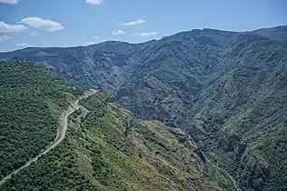
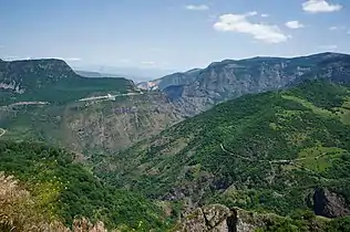
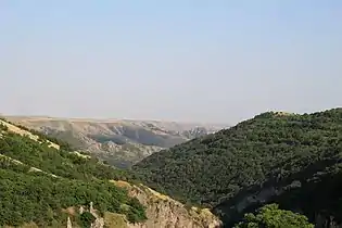
Zangezur Mountains
The Zangezur Mountains (Azerbaijani: Zəngəzur dağları, Armenian: Զանգեզուրի լեռներ) comprise a mountain range that defines the border between Armenia's southern provinces of Syunik, Vayots Dzor and Nakhchivan Autonomous Republic of Azerbaijan. The Zangezur region is internationally recognized as being the second-largest tract of forests in Armenia, which are located in the Zangezur Mountains where they cover more than 20% of the territory of Armenian Syunik province and reach an elevation of 2,200-2,400 m (4,000 feet).[1]

Zangezur Mountains
Conservation
Part of the Zangezur Mountains is included in Arevik National Park. There are also three Prime Butterfly Areas (PBA) designated and one proposed at the eastern slopes of the Zangezur Mountains.[2]
Gallery


See also
- Zangezur National Park, situated in the mountain range of the same name in the Nakhchivan Autonomous Republic, Azerbaijan
- Geography of Armenia
- Geography of Azerbaijan
References
- The Earth and Its Inhabitants ...: Asiatic Russia: Caucasia, Aralo-Caspian basin, Siberia - Elisée Reclus, Ernest George Ravenstein, Augustus Henry Keane - See, page 138
- Butterfly Conservation Armenia: Prime Butterfly Areas.
This article is issued from Wikipedia. The text is licensed under Creative Commons - Attribution - Sharealike. Additional terms may apply for the media files.