Ātiamuri
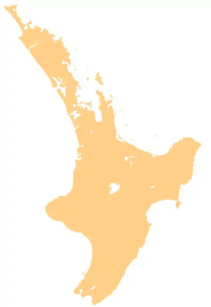
Ātiamuri is a former hydro village in the central North Island of New Zealand. It lies alongside State Highway 1 about 27 km south of Tokoroa and 38 km north of Taupō. It is bordered by the Waikato River and surrounded by pine plantations. Upper Ātiamuri, just north of the Waikato River, is a small community of lifestyle blocks, dairy farms and farm servicing businesses.
Ātiamuri | |
|---|---|
Hydro village | |
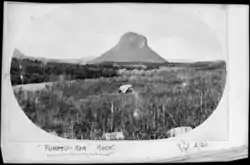 Pōhaturoa Rock, 1923 | |
 Ātiamuri | |
| Coordinates: 38.3937°S 176.0280°E | |
| Region | Waikato |
| Country | New Zealand |
Mount Pōhaturoa (520 m) is a distinctive volcanic plug that dominates the Ātiamuri landscape.[1] It overlooks Lake Ātiamuri which was formed behind the hydroelectric Atiamuri Power Station. This very visible rocky outcrop is significant in both Arawa and Ngāti Raukawa history, having been a strategic observation post during intertribal conflicts.[2]
Demographics
The area known as Ātiamuri is entirely within the Waikato Regional Council area but is in three district council areas: Rotorua Lakes[3] (Tatua area unit – 2013 population 288),[4] South Waikato[5] (Wawa area – 711)[4] and Taupo[6] (Marotiri area – 1,557).[4]
The Tatua area includes Ātiamuri village,[7] where meshblocks had these statistics – 1275700 – 3 (2013), 9 (2006), 1275800 – 6 (2013), 3 (2006) and 1276000 – 3 (2013), 6 (2006).[4]
The main meshblocks of the village are –
1275900[4]
| Year | Population | Households |
Average income | National average |
|---|---|---|---|---|
| 2001 | 45 | 15 | $12,500 | $18,500 |
| 2006 | 33 | 12 | $15,800 | $24,100 |
| 2013 | 30 | 9 | $22,500 | $27,900 |
and 1276100[4]
| Year | Population | Households |
Average income |
|---|---|---|---|
| 2001 | 36 | 12 | $7,500 |
| 2006 | 18 | 6 | $3,300 |
| 2013 | 21 | 9 | $36,300 |
Atiamuri Power Station
Atiamuri Power Station is a hydroelectric power station on the Waikato River owned by Mercury Energy. It has a total capacity of 84 MW and was first commissioned in 1958.[8]
Education
Upper Atiamuri School is a co-educational state primary school for Year 1 to 8 students,[9] with a roll of 36 as of March 2020.[10]
References
- Woodcut of Mount Pohaturoa Archived 12 June 2011 at the Wayback Machine.
- "Atiamuri". South Waikato District Council. Archived from the original on 22 October 2016. Retrieved 21 October 2016.
- "ATIAMURI GEOTHERMAL FIELD" (PDF). Waikato Regional Council. 2011.
- "2013 Census map – QuickStats about a place". archive.stats.govt.nz. Retrieved 14 September 2018.
- "Atiamuri – South Waikato District Council". www.southwaikato.govt.nz. Archived from the original on 15 July 2018. Retrieved 14 September 2018.
- "Mangakino – Taupo District Council". www.taupodc.govt.nz. Archived from the original on 24 January 2019. Retrieved 14 September 2018.
- "Atiamuri, Waikato – NZ Topo Map". NZ Topo Map. Retrieved 14 September 2018.
- Atiamuri Archived 10 June 2011 at the Wayback Machine, Mighty River Power, New Zealand.
- "Ministry of Education School Profile". educationcounts.govt.nz. Ministry of Education.
- "Education Review Office Report". ero.govt.nz. Education Review Office.